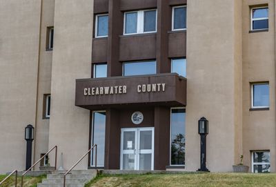
Clearwater County, Administrative division in northwestern Minnesota, United States.
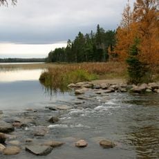
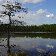
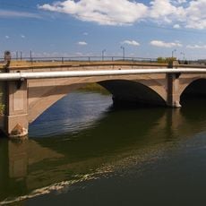
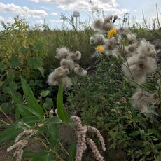
Clearwater County is an administrative division in northwestern Minnesota covering a wooded landscape with rolling terrain. The territory contains numerous lakes, ponds, and two major rivers that define its geography.
The Minnesota State Legislature established this county on December 20, 1902, naming it after the prominent lake and river located within its boundaries. This act formalized administrative governance for the region.
The county includes sections of the Red Lake and White Earth Indian reservations, with Native Americans representing 8.82 percent of the total population.
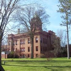
The county seat of Bagley houses administrative offices where visitors can obtain information and property records about the region. The area is best explored by car, as many locations are spread across the territory.
Within the county's boundaries sits Lake Itasca, marked as the source of the Mississippi River, North America's fourth longest river. This geographic landmark draws visitors interested in water and nature exploration.
Location: Minnesota
Inception: December 20, 1902
Capital city: Bagley
Shares border with: Beltrami County, Mahnomen County, Hubbard County, Becker County, Polk County, Pennington County
Website: http://co.clearwater.mn.us
GPS coordinates: 47.57000,-95.38000
Latest update: December 7, 2025 19:30
Paul Bunyan and Babe the Blue Ox
39.3 km
Itasca State Park
39 km
Lake Bemidji State Park
42.2 km
Waldsee
48.2 km
Rabideau CCC Camp
62.9 km
Paul Bunyan State Forest
46.3 km
Clearwater Evangelical Lutheran Church
49.6 km
Bemidji Carnegie Library
39.2 km
Beltrami County Courthouse
38.9 km
Mahnomen County Courthouse
52.5 km
Nymore Bridge
39.4 km
David Park House
39.1 km
Gran Evangelical Lutheran Church
8.4 km
Debs Consolidated School
26 km
Diamond Point Beach
39.5 km
White Earth State Forest
18.3 km
Lake Bemidji State Park CCC/NYA/Rustic Style Historic Resources
41.8 km
Sandtrap Golf Course
60.8 km
Schoolcraft Fire Tower
37.7 km
Height of Land Lookout Tower
38.8 km
Nymore Beach
40.5 km
Rabideau Civilian Conservation Corps Camp Picnic Shelter
62.8 km
Aiton Heights Fire Tower
45.1 km
Kabekona Lookout Tower
54.6 km
Tulaby Lookout Tower
48.7 km
Pinewood Fire Tower
36.5 km
LaSalle Lookout Tower
31.8 km
South Shore Beach
40.8 kmVisited this place? Tap the stars to rate it and share your experience / photos with the community! Try now! You can cancel it anytime.
Discover hidden gems everywhere you go!
From secret cafés to breathtaking viewpoints, skip the crowded tourist spots and find places that match your style. Our app makes it easy with voice search, smart filtering, route optimization, and insider tips from travelers worldwide. Download now for the complete mobile experience.
A unique approach to discovering new places❞
— Le Figaro
All the places worth exploring❞
— France Info
A tailor-made excursion in just a few clicks❞
— 20 Minutes