Enable Location

We need your location to show you interesting places around you

Discover nearby places

Find interesting locations and hidden gems around you

Precise directions

Get accurate directions and distances to places

Your location is never shared with other users. It's only used when you tap the location button.

Henry County

Log in to your account

Start exploring — it's free

Trusted by 61,908 travelers worldwide

Continue with Google
Continue with Apple
or

We will send you a code to connect

By continuing, you accept our Terms and Conditions and our Privacy Policy

Check your inbox

We've sent a pincode in your inbox. Please enter the code below.

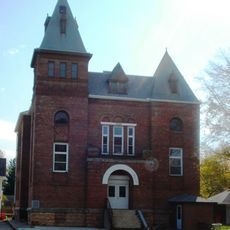
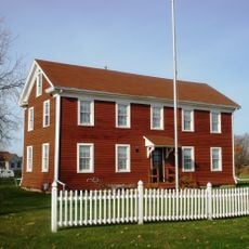
Henry County, Administrative division in Georgia, United States

Henry County is an administrative division in north-central Georgia comprising several municipalities with residential neighborhoods and commercial areas blended throughout. Its territory is crossed by major highways that connect it to the nearby metropolitan region.

The Georgia State Legislature created the county in 1821 after acquiring land from the Creek Nation through a treaty agreement. The territory was named to honor a significant figure in early American history.

The county was home to different Native American communities before European settlement arrived. This heritage shapes the stories and place names you encounter throughout the region today.

The county is best explored by car, as major highways make travel to neighboring areas straightforward and convenient. The best time to visit is during the milder seasons when weather conditions are pleasant and comfortable.

The county has developed into an important research and education center in recent decades, hosting several universities and research institutions. This growth has substantially transformed the landscape and character of the region.

The community of curious travelers

AroundUs brings together thousands of curated places, local tips, and hidden gems, enriched daily by 60,000 contributors worldwide.

Start exploring
GPS coordinates
41.34185,-90.11774
Latest update
December 7, 2025 19:27
Around this place
United States of America

John Deere Classic

27.4 km
United States of America

John Deere World Headquarters

29.8 km
Fred Schwengel Memorial Bridge
United States of America

Fred Schwengel Memorial Bridge

33.6 km
Lock and Dam No. 14
United States of America

Lock and Dam No. 14

35 km
Bishop Hill Colony
United States of America

Bishop Hill Colony

15.8 km
Lone Star
United States of America

Lone Star

34.2 km
Buffalo Bill Museum
United States of America

Buffalo Bill Museum

34.2 km
Johnson-Sauk Trail State Recreation Area
United States of America

Johnson-Sauk Trail State Recreation Area

19.1 km
Bishop Hill State Historic Site
United States of America

Bishop Hill State Historic Site

15.8 km
Ryan Round Barn
United States of America

Ryan Round Barn

19.6 km
Jenny Lind Chapel
United States of America

Jenny Lind Chapel

16.2 km
Old Mill House
United States of America

Old Mill House

33 km
Frederick Francis Woodland Palace
United States of America

Frederick Francis Woodland Palace

22.7 km
West Water Tower and Ground Storage Tank
United States of America

West Water Tower and Ground Storage Tank

22.1 km
Dawley House
United States of America

Dawley House

34.1 km
Henry County Courthouse
United States of America

Henry County Courthouse

7.8 km
Black's Store
United States of America

Black's Store

34.4 km
Olof Johnson House
United States of America

Olof Johnson House

20 km
Central Park Bandstand
United States of America

Central Park Bandstand

22 km
John Hoersch House
United States of America

John Hoersch House

23.4 km
Kewanee Public Library
United States of America

Kewanee Public Library

19.3 km
Galva Opera House
United States of America

Galva Opera House

20.6 km
Horton-Suiter House
United States of America

Horton-Suiter House

34.2 km
Annawan Chapter House
United States of America

Annawan Chapter House

14.7 km
Sherrard Banking Company
United States of America

Sherrard Banking Company

32.5 km
Atkinson Hall
United States of America

Atkinson Hall

12.2 km
Andover Chapter House
United States of America

Andover Chapter House

15.5 km
Hill Arches
United States of America

Hill Arches

29.7 km
Show the full map
« Henry County - Administrative division in Georgia, United States » is provided by Around Us (aroundus.com). Images and texts are derived from Wikimedia project under a Creative Commons license. You are allowed to copy, distribute, and modify copies of this page, under the conditions set by the license, as long as this note is clearly visible.

Discover hidden gems everywhere you go!

From secret cafés to breathtaking viewpoints, skip the crowded tourist spots and find places that match your style. Our app makes it easy with voice search, smart filtering, route optimization, and insider tips from travelers worldwide. Download now for the complete mobile experience.

Around Us App Screenshot

A unique approach to discovering new places

Le Figaro

All the places worth exploring

France Info

A tailor-made excursion in just a few clicks

20 Minutes

Around Us
Travel Guide & Maps
Download

Send to your phone

QR Code
1

Open the camera app on your mobile.

2

Point at the QR code with your camera. A notification will appear.

3

Tap the notification to open the link.