Chest opened
+${chestReward.xp} XP
Explorer
NOUVEAU ×${chestReward.collectible.quantity}
tapez pour fermer
Chest locked

Open chests in the app

Around Us is built for your phone — chests unlock when you walk, explore and capture nearby places.

Enable Location

We need your location to show you interesting places around you

Discover nearby places

Find interesting locations and hidden gems around you

Precise directions

Get accurate directions and distances to places

Your location is never shared with other users. It's only used when you tap the location button.

Alamagan

Log in to your account

Start exploring — it's free

Trusted by 72,877 travelers worldwide

Continue with Google
Continue with Apple
or

We will send you a code to connect

By continuing, you accept our Terms and Conditions and our Privacy Policy

Check your inbox

We've sent a pincode in your inbox. Please enter the code below.

Alamagan
Discussion Reviews 1 Photos
9.3k Popularity

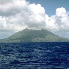
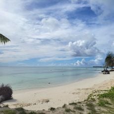
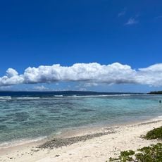
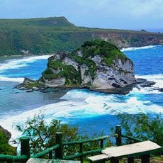
Alamagan, Volcanic island in Northern Mariana Islands, United States

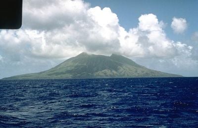
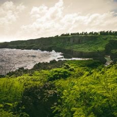
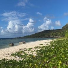
Alamagan is a volcanic island in the Northern Mariana Islands with a length of about 5 kilometers and a maximum width of about 4 kilometers. The landscape is dominated by Bandeera Peak, whose summit rises about 744 meters above the sea.

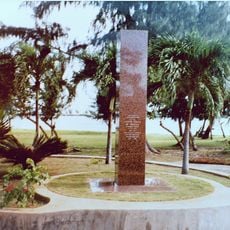
The island was discovered in 1669 by Spanish missionary Diego Luis de San Vitores, who named it Concepción. Around 1695 the native Chamorro population was forcibly relocated to Saipan by Spanish colonial authorities.

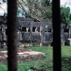
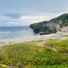
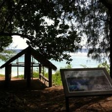
Archaeological finds such as latte stones and ceramics scattered across the island show that early Chamorro communities lived here. These remains reveal how the original people built their homes and organized their settlements.

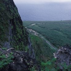
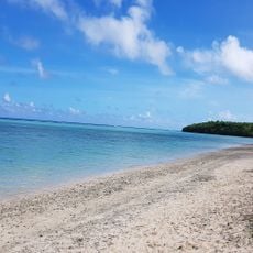
Access to the island is mainly by boat from neighboring islands. It is advisable to contact the Northern Islands Mayor's office in advance to arrange your visit.

The island is home to the only known specimens of Leptecophylla mariannensis, a plant discovered by Japanese botanist Ryōzō Kanehira. This rare species exists nowhere else in the world.

The community of curious travelers

AroundUs brings together thousands of curated places, local tips, and hidden gems, enriched daily by 60,000 contributors worldwide.

Start exploring
Elevation above the sea
744 m
Part of
Northern Mariana Islands
GPS coordinates
17.60000,145.83333
Latest update
December 10, 2025 15:58
Around this place
Suicide Cliff
United States of America

Suicide Cliff

258.6 km
Banzai Cliff
United States of America

Banzai Cliff

257.4 km
Military Air Transport Service
United States of America

Military Air Transport Service

276.1 km
Mount Tapochau
United States of America

Mount Tapochau

268.9 km
American Memorial Park
United States of America

American Memorial Park

265.6 km
East Field
United States of America

East Field

270.8 km
NMI Museum of History and Culture
United States of America

NMI Museum of History and Culture

267.2 km
Japanese Lighthouse
United States of America

Japanese Lighthouse

266.1 km
Sugar King Park
United States of America

Sugar King Park

267.2 km
Japanese Hospital
United States of America

Japanese Hospital

267.3 km
Catholic Belltower
United States of America

Catholic Belltower

267.3 km
Japanese 20mm Cannon Blockhouse
United States of America

Japanese 20mm Cannon Blockhouse

277.4 km
Japanese Jail Historic and Archeological District
United States of America

Japanese Jail Historic and Archeological District

250.7 km
Santa Remedios Church
United States of America

Santa Remedios Church

262.6 km
Alamagan (volcano)
United States of America

Alamagan (volcano)

415 m
American Saipan Memorial
United States of America

American Saipan Memorial

265.4 km
Pau Pau Beach
United States of America

Pau Pau Beach

261.4 km
Ladder Beach
United States of America

Ladder Beach

277.7 km
Micro Beach
United States of America

Micro Beach

265.4 km
Obyan Beach
United States of America

Obyan Beach

277.9 km
Landing Beaches; Aslito/Isely Field; & Marpi Point, Saipan Island
United States of America

Landing Beaches; Aslito/Isely Field; & Marpi Point, Saipan Island

276.7 km
Bird Island Beach
United States of America

Bird Island Beach

260.4 km
Unai Baput
United States of America

Unai Baput

271.5 km
Unai Makpe
United States of America

Unai Makpe

259.3 km
Old man by the sea
United States of America

Old man by the sea

266.1 km
Joeten-Kiyu Public Library
United States of America

Joeten-Kiyu Public Library

272.2 km
Wing Beach
United States of America

Wing Beach

259.4 km
Jeffrey´s Beach
United States of America

Jeffrey´s Beach

265.5 km
Show the full map
Reviews
Share your experience

No review yet

Discussions
Start a discussion...

No discussion yet

« Alamagan - Volcanic island in Northern Mariana Islands, United States » is provided by Around Us (aroundus.com). Images and texts are derived from Wikimedia project under a Creative Commons license. You are allowed to copy, distribute, and modify copies of this page, under the conditions set by the license, as long as this note is clearly visible.

Discover hidden gems everywhere you go!

From secret cafés to breathtaking viewpoints, skip the crowded tourist spots and find places that match your style. Our app makes it easy with voice search, smart filtering, route optimization, and insider tips from travelers worldwide. Download now for the complete mobile experience.

Around Us App Screenshot

A unique approach to discovering new places

Le Figaro

All the places worth exploring

France Info

A tailor-made excursion in just a few clicks

20 Minutes

Around Us
Travel Guide & Maps
Download

Send to your phone

QR Code
1

Open the camera app on your mobile.

2

Point at the QR code with your camera. A notification will appear.

3

Tap the notification to open the link.