Enable Location

We need your location to show you interesting places around you

Discover nearby places

Find interesting locations and hidden gems around you

Precise directions

Get accurate directions and distances to places

Your location is never shared with other users. It's only used when you tap the location button.

Moultrie County

Log in to your account

Start exploring — it's free

Trusted by 62,169 travelers worldwide

Continue with Google
Continue with Apple
or

We will send you a code to connect

By continuing, you accept our Terms and Conditions and our Privacy Policy

Check your inbox

We've sent a pincode in your inbox. Please enter the code below.

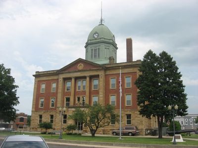
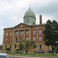
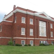
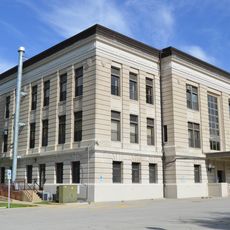
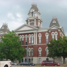
Moultrie County, County administration center in Sullivan, Illinois, United States.

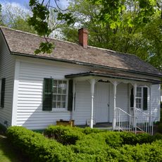
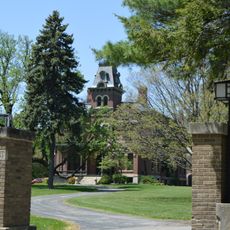
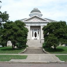
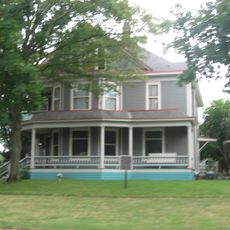
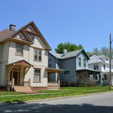
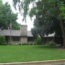
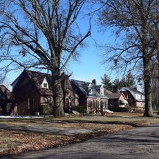
Moultrie County is a county in central Illinois with Sullivan serving as its administrative center. The territory combines farmland, residential neighborhoods, and natural areas into a single county system.

The county was established in 1843 and named after William Moultrie, a general from South Carolina who served during the American Revolutionary War. Its founding marked the early settlement of central Illinois.

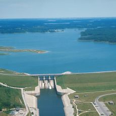
The county maintains several recreational spaces, including the Forrest W Wood Access Area and the Kaskaskia River State Fish and Wildlife Management Area.

Sullivan offers administrative services and public offices in one central location where visitors can address local matters. Communities throughout the county are connected by local roads and easy to reach.

The area contains the Forrest W Wood Access Area and the Kaskaskia River State Fish and Wildlife Management Area, where visitors can fish and explore nature. These water features shape local recreation and connect residents with the outdoors.

The community of curious travelers

AroundUs brings together thousands of curated places, local tips, and hidden gems, enriched daily by 60,000 contributors worldwide.

Start exploring
Location
Inception
1843
Capital city
Sullivan
Shares border with
Piatt County, Coles County, Douglas County, Shelby County, Macon County
GPS coordinates
39.64000,-88.62000
Latest update
December 8, 2025 13:42
Around this place
Interstate 57
United States of America

Interstate 57

34.5 km
Voorhies Castle
United States of America

Voorhies Castle

25.5 km
Chautauqua Auditorium
United States of America

Chautauqua Auditorium

28.7 km
Bryant Cottage State Historic Site
United States of America

Bryant Cottage State Historic Site

31.8 km
James Millikin House
United States of America

James Millikin House

37.2 km
Moultrie County Courthouse
United States of America

Moultrie County Courthouse

4.7 km
Arcola Carnegie Public Library
United States of America

Arcola Carnegie Public Library

27.6 km
Shelbyville Historic District
United States of America

Shelbyville Historic District

29.8 km
Westervelt Christian Church
United States of America

Westervelt Christian Church

27.1 km
Clarksburg Schoolhouse
United States of America

Clarksburg Schoolhouse

36 km
Unity Church
United States of America

Unity Church

26.9 km
Illinois State Bank Building
United States of America

Illinois State Bank Building

39.2 km
Horace M. Tallman House
United States of America

Horace M. Tallman House

30.4 km
United States Post Office (Mattoon, Illinois)
United States of America

United States Post Office (Mattoon, Illinois)

27.4 km
Douglas County Courthouse
United States of America

Douglas County Courthouse

33.5 km
Decatur Historic District
United States of America

Decatur Historic District

37 km
Shelby County Courthouse
United States of America

Shelby County Courthouse

29.8 km
Eli Ulery House
United States of America

Eli Ulery House

23 km
Macon County Courthouse
United States of America

Macon County Courthouse

36.2 km
Burgess-Osborne Memorial Auditorium
United States of America

Burgess-Osborne Memorial Auditorium

27.5 km
Richard Roytek House
United States of America

Richard Roytek House

25.5 km
Lumpkin Heights and Elm Ridge Subdivision Historic District
United States of America

Lumpkin Heights and Elm Ridge Subdivision Historic District

28.8 km
Trobaugh-Good House
United States of America

Trobaugh-Good House

37.7 km
Children's Museum of Illinois
United States of America

Children's Museum of Illinois

32.7 km
Chevrolet Hall of Fame Museum
United States of America

Chevrolet Hall of Fame Museum

31.3 km
Two-Story Outhouse
United States of America

Two-Story Outhouse

22.8 km
Gays Water Tower
United States of America

Gays Water Tower

22.9 km
Lake Shelbyville
United States of America

Lake Shelbyville

20.4 km
Show the full map
« Moultrie County - County administration center in Sullivan, Illinois, United States » is provided by Around Us (aroundus.com). Images and texts are derived from Wikimedia project under a Creative Commons license. You are allowed to copy, distribute, and modify copies of this page, under the conditions set by the license, as long as this note is clearly visible.

Discover hidden gems everywhere you go!

From secret cafés to breathtaking viewpoints, skip the crowded tourist spots and find places that match your style. Our app makes it easy with voice search, smart filtering, route optimization, and insider tips from travelers worldwide. Download now for the complete mobile experience.

Around Us App Screenshot

A unique approach to discovering new places

Le Figaro

All the places worth exploring

France Info

A tailor-made excursion in just a few clicks

20 Minutes

Around Us
Travel Guide & Maps
Download

Send to your phone

QR Code
1

Open the camera app on your mobile.

2

Point at the QR code with your camera. A notification will appear.

3

Tap the notification to open the link.