·

Enable Location

We need your location to show you interesting places around you

Discover nearby places

Find interesting locations and hidden gems around you

Precise directions

Get accurate directions and distances to places

Your location is never shared with other users. It's only used when you tap the location button.

Murfreesboro

Log in to your account

Start exploring — it's free

Trusted by 62,714 travelers worldwide

Continue with Google
Continue with Apple
or

We will send you a code to connect

By continuing, you accept our Terms and Conditions and our Privacy Policy

Check your inbox

We've sent a pincode in your inbox. Please enter the code below.

Murfreesboro, County seat in Tennessee, United States.

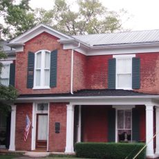
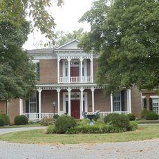
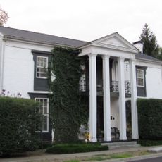
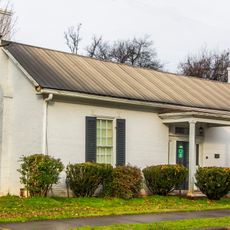
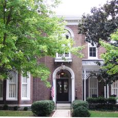
Murfreesboro is a county seat in Rutherford County, Tennessee, spreading across a mix of residential and commercial districts about 34 miles southeast of Nashville. The town sits in gently rolling terrain where wide roads and tree-lined avenues connect parks, shopping centers, and neighborhoods.

The town served as the state capital of Tennessee from 1818 to 1826 before the government moved permanently to Nashville. During the Civil War, the area witnessed the Battle of Stones River, one of the bloodiest engagements in the Western Theater.

The town square hosts a weekly farmers market where locals gather on Saturday mornings to buy produce and handcrafted goods. Many residents refer to the area as a gateway between rolling farmland and suburban neighborhoods along the interstate.

Visitors can reach most points of interest by car, as parking lots are widely available near shops and public buildings. Warmer months are comfortable for walking along the riverfront paths and through the town parks.

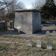
The Stones River National Battlefield preserves the site of the fighting and offers trails through open fields where visitors can spot cannons and monuments. The central cemetery gathers graves of soldiers who fell during the battle.

The community of curious travelers

AroundUs brings together thousands of curated places, local tips, and hidden gems, enriched daily by 60,000 contributors worldwide.

Start exploring
Inception
1811
Elevation above the sea
186 m
GPS coordinates
35.84611,-86.39194
Latest update
December 13, 2025 06:28
Around this place
Johnny "Red" Floyd Stadium
United States of America

Johnny "Red" Floyd Stadium

2.2 km
Hazen Brigade Monument
United States of America

Hazen Brigade Monument

4.7 km
Oaklands Historic House Museum
United States of America

Oaklands Historic House Museum

1.3 km
Snail Shell Cave
United States of America

Snail Shell Cave

14.8 km
United States of America

Evergreen Cemetery

2.6 km
United States of America

Discovery Center at Murfree Spring

930 m
Rutherford County Courthouse
United States of America

Rutherford County Courthouse

0 m
United States of America

Stones River Greenway Arboretum

7 km
Marymont
United States of America

Marymont

8.4 km
Bradley Academy Museum
United States of America

Bradley Academy Museum

498 m
Boxwood
United States of America

Boxwood

6.8 km
Allen Chapel A.M.E. Church
United States of America

Allen Chapel A.M.E. Church

493 m
Childress-Ray House
United States of America

Childress-Ray House

327 m
United States of America

Providence Primitive Baptist Church

10.3 km
Collier-Crichlow House
United States of America

Collier-Crichlow House

793 m
Beesley Primitive Baptist Church
United States of America

Beesley Primitive Baptist Church

9.6 km
John C. Spence House
United States of America

John C. Spence House

511 m
Arnold-Harrell House
United States of America

Arnold-Harrell House

2.6 km
United States of America

Elmwood

8.1 km
United States of America

Benjamine Rucker House

10 km
Thomas C. Black House
United States of America

Thomas C. Black House

9.1 km
Collier-Lane-Crichlow House
United States of America

Collier-Lane-Crichlow House

487 m
Landsberger-Gerhardt House
United States of America

Landsberger-Gerhardt House

490 m
Gen. Joseph B. Palmer House
United States of America

Gen. Joseph B. Palmer House

623 m
Fortress Rosecrans
United States of America

Fortress Rosecrans

1.9 km
Islamic Center of Murfreesboro
United States of America

Islamic Center of Murfreesboro

5.3 km
Stones River National Battlefield Visitor Center
United States of America

Stones River National Battlefield Visitor Center

5.4 km
United States of America

Cheri Theatre

2 km
Show the full map
« Murfreesboro - County seat in Tennessee, United States » is provided by Around Us (aroundus.com). Images and texts are derived from Wikimedia project under a Creative Commons license. You are allowed to copy, distribute, and modify copies of this page, under the conditions set by the license, as long as this note is clearly visible.

Discover hidden gems everywhere you go!

From secret cafés to breathtaking viewpoints, skip the crowded tourist spots and find places that match your style. Our app makes it easy with voice search, smart filtering, route optimization, and insider tips from travelers worldwide. Download now for the complete mobile experience.

Around Us App Screenshot

A unique approach to discovering new places

Le Figaro

All the places worth exploring

France Info

A tailor-made excursion in just a few clicks

20 Minutes

Around Us
Travel Guide & Maps
Download

Send to your phone

QR Code
1

Open the camera app on your mobile.

2

Point at the QR code with your camera. A notification will appear.

3

Tap the notification to open the link.