Enable Location

We need your location to show you interesting places around you

Discover nearby places

Find interesting locations and hidden gems around you

Precise directions

Get accurate directions and distances to places

Your location is never shared with other users. It's only used when you tap the location button.

Haywood County

Log in to your account

Start exploring — it's free

Trusted by 61,974 travelers worldwide

Continue with Google
Continue with Apple
or

We will send you a code to connect

By continuing, you accept our Terms and Conditions and our Privacy Policy

Check your inbox

We've sent a pincode in your inbox. Please enter the code below.

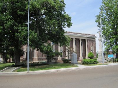
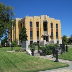
Haywood County, County administration center in Brownsville, Tennessee.

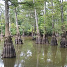
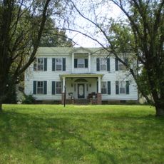
Haywood County is an administrative division in western Tennessee spanning roughly 1,300 square miles. The region includes several communities with public schools, government offices, and farms that have long focused on crop cultivation.

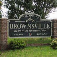
The Tennessee General Assembly created this county in 1823, naming it after Judge John Haywood and establishing Brownsville as its seat. The area developed as an agricultural center and remained connected to the broader growth of western Tennessee.

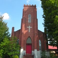
The county maintains deep roots in African-American history and community life. This heritage shapes the character of towns and neighborhoods throughout the region.

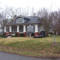
The county has several public schools, government offices, and medical clinics serving residents and visitors. Services are spread across smaller towns, so planning travel between locations is helpful.

Two musicians with national fame trace their origins to this county: blues guitarist Sleepy John Estes and singer Tina Turner. Turner wrote her song 'Nutbush City Limits' about the small town where she grew up here.

The community of curious travelers

AroundUs brings together thousands of curated places, local tips, and hidden gems, enriched daily by 60,000 contributors worldwide.

Start exploring
Location
Inception
1823
Capital city
Brownsville
Shares border with
Crockett County, Madison County, Hardeman County, Fayette County, Lauderdale County, Tipton County
GPS coordinates
35.58000,-89.29000
Latest update
December 22, 2025 10:51
Around this place
Alex Haley House and Museum
United States of America

Alex Haley House and Museum

27.9 km
Hatchie National Wildlife Refuge
United States of America

Hatchie National Wildlife Refuge

11.1 km
Temple Adas Israel
United States of America

Temple Adas Israel

3 km
United States of America

Republican Primitive Baptist Church

14.2 km
Oak Hill Farm
United States of America

Oak Hill Farm

21.8 km
United States of America

Lauderdale High School

27.7 km
United States of America

Canaan Baptist Church

31.7 km
Zion Church
United States of America

Zion Church

3.1 km
United States of America

Dancyville United Methodist Church and Cemetery

19.4 km
Lauderdale County Courthouse
United States of America

Lauderdale County Courthouse

28.5 km
Bank of Alamo
United States of America

Bank of Alamo

27.7 km
United States of America

Wardlaw-Steele House

28.4 km
United States of America

Jefferson Street Historic District

2.9 km
United States of America

Lucerne

26.4 km
Joshua K. Hutchison House
United States of America

Joshua K. Hutchison House

3.3 km
United States of America

Stanton Masonic Lodge and School

16.4 km
Brownsville Carnegie Library
United States of America

Brownsville Carnegie Library

2.8 km
Stanton School
United States of America

Stanton School

16.7 km
United States of America

Dunbar-Carver Historic District

3.6 km
United States of America

North Washington Historic District

3.2 km
Trinity United Methodist Church
United States of America

Trinity United Methodist Church

16.2 km
United States of America

Duffy Lake

15.8 km
United States of America

Ritz Theatre

2.9 km
United States of America

Bells Theatre

23.4 km
United States of America

Billy Tripp's Mindfield

2.6 km
United States of America

Tina Turner Museum

5.9 km
United States of America

Sleepy John Estes Museum

5.9 km
United States of America

Tina Turner

3.4 km
Show the full map
Administrative divisions
« Haywood County - County administration center in Brownsville, Tennessee » is provided by Around Us (aroundus.com). Images and texts are derived from Wikimedia project under a Creative Commons license. You are allowed to copy, distribute, and modify copies of this page, under the conditions set by the license, as long as this note is clearly visible.

Discover hidden gems everywhere you go!

From secret cafés to breathtaking viewpoints, skip the crowded tourist spots and find places that match your style. Our app makes it easy with voice search, smart filtering, route optimization, and insider tips from travelers worldwide. Download now for the complete mobile experience.

Around Us App Screenshot

A unique approach to discovering new places

Le Figaro

All the places worth exploring

France Info

A tailor-made excursion in just a few clicks

20 Minutes

Around Us
Travel Guide & Maps
Download

Send to your phone

QR Code
1

Open the camera app on your mobile.

2

Point at the QR code with your camera. A notification will appear.

3

Tap the notification to open the link.