Enable Location

We need your location to show you interesting places around you

Discover nearby places

Find interesting locations and hidden gems around you

Precise directions

Get accurate directions and distances to places

Your location is never shared with other users. It's only used when you tap the location button.

Macon County

Log in to your account

Start exploring — it's free

Trusted by 61,974 travelers worldwide

Continue with Google
Continue with Apple
or

We will send you a code to connect

By continuing, you accept our Terms and Conditions and our Privacy Policy

Check your inbox

We've sent a pincode in your inbox. Please enter the code below.

Macon County, Administrative county in northern Tennessee, United States.

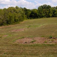
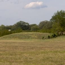
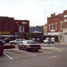
Macon County is an administrative county in northeastern Tennessee, characterized by rolling hills and rural landscapes throughout the region. Multiple state highways, including SR 10, SR 52, and SR 56, connect communities across the area.

Macon County was established in 1842, and during the Civil War many residents joined Kentucky regiments due to local circumstances. This experience shaped the county's early development.

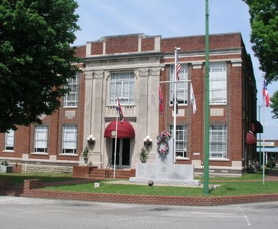
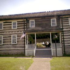
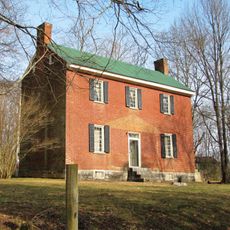
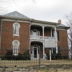
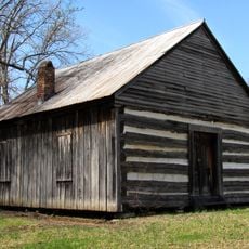
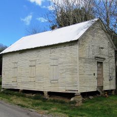
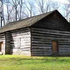
The county seat of Lafayette carries the name of a French military officer and holds museums along with historic log cabins that show regional heritage.

Visitors can reach the area through Lafayette Municipal Airport and state highways SR 10, SR 52, and SR 56. The road network connects various towns and makes traveling through the region straightforward.

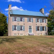
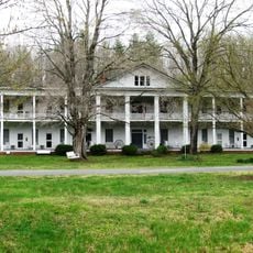
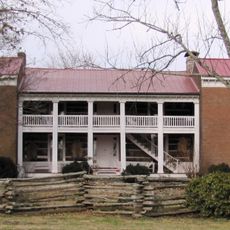
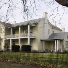
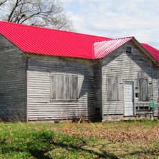
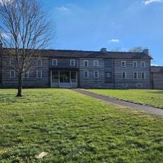
Red Boiling Springs preserves three hotels from the 1920s, when visitors came for the healing mineral springs in the mountain area. These buildings still stand as reminders of that therapeutic retreat period.

The community of curious travelers

AroundUs brings together thousands of curated places, local tips, and hidden gems, enriched daily by 60,000 contributors worldwide.

Start exploring
Location
Inception
1842
Capital city
Lafayette
Shares border with
Monroe County, Clay County, Jackson County, Smith County, Trousdale County, Sumner County, Allen County
GPS coordinates
36.53000,-86.01000
Latest update
December 7, 2025 20:40
Around this place
Bledsoe's Station
United States of America

Bledsoe's Station

31.4 km
Castalian Springs Mound Site
United States of America

Castalian Springs Mound Site

30.9 km
Cragfont
United States of America

Cragfont

32.9 km
Donoho Hotel
United States of America

Donoho Hotel

15.1 km
Fort Blount
United States of America

Fort Blount

33 km
Wynnewood
United States of America

Wynnewood

31.3 km
Old Mulkey Meetinghouse State Historic Site
United States of America

Old Mulkey Meetinghouse State Historic Site

31.6 km
Davis-Hull House
United States of America

Davis-Hull House

30.5 km
Dixona
United States of America

Dixona

19.2 km
Cordell Hull Bridge
United States of America

Cordell Hull Bridge

31.7 km
Cullum Mansion
United States of America

Cullum Mansion

31.1 km
James Bradley House
United States of America

James Bradley House

21 km
Smith County Courthouse
United States of America

Smith County Courthouse

31.4 km
Fite-Williams-Ligon House
United States of America

Fite-Williams-Ligon House

31.1 km
James R. DeBow House
United States of America

James R. DeBow House

19.1 km
Mount Vernon AME Church
United States of America

Mount Vernon AME Church

24.8 km
James B. Jameson House
United States of America

James B. Jameson House

33.7 km
Long Creek School
United States of America

Long Creek School

8.1 km
Brown-Chenault House
United States of America

Brown-Chenault House

28.7 km
Scottsville Downtown Commercial Historic District
United States of America

Scottsville Downtown Commercial Historic District

29.7 km
Turney-Hutchins House
United States of America

Turney-Hutchins House

20 km
Belview School
United States of America

Belview School

9.4 km
The Tabernacle
United States of America

The Tabernacle

28.5 km
Dr. Pellie G. Graves House
United States of America

Dr. Pellie G. Graves House

29.6 km
Old Mulkey Meetinghouse
United States of America

Old Mulkey Meetinghouse

31.6 km
Macon County Fairgrounds
United States of America

Macon County Fairgrounds

5.3 km
Wynnewood State Historical Site
United States of America

Wynnewood State Historical Site

31.3 km
Lafayette Theatre
United States of America

Lafayette Theatre

1.9 km
Show the full map
Administrative divisions
« Macon County - Administrative county in northern Tennessee, United States » is provided by Around Us (aroundus.com). Images and texts are derived from Wikimedia project under a Creative Commons license. You are allowed to copy, distribute, and modify copies of this page, under the conditions set by the license, as long as this note is clearly visible.

Discover hidden gems everywhere you go!

From secret cafés to breathtaking viewpoints, skip the crowded tourist spots and find places that match your style. Our app makes it easy with voice search, smart filtering, route optimization, and insider tips from travelers worldwide. Download now for the complete mobile experience.

Around Us App Screenshot

A unique approach to discovering new places

Le Figaro

All the places worth exploring

France Info

A tailor-made excursion in just a few clicks

20 Minutes

Around Us
Travel Guide & Maps
Download

Send to your phone

QR Code
1

Open the camera app on your mobile.

2

Point at the QR code with your camera. A notification will appear.

3

Tap the notification to open the link.