Clinton County

Log in to your account

AroundUs is a community-driven map of interesting places, built by curious explorers like you. It grows with every review, story, and photo you share.
Connect to save your favorite spots, contribute locations, and create personalized routes.
By continuing, you accept our Terms and Conditions and our Privacy Policy
Add to collection
Map
Suggest a change
Share

Clinton County, Administrative county in southern Kentucky, United States

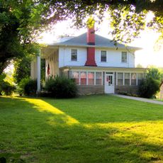
Clinton County is an administrative division in south-central Kentucky spanning roughly 532 square kilometers, defined by farmland and small residential communities centered around the county seat of Albany. Rolling terrain and open landscapes dominate the area, where agriculture remains the primary land use.

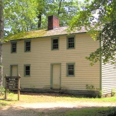
The area was established on February 20, 1836, carved from parts of Cumberland and Russell Counties and named after Governor DeWitt Clinton of New York. Its creation as an administrative district followed regional settlement movements and the growth of farming communities in the area.

Residents here maintain strong ties to regional traditions through regular county fairs, agricultural exhibitions, and community gatherings held throughout the year. These events shape how people live together and show how they keep their rural way of life alive.

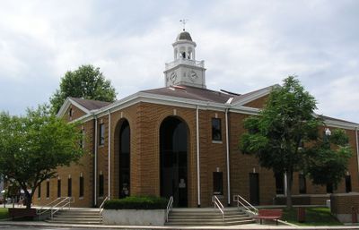
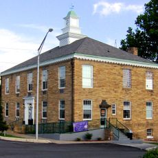
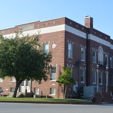
Albany serves as the administrative hub where residents access county services, public records, and official matters from local government offices. Visit during the county fairs and local events to experience the area when public activity is most active.

This area is known for its strict dry county status, prohibiting all alcohol sales throughout its territory since its founding. This unusual regulation has shaped local business patterns and daily life for generations, setting it apart from many other Kentucky regions.

Location: Kentucky

Inception: February 20, 1836

Capital city: Albany

Shares border with: Wayne County, Russell County, Cumberland County, Clay County, Pickett County

Website: http://albanyclintonco.com

GPS coordinates: 36.72000,-85.13000

Latest update: December 7, 2025 20:44

Photos
Around this place
Sgt. Alvin C. York State Historic Park
United States of America

Sgt. Alvin C. York State Historic Park

24.9 km
Standing Stone State Park
United States of America

Standing Stone State Park

37.7 km
Pickett Civilian Conservation Corps Memorial State Park
United States of America

Pickett Civilian Conservation Corps Memorial State Park

35.2 km
Lake Cumberland State Resort Park
United States of America

Lake Cumberland State Resort Park

22 km
Creelsboro Natural Bridge
United States of America

Creelsboro Natural Bridge

20.7 km
Cordell Hull Birthplace State Park
United States of America

Cordell Hull Birthplace State Park

16.1 km
Mill Springs Mill
United States of America

Mill Springs Mill

39.3 km
Alpine Institute
United States of America

Alpine Institute

37.3 km
Old Wayne County High School
United States of America

Old Wayne County High School

26.6 km
Pickett County Courthouse
United States of America

Pickett County Courthouse

16.7 km
Judge Killis Huddleston House
United States of America

Judge Killis Huddleston House

2.1 km
Sgt. Alvin C. York State Historic Park
United States of America

Sgt. Alvin C. York State Historic Park

25 km
Marrowbone Historic District
United States of America

Marrowbone Historic District

35.4 km
Jesse Noland House
United States of America

Jesse Noland House

8.4 km
Fairchild House
United States of America

Fairchild House

27.4 km
Clay County Courthouse
United States of America

Clay County Courthouse

38.5 km
James Baker House
United States of America

James Baker House

26.9 km
Russell Lodge No. 284
United States of America

Russell Lodge No. 284

30 km
Coe House
United States of America

Coe House

22.7 km
Zion Meetinghouse and School
United States of America

Zion Meetinghouse and School

38.6 km
Monticello Historic Commercial District
United States of America

Monticello Historic Commercial District

27.8 km
Pickett State Rustic Park Historic District
United States of America

Pickett State Rustic Park Historic District

35 km
Sgt. Alvin C. York State Historic Park Visitor Center
United States of America

Sgt. Alvin C. York State Historic Park Visitor Center

25 km
Star Theater
United States of America

Star Theater

38.1 km
Standing Stone Rustic Park Historic District
United States of America

Standing Stone Rustic Park Historic District

37.9 km
Pickett State Park Fire Tower
United States of America

Pickett State Park Fire Tower

35.7 km
Cumberland County Courthouse
United States of America

Cumberland County Courthouse

22.8 km
Lake Cumberland
United States of America

Lake Cumberland

20.1 km
Show the full map
Reviews

Visited this place? Tap the stars to rate it and share your experience / photos with the community! Try now! You can cancel it anytime.

« Clinton County - Administrative county in southern Kentucky, United States » is provided by Around Us (aroundus.com). Images and texts are derived from Wikimedia project under a Creative Commons license. You are allowed to copy, distribute, and modify copies of this page, under the conditions set by the license, as long as this note is clearly visible.

Discover hidden gems everywhere you go!

From secret cafés to breathtaking viewpoints, skip the crowded tourist spots and find places that match your style. Our app makes it easy with voice search, smart filtering, route optimization, and insider tips from travelers worldwide. Download now for the complete mobile experience.

Around Us App Screenshot

A unique approach to discovering new places

Le Figaro

All the places worth exploring

France Info

A tailor-made excursion in just a few clicks

20 Minutes