Moore County

Log in to your account

AroundUs is a community-driven map of interesting places, built by curious explorers like you. It grows with every review, story, and photo you share.
Connect to save your favorite spots, contribute locations, and create personalized routes.
Continue with Google
Continue with Apple
Continue with X
Continue with Facebook
Continue with email
By continuing, you accept our Terms and Conditions and our Privacy Policy
Create an account
Add to collection
Map
Suggest a change
Share

Moore County, County seat in central North Carolina, United States

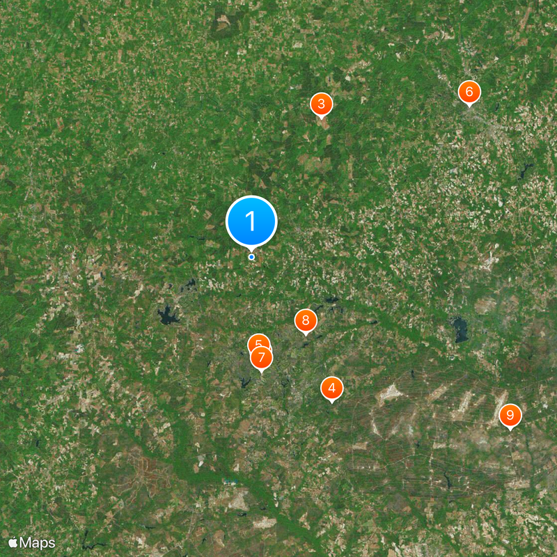
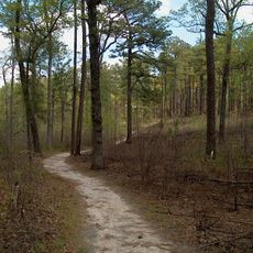
Moore County is an administrative region in central North Carolina with Carthage as its seat and features rolling hills and farm lands throughout the area. The county encompasses quiet towns and rural landscapes marked by forests and open fields.

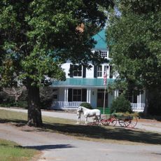
The area was founded in 1784, followed by Carthage in 1796 as the seat, where cart and buggy production became the economic foundation. The Tyson & Jones Buggy Company factory made the area known for manufacturing these vehicles.

The annual Buggy Festival in Carthage brings together local artisans, musicians, and vintage vehicle collectors to celebrate the region's cart-making heritage. Visitors can watch craftspeople work and experience traditions that remain active in the community today.

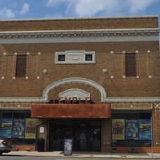
The administrative center in Carthage offers visitor information and is easily reached via Highway 15/501. The region is relatively flat and simple to navigate, with most shops and dining concentrated in Carthage.

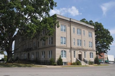
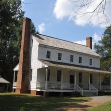
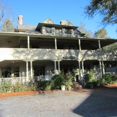
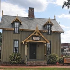
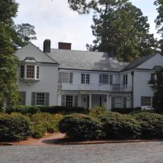
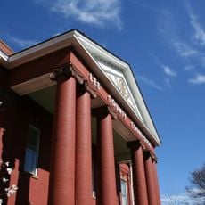
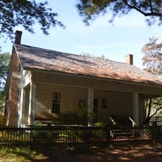
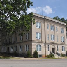
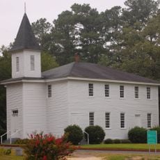
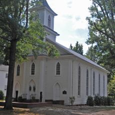
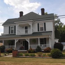
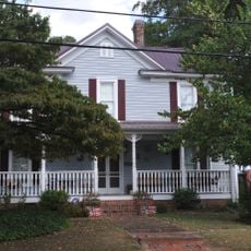
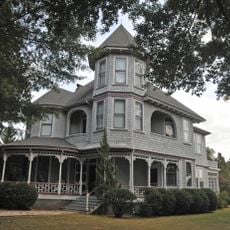
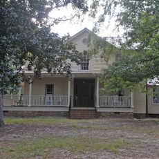
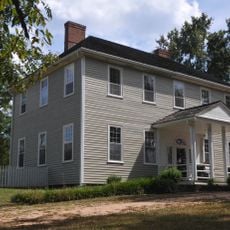
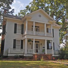
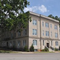
Several historic buildings in Carthage, including the Bruce-Dowd-Kennedy House and the Moore County Courthouse, are listed on the National Register of Historic Places. These structures display late 1800s architecture and reflect the town's past.

Location: North Carolina

Inception: 1784

Capital city: Carthage

Shares border with: Chatham County, Lee County, Harnett County, Cumberland County, Hoke County, Scotland County, Richmond County, Montgomery County, Randolph County

Website: https://moorecountync.gov

GPS coordinates: 35.31000,-79.48000

Latest update: December 14, 2025 20:46

Photos
Around this place
Pinehurst Resort
United States of America

Pinehurst Resort

13.5 km
House in the Horseshoe
United States of America

House in the Horseshoe

19.6 km
Weymouth Woods-Sandhills Nature Preserve
United States of America

Weymouth Woods-Sandhills Nature Preserve

20.7 km
Mystic Cottage
United States of America

Mystic Cottage

12.8 km
Temple Theater
United States of America

Temple Theater

33.3 km
Pinehurst Race Track
United States of America

Pinehurst Race Track

14.3 km
United States of America

Sandhills Horticultural Gardens

11.8 km
United States of America

Long Street Church

39 km
Railroad House
United States of America

Railroad House

33.4 km
James Boyd House
United States of America

James Boyd House

17.8 km
Lee County Courthouse
United States of America

Lee County Courthouse

33.6 km
Malcolm Blue Farm
United States of America

Malcolm Blue Farm

20.4 km
Moore County Courthouse
United States of America

Moore County Courthouse

7 km
Bethesda Presbyterian Church
United States of America

Bethesda Presbyterian Church

20.8 km
Buffalo Presbyterian Church and Cemeteries
United States of America

Buffalo Presbyterian Church and Cemeteries

31 km
Carthage Historic District
United States of America

Carthage Historic District

6.9 km
Lee Avenue Historic District
United States of America

Lee Avenue Historic District

33.8 km
Ellerbe Springs Hotel
United States of America

Ellerbe Springs Hotel

35.4 km
United States of America

Moore County Hunt Lands and Mile-Away Farms

17.1 km
United States of America

Shaw House

17.3 km
J.C. Black House
United States of America

J.C. Black House

7.1 km
Aberdeen Historic District
United States of America

Aberdeen Historic District

20.5 km
Alexander Kelly House
United States of America

Alexander Kelly House

8 km
Lee County Training School
United States of America

Lee County Training School

32.5 km
Southern Pines Historic District
United States of America

Southern Pines Historic District

17.7 km
Euphronia Presbyterian Church
United States of America

Euphronia Presbyterian Church

21.6 km
United States of America

Lakeview Historic District

17.2 km
Hawkins Avenue Historic District
United States of America

Hawkins Avenue Historic District

33.5 km
Show the full map
Reviews

Visited this place? Tap the stars to rate it and share your experience / photos with the community! Try now! You can cancel it anytime.

Administrative divisions
« Moore County - County seat in central North Carolina, United States » is provided by Around Us (aroundus.com). Images and texts are derived from Wikimedia project under a Creative Commons license. You are allowed to copy, distribute, and modify copies of this page, under the conditions set by the license, as long as this note is clearly visible.

Discover hidden gems everywhere you go!

From secret cafés to breathtaking viewpoints, skip the crowded tourist spots and find places that match your style. Our app makes it easy with voice search, smart filtering, route optimization, and insider tips from travelers worldwide. Download now for the complete mobile experience.

Around Us App Screenshot

A unique approach to discovering new places

Le Figaro

All the places worth exploring

France Info

A tailor-made excursion in just a few clicks

20 Minutes