Surry County

Log in to your account

AroundUs is a community-driven map of interesting places, built by curious explorers like you. It grows with every review, story, and photo you share.
Connect to save your favorite spots, contribute locations, and create personalized routes.
Continue with Google
Continue with Apple
Continue with X
Continue with Facebook
Continue with email
By continuing, you accept our Terms and Conditions and our Privacy Policy
Create an account
Add to collection
Map
Suggest a change
Share

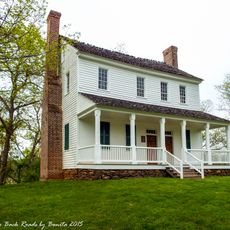
Surry County, Administrative division in North Carolina, United States.

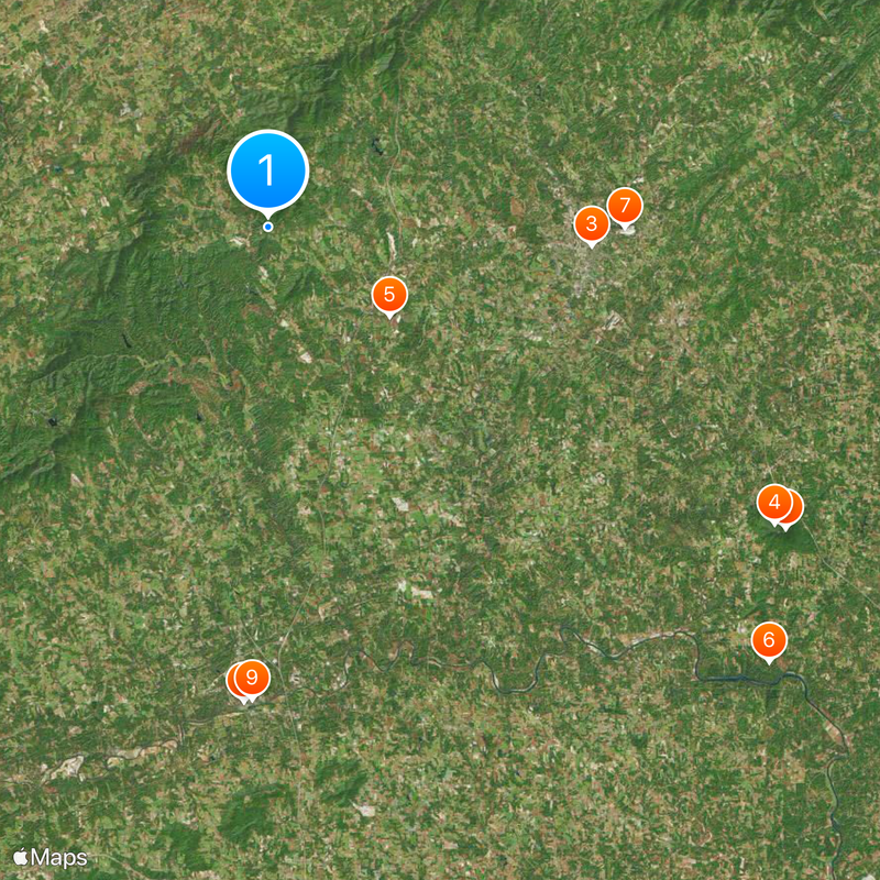
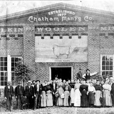
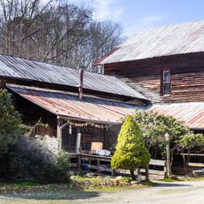
Surry County is an administrative division in the Piedmont region of North Carolina that covers rolling terrain dotted with farms, pastures, and industrial areas. The landscape blends agricultural land with manufacturing facilities, creating a mix of rural and developed spaces.

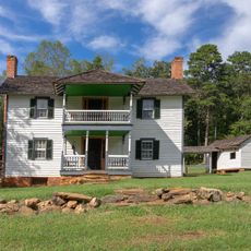
The county was established in 1770 during the colonial period as a structured administrative unit of the Province of North Carolina. Over time it evolved from a primarily agricultural area into a region with diverse economic activities.

The area maintains strong ties to farming and the Yadkin Valley wine region, where vineyards remain central to how local people think about their land. You can experience this connection by visiting the many family-run operations that dot the countryside.

Spring and fall are the best times to explore, when weather is mild and the countryside looks its best. The area is easy to navigate by car, and visitor information centers can help you find your way around.

The county is known for producing a wide variety of cheeses that are shipped beyond the region. This specialized production has become an important part of the local economy.

Location: North Carolina

Inception: 1770

Capital city: Dobson

Shares border with: Yadkin County, Forsyth County, Stokes County, Patrick County, Carroll County, Grayson County, Alleghany County, Wilkes County

Website: http://co.surry.nc.us

GPS coordinates: 36.50806,-80.83333

Latest update: December 20, 2025 01:25

Photos
Around this place
Pilot Mountain
United States of America

Pilot Mountain

37.2 km
Andy Griffith Museum
United States of America

Andy Griffith Museum

20.1 km
Pilot Mountain State Park
United States of America

Pilot Mountain State Park

36.4 km
United States of America

Haystack Farm

9.4 km
Horne Creek Living Historical Farm
United States of America

Horne Creek Living Historical Farm

41.2 km
North Carolina Granite Corporation Quarry Complex
United States of America

North Carolina Granite Corporation Quarry Complex

22.1 km
Downtown Elkin Historic District
United States of America

Downtown Elkin Historic District

29.5 km
Chatham Manufacturing Mill
United States of America

Chatham Manufacturing Mill

29.3 km
Trinity Episcopal Church
United States of America

Trinity Episcopal Church

20.3 km
W. F. Carter House
United States of America

W. F. Carter House

20.5 km
Surry County Courthouse
United States of America

Surry County Courthouse

15.9 km
Mount Airy Historic District
United States of America

Mount Airy Historic District

20.3 km
United States of America

Rock House

15.7 km
Edwards-Franklin House
United States of America

Edwards-Franklin House

5.8 km
William Alfred Moore House
United States of America

William Alfred Moore House

20.4 km
Edgar Harvey Hennis House
United States of America

Edgar Harvey Hennis House

20.2 km
Gwyn Avenue–Bridge Street Historic District
United States of America

Gwyn Avenue–Bridge Street Historic District

29.3 km
United States of America

William Carter House

15.2 km
Bank of Pilot Mountain
United States of America

Bank of Pilot Mountain

35.6 km
Cedar Point
United States of America

Cedar Point

29.6 km
Samuel Josiah Atkinson House
United States of America

Samuel Josiah Atkinson House

34 km
Marion House and Marion Brothers Store
United States of America

Marion House and Marion Brothers Store

34.5 km
United States of America

William T. Vogler Cottage

16.8 km
Elkin Creek Mill
United States of America

Elkin Creek Mill

25.9 km
United States of America

C. C. Cundiff House

33.4 km
United States of America

Mount Airy Museum of Regional History

20.1 km
United States of America

South Atlantic Coastal Plain

34 km
United States of America

Bean Shoals

40.6 km
Show the full map
Reviews

Visited this place? Tap the stars to rate it and share your experience / photos with the community! Try now! You can cancel it anytime.

Administrative divisions
« Surry County - Administrative division in North Carolina, United States » is provided by Around Us (aroundus.com). Images and texts are derived from Wikimedia project under a Creative Commons license. You are allowed to copy, distribute, and modify copies of this page, under the conditions set by the license, as long as this note is clearly visible.

Discover hidden gems everywhere you go!

From secret cafés to breathtaking viewpoints, skip the crowded tourist spots and find places that match your style. Our app makes it easy with voice search, smart filtering, route optimization, and insider tips from travelers worldwide. Download now for the complete mobile experience.

Around Us App Screenshot

A unique approach to discovering new places

Le Figaro

All the places worth exploring

France Info

A tailor-made excursion in just a few clicks

20 Minutes