Ashland County

Log in to your account

AroundUs is a community-driven map of interesting places, built by curious explorers like you. It grows with every review, story, and photo you share.
Connect to save your favorite spots, contribute locations, and create personalized routes.
Continue with Google
Continue with Apple
Continue with X
Continue with Facebook
Continue with email
By continuing, you accept our Terms and Conditions and our Privacy Policy
Create an account
Add to collection
Map
Suggest a change
Share

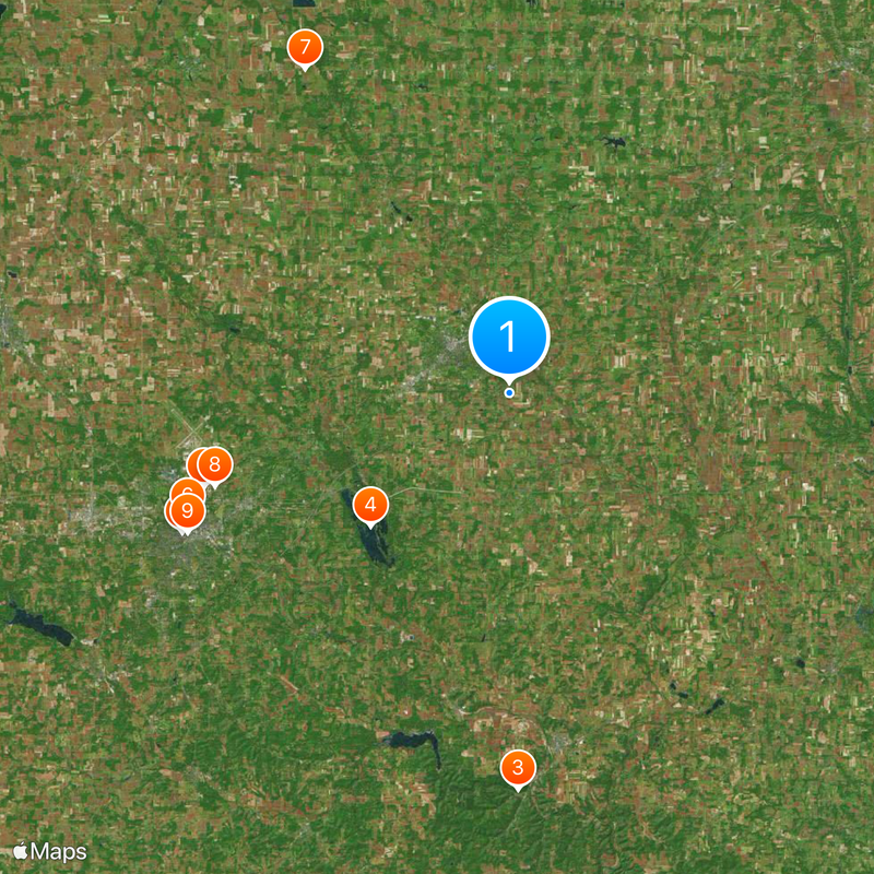
Ashland County, Administrative county in Ohio, United States.

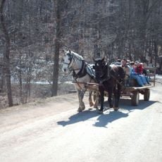
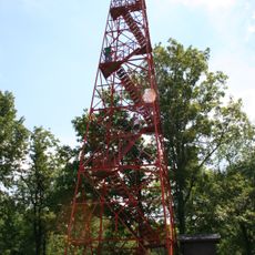
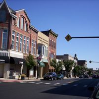
Ashland County is an administrative division in northeastern Ohio positioned between Cleveland and Columbus. The area consists of several smaller towns and communities spread across farmland and woodlands with a mix of rural and developed zones.

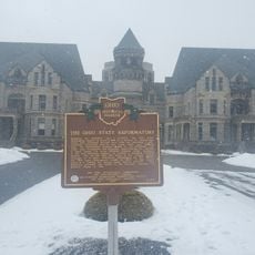
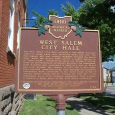
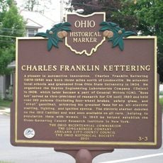
This county was established in 1846, carved from portions of neighboring territories as Ohio expanded its administrative structure. Its creation reflected the broader settlement movement pushing into the region during the 19th century.

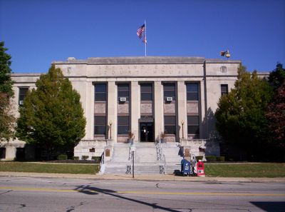
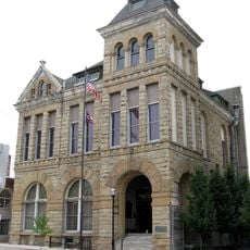
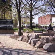
The courthouse in this county is where residents gather to handle official business and attend community meetings. It reflects how local government remains central to everyday civic life here.

The county offers public services and information through its official website ashlandcounty.org where visitors can find local resources and government information. Most of the area is accessible by car, with smaller communities connected by rural roads.

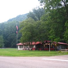
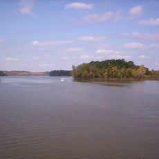
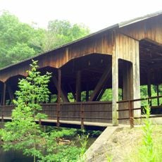
The county contains roughly 700 hectares (1,730 acres) of water bodies including lakes, streams, and wetlands scattered throughout. These waterways offer fishing and boating opportunities that many visitors overlook when exploring the region.

Location: Ohio

Inception: February 24, 1846

Capital city: Ashland

Shares border with: Lorain County, Medina County, Wayne County, Holmes County, Knox County, Richland County, Huron County

Website: http://ashlandcounty.org

GPS coordinates: 40.84000,-82.27000

Latest update: December 20, 2025 15:54

Photos
Around this place
Ohio State Reformatory
United States of America

Ohio State Reformatory

20.7 km
Mohican State Park
United States of America

Mohican State Park

25.7 km
Charles Mill Lake
United States of America

Charles Mill Lake

12.5 km
Renaissance Theatre
United States of America

Renaissance Theatre

23 km
Oak Hill Cottage
United States of America

Oak Hill Cottage

22.4 km
Crittenden Farm
United States of America

Crittenden Farm

24.8 km
BibleWalk
United States of America

BibleWalk

20 km
Mansfield Memorial Museum
United States of America

Mansfield Memorial Museum

22.7 km
Mansfield Lahm Air National Guard Base
United States of America

Mansfield Lahm Air National Guard Base

21 km
Ashland County Courthouse
United States of America

Ashland County Courthouse

5.2 km
Martin Bushnell House
United States of America

Martin Bushnell House

23.5 km
Ohio Theatre
United States of America

Ohio Theatre

22.8 km
Anderson Schoolhouse
United States of America

Anderson Schoolhouse

7.5 km
Samuel Lewis House
United States of America

Samuel Lewis House

19.2 km
Richland Trust Building
United States of America

Richland Trust Building

22.6 km
Jacob H. Barr House
United States of America

Jacob H. Barr House

24.4 km
Diamond Hill Cathedral
United States of America

Diamond Hill Cathedral

19.9 km
KV Market
United States of America

KV Market

23.5 km
Malabar Farm State Park
United States of America

Malabar Farm State Park

23.6 km
Mansfield Art Center
United States of America

Mansfield Art Center

25.1 km
Mohican-Memorial State Forest Fire Tower
United States of America

Mohican-Memorial State Forest Fire Tower

26.4 km
Park Theatre
United States of America

Park Theatre

22.5 km
Mansfield/Richland County Public Library
United States of America

Mansfield/Richland County Public Library

22.7 km
Central Park
United States of America

Central Park

22.5 km
The Ohio State Reformatory
United States of America

The Ohio State Reformatory

20.6 km
West Salem City Hall
United States of America

West Salem City Hall

19.9 km
Charles Franklin Kettering
United States of America

Charles Franklin Kettering

23 km
Mohican State Park Covered Bridge
United States of America

Mohican State Park Covered Bridge

25.6 km
Show the full map
Reviews

Visited this place? Tap the stars to rate it and share your experience / photos with the community! Try now! You can cancel it anytime.

Administrative divisions
« Ashland County - Administrative county in Ohio, United States » is provided by Around Us (aroundus.com). Images and texts are derived from Wikimedia project under a Creative Commons license. You are allowed to copy, distribute, and modify copies of this page, under the conditions set by the license, as long as this note is clearly visible.

Discover hidden gems everywhere you go!

From secret cafés to breathtaking viewpoints, skip the crowded tourist spots and find places that match your style. Our app makes it easy with voice search, smart filtering, route optimization, and insider tips from travelers worldwide. Download now for the complete mobile experience.

Around Us App Screenshot

A unique approach to discovering new places

Le Figaro

All the places worth exploring

France Info

A tailor-made excursion in just a few clicks

20 Minutes