Enable Location

We need your location to show you interesting places around you

Discover nearby places

Find interesting locations and hidden gems around you

Precise directions

Get accurate directions and distances to places

Your location is never shared with other users. It's only used when you tap the location button.

Barron County

Log in to your account

Start exploring — it's free

Trusted by 62,067 travelers worldwide

Continue with Google
Continue with Apple
or

We will send you a code to connect

By continuing, you accept our Terms and Conditions and our Privacy Policy

Check your inbox

We've sent a pincode in your inbox. Please enter the code below.

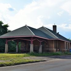
Barron County, Administrative county in northwestern Wisconsin, United States

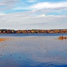
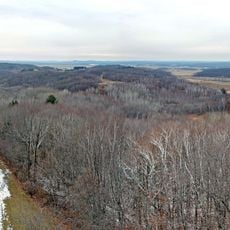
Barron County is an administrative region in northwestern Wisconsin that covers approximately 890 square miles. The landscape combines land areas with water bodies, creating a mixed terrain shaped by rivers and water systems.

The area was originally established as Dallas County in 1859 but was renamed Barron County in 1869 to honor circuit judge Henry D. Barron. This change reflected the region's evolving administrative identity.

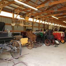
Russian immigrants settled in this area during the late 1800s and shaped the local population and regional traditions that remain visible today. Their influence can be seen in how communities are structured and the customs people still observe.

The region has several airports including Rice Lake Regional Airport and Cumberland Municipal Airport for travel connections. A network of rail services provides additional transportation options for moving through the area.

The Red Cedar River flows through the region and supports smallmouth bass populations while opening access to over 250 miles of winter recreation trails. This waterway serves as the backbone for seasonal outdoor activities.

The community of curious travelers

AroundUs brings together thousands of curated places, local tips, and hidden gems, enriched daily by 60,000 contributors worldwide.

Start exploring
Location
Inception
1874
Capital city
Barron
Shares border with
Washburn County, Sawyer County, Rusk County, Chippewa County, Dunn County, St. Croix County, Polk County, Burnett County
GPS coordinates
45.42000,-91.85000
Latest update
December 7, 2025 10:07
Around this place
Brunet Island State Park
United States of America

Brunet Island State Park

59.9 km
Tainter Lake
United States of America

Tainter Lake

54.1 km
Lake Menomin
United States of America

Lake Menomin

58.9 km
Straight Lake State Park
United States of America

Straight Lake State Park

48.6 km
Hoffman Hills State Recreation Area
United States of America

Hoffman Hills State Recreation Area

53.1 km
Cornell Pulpwood Stacker
United States of America

Cornell Pulpwood Stacker

60.9 km
Wilson Place Museum
United States of America

Wilson Place Museum

60.1 km
Louis Smith Tainter House
United States of America

Louis Smith Tainter House

60.6 km
Cumberland Public Library
United States of America

Cumberland Public Library

18.5 km
United States of America

Cylon Wildlife Area

46.7 km
Taylors Falls Public Library
United States of America

Taylors Falls Public Library

62.8 km
Edward N. and Mary T. Stebbins House
United States of America

Edward N. and Mary T. Stebbins House

2.1 km
Flambeau Mission Church
United States of America

Flambeau Mission Church

52.6 km
Wisconsin Canoe Heritage Museum
United States of America

Wisconsin Canoe Heritage Museum

45.1 km
Colfax Municipal Building
United States of America

Colfax Municipal Building

47.6 km
ZCBJ Hall
United States of America

ZCBJ Hall

21.6 km
Polk County Courthouse
United States of America

Polk County Courthouse

47.2 km
Mrs. Richard Polson House
United States of America

Mrs. Richard Polson House

46.7 km
Thomas Henry Thompson House
United States of America

Thomas Henry Thompson House

62 km
Daniels Town Hall
United States of America

Daniels Town Hall

62.4 km
Chippewa Moraine Lakes State Natural Area
United States of America

Chippewa Moraine Lakes State Natural Area

45.2 km
George V. Siegner House
United States of America

George V. Siegner House

45.6 km
Rice Lake station
United States of America

Rice Lake station

12.9 km
Pioneer Village Museum
United States of America

Pioneer Village Museum

6.3 km
Interstate Park
United States of America

Interstate Park

62.6 km
Interstate State Park WPA/Rustic Style Historic Resources
United States of America

Interstate State Park WPA/Rustic Style Historic Resources

62.6 km
Mabel Tainter Center for the Arts
United States of America

Mabel Tainter Center for the Arts

60.8 km
Auditorium Theatre
United States of America

Auditorium Theatre

62.1 km
Show the full map
Administrative divisions
« Barron County - Administrative county in northwestern Wisconsin, United States » is provided by Around Us (aroundus.com). Images and texts are derived from Wikimedia project under a Creative Commons license. You are allowed to copy, distribute, and modify copies of this page, under the conditions set by the license, as long as this note is clearly visible.

Discover hidden gems everywhere you go!

From secret cafés to breathtaking viewpoints, skip the crowded tourist spots and find places that match your style. Our app makes it easy with voice search, smart filtering, route optimization, and insider tips from travelers worldwide. Download now for the complete mobile experience.

Around Us App Screenshot

A unique approach to discovering new places

Le Figaro

All the places worth exploring

France Info

A tailor-made excursion in just a few clicks

20 Minutes

Around Us
Travel Guide & Maps
Download

Send to your phone

QR Code
1

Open the camera app on your mobile.

2

Point at the QR code with your camera. A notification will appear.

3

Tap the notification to open the link.