Enable Location

We need your location to show you interesting places around you

Discover nearby places

Find interesting locations and hidden gems around you

Precise directions

Get accurate directions and distances to places

Your location is never shared with other users. It's only used when you tap the location button.

Calumet County

Log in to your account

Start exploring — it's free

Trusted by 62,009 travelers worldwide

Continue with Google
Continue with Apple
or

We will send you a code to connect

By continuing, you accept our Terms and Conditions and our Privacy Policy

Check your inbox

We've sent a pincode in your inbox. Please enter the code below.

Calumet County, Administrative county in Wisconsin, United States.

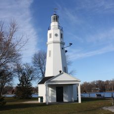
Calumet County is an administrative division in eastern Wisconsin spanning both farmland and small towns. Lake Winnebago forms its western boundary and shapes much of the region's geography.

The county was founded in 1836 during the Wisconsin Territory period and took its name from French terms tied to Native American ceremonial objects. This name choice reflects early contact between European traders and the native peoples of the region.

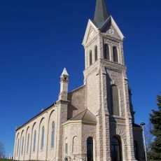
German-speaking settlers from Schleswig-Holstein shaped the southern areas starting in the 1840s, building farming communities there. Their agricultural traditions remain visible in the landscape and local community life today.

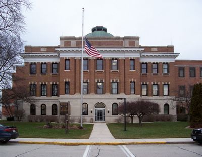
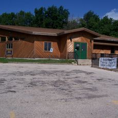
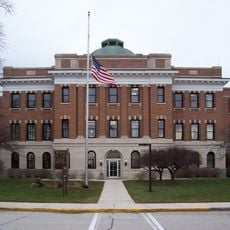
The county seat is based in Chilton, where main administrative services are coordinated. Visitors can stop by local offices for general information and orientation about the area and its services.

The region has far more dairy cows than human inhabitants, reflecting a deep connection to cheese making. This animal population plays a central role in Wisconsin's standing as a leading cheese producer.

The community of curious travelers

AroundUs brings together thousands of curated places, local tips, and hidden gems, enriched daily by 60,000 contributors worldwide.

Start exploring
Location
Inception
1850
Capital city
Chilton
Shares border with
Brown County, Manitowoc County, Sheboygan County, Fond du Lac County, Winnebago County, Outagamie County
GPS coordinates
44.08000,-88.22000
Latest update
December 22, 2025 10:38
Around this place
High Cliff State Park
United States of America

High Cliff State Park

10.4 km
United States of America

Wisconsin International Raceway

18.7 km
St. John the Baptist Catholic Church
United States of America

St. John the Baptist Catholic Church

23.3 km
Herman C. Timm House
United States of America

Herman C. Timm House

18 km
Neenah Light
United States of America

Neenah Light

21.2 km
Ledge View Nature Center
United States of America

Ledge View Nature Center

10.1 km
Calumet County Courthouse
United States of America

Calumet County Courthouse

6.9 km
Stockbridge Indian Cemetery
United States of America

Stockbridge Indian Cemetery

6.5 km
Havilah Babcock House
United States of America

Havilah Babcock House

21.5 km
George O. Bergstrom House
United States of America

George O. Bergstrom House

21.5 km
United States of America

Aldo Leopold Nature Center

10.1 km
Calumet Light
United States of America

Calumet Light

20.4 km
Thomas B. Hart House
United States of America

Thomas B. Hart House

17.1 km
Haese Memorial Village Historic District
United States of America

Haese Memorial Village Historic District

15.5 km
Club Harbor
United States of America

Club Harbor

19.9 km
J. Leslie Sensenbrenner House
United States of America

J. Leslie Sensenbrenner House

21.4 km
Neenah City Pool
United States of America

Neenah City Pool

21 km
United States of America

High Cliff

10.3 km
United States of America

Eagle Links Golf Club

20.6 km
United States of America

Hickory Hills Country Club

3.6 km
United States of America

High Cliff Public Golf Course

11.6 km
United States of America

Countryside Golf Club

19.7 km
United States of America

Endries Performing Arts Center

15.5 km
United States of America

Calumet County Park

8.8 km
United States of America

Red Bird Statue

10.8 km
United States of America

Galloping Ghost

20 km
United States of America

Kimberly Point

21.3 km
United States of America

Scenic viewpoint

10.4 km
Show the full map
Administrative divisions
« Calumet County - Administrative county in Wisconsin, United States » is provided by Around Us (aroundus.com). Images and texts are derived from Wikimedia project under a Creative Commons license. You are allowed to copy, distribute, and modify copies of this page, under the conditions set by the license, as long as this note is clearly visible.

Discover hidden gems everywhere you go!

From secret cafés to breathtaking viewpoints, skip the crowded tourist spots and find places that match your style. Our app makes it easy with voice search, smart filtering, route optimization, and insider tips from travelers worldwide. Download now for the complete mobile experience.

Around Us App Screenshot

A unique approach to discovering new places

Le Figaro

All the places worth exploring

France Info

A tailor-made excursion in just a few clicks

20 Minutes

Around Us
Travel Guide & Maps
Download

Send to your phone

QR Code
1

Open the camera app on your mobile.

2

Point at the QR code with your camera. A notification will appear.

3

Tap the notification to open the link.