Kosciusko County

Log in to your account

AroundUs is a community-driven map of interesting places, built by curious explorers like you. It grows with every review, story, and photo you share.
Connect to save your favorite spots, contribute locations, and create personalized routes.
Continue with Google
Continue with Apple
Continue with X
Continue with Facebook
Continue with email
By continuing, you accept our Terms and Conditions and our Privacy Policy
Create an account
Add to collection
Map
Suggest a change
Share

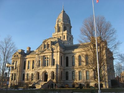
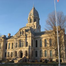
Kosciusko County, Administrative county in northern Indiana, United States

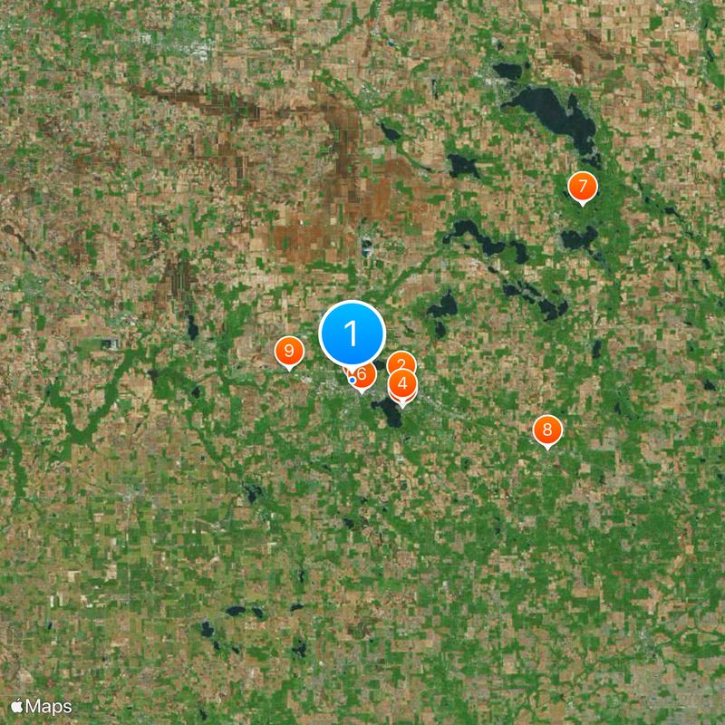
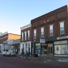
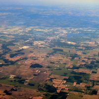
Kosciusko County is an administrative division in northern Indiana featuring multiple lakes, rolling terrain, and farmland throughout the region. The Tippecanoe River runs through the central area and connects various water bodies, while major highways like U.S. Route 30 serve as primary transportation corridors.

The county was established in 1836 and named after a Polish general who supported the United States during the Revolutionary War. This naming choice reflected early connections between the region and international history.

The county takes its name from an 18th-century Polish general, reflecting a connection to Polish-American history that shapes the community's identity today. This heritage influences local celebrations, institutions, and the values residents share across generations.

The county is easily navigable by car, as several state roads and U.S. Route 30 connect different parts of the region. The area offers plenty of space to explore and different types of landscapes depending on where you travel.

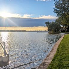
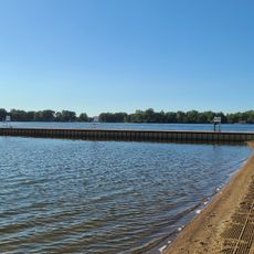
The area is home to several connected lakes and waterways, including Lake Wawasee and Winona Lake, which cover more than one-fifth of the county's surface. These water systems define the region's character and influence both its natural and economic makeup.

Location: Indiana

Inception: February 7, 1835

Capital city: Warsaw

Shares border with: Elkhart County, Wabash County, Whitley County, Noble County, Fulton County, Marshall County

Website: http://kcgov.com

GPS coordinates: 41.24000,-85.86000

Latest update: December 20, 2025 14:43

Photos
Around this place
Justin Zimmer House
United States of America

Justin Zimmer House

3.2 km
Billy Sunday Historic Home
United States of America

Billy Sunday Historic Home

3.8 km
Winona Lake Historic District
United States of America

Winona Lake Historic District

3.6 km
Warsaw Courthouse Square Historic District
United States of America

Warsaw Courthouse Square Historic District

319 m
Warsaw Cut Glass Company
United States of America

Warsaw Cut Glass Company

972 m
United States of America

Tri-County Fish and Wildlife Area

19.3 km
Pierceton Historic District
United States of America

Pierceton Historic District

13.7 km
Chinworth Bridge
United States of America

Chinworth Bridge

4.3 km
Leesburg Historic District
United States of America

Leesburg Historic District

10.2 km
East Fort Wayne Street Historic District
United States of America

East Fort Wayne Street Historic District

814 m
Robert Orr Polygonal Barn
United States of America

Robert Orr Polygonal Barn

13.3 km
Dixie
United States of America

Dixie

16.7 km
Silver Lake Historic District
United States of America

Silver Lake Historic District

18.9 km
Butler Community Mausoleum
United States of America

Butler Community Mausoleum

21.2 km
Winona Lake Splash Pad
United States of America

Winona Lake Splash Pad

3.8 km
United States of America

Wawasee Public Fishing Area

22.1 km
Pike Lake Beach
United States of America

Pike Lake Beach

1.7 km
United States of America

Pickwick Theatre

22.7 km
United States of America

Maxwelton Golf Club

24.1 km
United States of America

South Shore Golf Club

21 km
United States of America

Wawasee Golf Club

24.1 km
United States of America

Stonehenge Golf Club

7.1 km
United States of America

Mentone Egg

16.4 km
United States of America

M101

10.2 km
United States of America

Big Chapman Lake

8.1 km
United States of America

Lucerne Park Amphitheater

1.2 km
United States of America

Happy Trees Studio

1.5 km
United States of America

Work of art

778 m
Show the full map
Reviews

Visited this place? Tap the stars to rate it and share your experience / photos with the community! Try now! You can cancel it anytime.

Administrative divisions
« Kosciusko County - Administrative county in northern Indiana, United States » is provided by Around Us (aroundus.com). Images and texts are derived from Wikimedia project under a Creative Commons license. You are allowed to copy, distribute, and modify copies of this page, under the conditions set by the license, as long as this note is clearly visible.

Discover hidden gems everywhere you go!

From secret cafés to breathtaking viewpoints, skip the crowded tourist spots and find places that match your style. Our app makes it easy with voice search, smart filtering, route optimization, and insider tips from travelers worldwide. Download now for the complete mobile experience.

Around Us App Screenshot

A unique approach to discovering new places

Le Figaro

All the places worth exploring

France Info

A tailor-made excursion in just a few clicks

20 Minutes