Enable Location

We need your location to show you interesting places around you

Discover nearby places

Find interesting locations and hidden gems around you

Precise directions

Get accurate directions and distances to places

Your location is never shared with other users. It's only used when you tap the location button.

Ohio County

Log in to your account

Start exploring — it's free

Trusted by 62,120 travelers worldwide

Continue with Google
Continue with Apple
or

We will send you a code to connect

By continuing, you accept our Terms and Conditions and our Privacy Policy

Check your inbox

We've sent a pincode in your inbox. Please enter the code below.

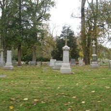
Ohio County, County administrative division in southeastern Indiana, United States.

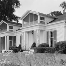
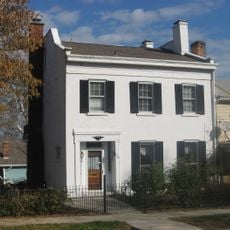
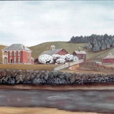
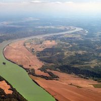
Ohio County covers 87 square miles along the Ohio River and functions as part of the Cincinnati metropolitan area, with Rising Sun serving as its county seat. The land is shaped by the river valley and its connections to the broader regional economy.

The county was established in 1844 when it separated from Dearborn County, following legislative action to resolve a dispute between Rising Sun and Lawrenceburg over which town should be the county seat. This division allowed Rising Sun to become its own regional administrative center.

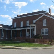
The county is organized into four townships—Cass, Pike, Randolph, and Union—each maintaining its own local services and community identity. This structure shapes how people in different areas organize their daily lives and local affairs.

The Rising Sun/Ohio County Convention and Visitors Bureau provides information about local attractions, accommodations, and river-based activities for visitors exploring the area. Staff there can guide you to various points of interest throughout the county.

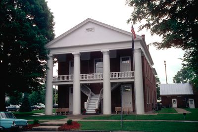
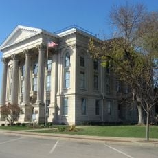
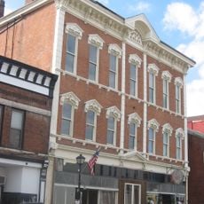
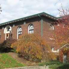
The county courthouse, built in 1845 with Greek Revival architecture and Doric pillars, is Indiana's oldest continuously operating judicial building. The structure remains in active use today and anchors the community's civic center.

The community of curious travelers

AroundUs brings together thousands of curated places, local tips, and hidden gems, enriched daily by 60,000 contributors worldwide.

Start exploring
Location
Inception
1844
Capital city
Rising Sun
Part of
Cincinnati metropolitan area
Shares border with
Dearborn County, Boone County, Switzerland County, Ripley County
GPS coordinates
38.95000,-84.97000
Latest update
December 7, 2025 19:30
Around this place
Hillforest
United States of America

Hillforest

13 km
Dinsmore Homestead
United States of America

Dinsmore Homestead

14.7 km
Laughery Creek Bridge
United States of America

Laughery Creek Bridge

11 km
Rabbit Hash Historic District
United States of America

Rabbit Hash Historic District

10.8 km
Veraestau
United States of America

Veraestau

12.1 km
George Street Bridge
United States of America

George Street Bridge

13.5 km
Dearborn County Courthouse
United States of America

Dearborn County Courthouse

18.8 km
Levi Stevens House
United States of America

Levi Stevens House

13 km
River View Cemetery
United States of America

River View Cemetery

11.1 km
Prospect Farm
United States of America

Prospect Farm

15.6 km
First Presbyterian Church
United States of America

First Presbyterian Church

13.2 km
First Evangelical United Church of Christ
United States of America

First Evangelical United Church of Christ

13 km
Downtown Aurora Historic District
United States of America

Downtown Aurora Historic District

13 km
John Linsey Rand House
United States of America

John Linsey Rand House

15.3 km
Vance-Tousey House
United States of America

Vance-Tousey House

18.6 km
Leive, Parks and Stapp Opera House
United States of America

Leive, Parks and Stapp Opera House

13.3 km
First Methodist Church
United States of America

First Methodist Church

13.2 km
Aurora Public Library
United States of America

Aurora Public Library

13.3 km
Hamline Chapel United Methodist Church
United States of America

Hamline Chapel United Methodist Church

19 km
Daniel S. Major House
United States of America

Daniel S. Major House

17.5 km
James Rogers House
United States of America

James Rogers House

13.2 km
Christian Meeting House
United States of America

Christian Meeting House

15.9 km
Boone County Distillery Superintendent's House and Guest House
United States of America

Boone County Distillery Superintendent's House and Guest House

15.8 km
United States of America

Belleview Post Office

13.1 km
Clore Plow Works-J.W. Whitlock and Company
United States of America

Clore Plow Works-J.W. Whitlock and Company

9.9 km
Farmers Bank of Petersburg
United States of America

Farmers Bank of Petersburg

15.9 km
Donald Barger House
United States of America

Donald Barger House

16.1 km
Lewis Hurlbert, Sr. House
United States of America

Lewis Hurlbert, Sr. House

13 km
Show the full map
Administrative divisions
« Ohio County - County administrative division in southeastern Indiana, United States » is provided by Around Us (aroundus.com). Images and texts are derived from Wikimedia project under a Creative Commons license. You are allowed to copy, distribute, and modify copies of this page, under the conditions set by the license, as long as this note is clearly visible.

Discover hidden gems everywhere you go!

From secret cafés to breathtaking viewpoints, skip the crowded tourist spots and find places that match your style. Our app makes it easy with voice search, smart filtering, route optimization, and insider tips from travelers worldwide. Download now for the complete mobile experience.

Around Us App Screenshot

A unique approach to discovering new places

Le Figaro

All the places worth exploring

France Info

A tailor-made excursion in just a few clicks

20 Minutes

Around Us
Travel Guide & Maps
Download

Send to your phone

QR Code
1

Open the camera app on your mobile.

2

Point at the QR code with your camera. A notification will appear.

3

Tap the notification to open the link.