Enable Location

We need your location to show you interesting places around you

Discover nearby places

Find interesting locations and hidden gems around you

Precise directions

Get accurate directions and distances to places

Your location is never shared with other users. It's only used when you tap the location button.

Spink County

Log in to your account

Start exploring — it's free

Trusted by 62,849 travelers worldwide

Continue with Google
Continue with Apple
or

We will send you a code to connect

By continuing, you accept our Terms and Conditions and our Privacy Policy

Check your inbox

We've sent a pincode in your inbox. Please enter the code below.

Spink County, Administrative county in South Dakota, United States.

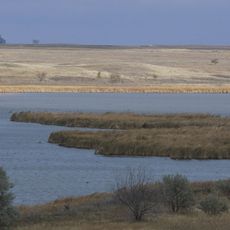
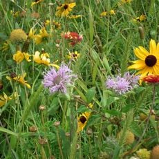
Spink County is an administrative county in South Dakota characterized by rolling farmland and hills that the James River winds through across its landscape. The region combines agricultural property with natural waterways that shape its geography.

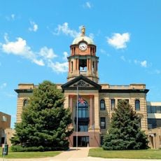
The county was established in 1873 and named after Solomon L. Spink, a Dakota Territory representative in the U.S. House of Representatives. Its founding reflected the broader western expansion and settlement movement of that era.

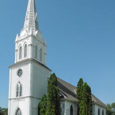
German, Norwegian, and Irish settlers shaped the region's traditions, which remain visible in local communities today. These heritage groups influenced how people here built their towns and maintained their customs over time.

Visitors can access outdoor recreation at Fisher Grove State Park, the main destination for activities in the area. Major highways 212 and 281 cross through the region and link the communities together.

The northeastern edge of the county reaches its highest point and offers views across surrounding farmland. This spot provides a vantage point for those wanting to see the broader landscape from above.

The community of curious travelers

AroundUs brings together thousands of curated places, local tips, and hidden gems, enriched daily by 60,000 contributors worldwide.

Start exploring
Location
Inception
1873
Capital city
Redfield
Shares border with
Brown County, Day County, Clark County, Beadle County, Hand County, Faulk County
GPS coordinates
44.94000,-98.35000
Latest update
December 10, 2025 15:47
Around this place
Chicago, Milwaukee, St. Paul and Pacific Railroad Depot
United States of America

Chicago, Milwaukee, St. Paul and Pacific Railroad Depot

59.5 km
Alonzo Ward Hotel
United States of America

Alonzo Ward Hotel

59.3 km
Storybook Land
United States of America

Storybook Land

62.9 km
Huron Wetland Management District
United States of America

Huron Wetland Management District

59.7 km
Augustana Swedish Lutheran Church
United States of America

Augustana Swedish Lutheran Church

78.5 km
First United Methodist Church
United States of America

First United Methodist Church

58.9 km
Brown County Courthouse
United States of America

Brown County Courthouse

59.4 km
Kuhnert Arboretum
United States of America

Kuhnert Arboretum

56.4 km
Western Union Building
United States of America

Western Union Building

59.4 km
Pyle House
United States of America

Pyle House

65.3 km
Lars J. Fiksdal House
United States of America

Lars J. Fiksdal House

78.3 km
Bethel Church
United States of America

Bethel Church

47.5 km
Chicago and North Western Roundhouse
United States of America

Chicago and North Western Roundhouse

64.9 km
Grace Episcopal Church
United States of America

Grace Episcopal Church

65.3 km
Hattie O. and Henry Drake Octagon House
United States of America

Hattie O. and Henry Drake Octagon House

64.9 km
First National Bank
United States of America

First National Bank

78.5 km
Ipswich State Bank
United States of America

Ipswich State Bank

76.6 km
Spink County Courthouse
United States of America

Spink County Courthouse

14.8 km
Clark County Courthouse
United States of America

Clark County Courthouse

49.1 km
Redfield Carnegie Library
United States of America

Redfield Carnegie Library

15.3 km
John and Kittie Williams House
United States of America

John and Kittie Williams House

78.7 km
Masonic Temple
United States of America

Masonic Temple

58.9 km
Frank and Clara Turner House
United States of America

Frank and Clara Turner House

62.6 km
William Havens House
United States of America

William Havens House

78.2 km
Anton and Mary Agnes Karpen House
United States of America

Anton and Mary Agnes Karpen House

78.6 km
Faulkton American Legion Hall
United States of America

Faulkton American Legion Hall

61.9 km
Gov. Frank M. Byrne House
United States of America

Gov. Frank M. Byrne House

62.1 km
Old Redfield City Hall
United States of America

Old Redfield City Hall

15 km
Show the full map
« Spink County - Administrative county in South Dakota, United States » is provided by Around Us (aroundus.com). Images and texts are derived from Wikimedia project under a Creative Commons license. You are allowed to copy, distribute, and modify copies of this page, under the conditions set by the license, as long as this note is clearly visible.

Discover hidden gems everywhere you go!

From secret cafés to breathtaking viewpoints, skip the crowded tourist spots and find places that match your style. Our app makes it easy with voice search, smart filtering, route optimization, and insider tips from travelers worldwide. Download now for the complete mobile experience.

Around Us App Screenshot

A unique approach to discovering new places

Le Figaro

All the places worth exploring

France Info

A tailor-made excursion in just a few clicks

20 Minutes

Around Us
Travel Guide & Maps
Download

Send to your phone

QR Code
1

Open the camera app on your mobile.

2

Point at the QR code with your camera. A notification will appear.

3

Tap the notification to open the link.