Enable Location

We need your location to show you interesting places around you

Discover nearby places

Find interesting locations and hidden gems around you

Precise directions

Get accurate directions and distances to places

Your location is never shared with other users. It's only used when you tap the location button.

Snyder County

Log in to your account

Start exploring — it's free

Trusted by 61,829 travelers worldwide

Continue with Google
Continue with Apple
or

We will send you a code to connect

By continuing, you accept our Terms and Conditions and our Privacy Policy

Check your inbox

We've sent a pincode in your inbox. Please enter the code below.

Snyder County, Administrative county in Pennsylvania, United States.

Description

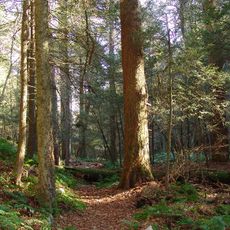
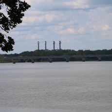
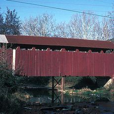
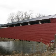
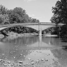
Snyder County sits in the Ridge and Valley region of the Appalachian Mountains, with forests and farmland covering the landscape. Two major routes run through it: U.S. Routes 11 and 15 follow the Susquehanna River while U.S. Route 522 connects several communities.

History

The county was created in 1855 when it separated from Union County and was named after Simon Snyder, a former governor. Settlement developed around the Susquehanna River and agricultural land, which became the foundation of its economy.

Culture

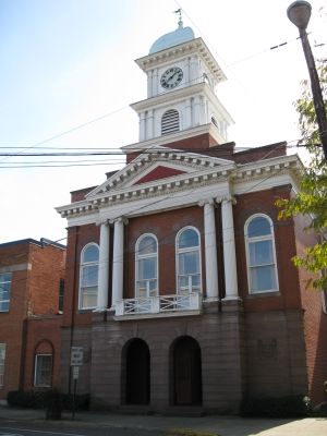
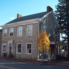
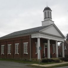
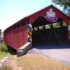
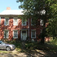
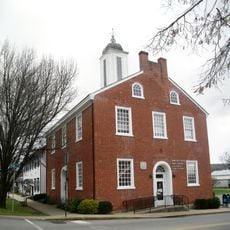
Pennsylvania German traditions shape local life through county fairs, farming methods, and historic buildings like the Governor Snyder Mansion. Visitors can see these practices firsthand at community events and in the rural villages throughout the region.

Practical

The two main highways make it easy to travel between the towns and villages spread across the county. Allow extra time for driving between communities since the routes pass through hilly terrain.

Did you know?

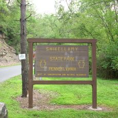
About half the land remains covered in original forest, creating a heavily wooded landscape. Yet more than 400 working farms operate across the county, showing how farming and forest have coexisted here for generations.

Location
Inception
March 2, 1855
Capital city
Middleburg
Shares border with
Union County, Northumberland County, Juniata County, Mifflin County
GPS coordinates
40.77000,-77.08000
Latest update
December 22, 2025 19:31

AroundUs brings together thousands of curated places, local tips, and hidden gems, enriched daily by 60,000 contributors worldwide. Discover all places nearby (Pennsylvania).

Around this place
Shikellamy State Park
United States of America

Shikellamy State Park

26.3 km
Snyder Middleswarth Natural Area
United States of America

Snyder Middleswarth Natural Area

17.7 km
Veterans Memorial Bridge
United States of America

Veterans Memorial Bridge

24.7 km
Gov. Simon Snyder Mansion
United States of America

Gov. Simon Snyder Mansion

18.7 km
North Oriental Covered Bridge
United States of America

North Oriental Covered Bridge

13.4 km
Millmont Red Bridge
United States of America

Millmont Red Bridge

13.6 km
Selinsgrove Hall and Seibert Hall
United States of America

Selinsgrove Hall and Seibert Hall

17.8 km
Aline Covered Bridge
United States of America

Aline Covered Bridge

13.4 km
Dreese's Covered Bridge
United States of America

Dreese's Covered Bridge

5.5 km
East Oriental Covered Bridge
United States of America

East Oriental Covered Bridge

16 km
United States of America

Trevorton Bridge

20.4 km
Selinsgrove Bridge
United States of America

Selinsgrove Bridge

20.1 km
Bridge between Monroe and Penn Townships
United States of America

Bridge between Monroe and Penn Townships

18.5 km
New Berlin Presbyterian Church
United States of America

New Berlin Presbyterian Church

14.5 km
Gross Covered Bridge
United States of America

Gross Covered Bridge

11.4 km
Caspar Snyder House
United States of America

Caspar Snyder House

20.1 km
Old Union County Courthouse
United States of America

Old Union County Courthouse

14.4 km
United States of America

Joyce Kilmer Monument

21.2 km
United States of America

State Game Lands Number 223

19.8 km
United States of America

State Game Lands Number 212

16.8 km
United States of America

AMC Selinsgrove 12

20.3 km
United States of America

State Game Lands Number 201

12.2 km
United States of America

State Game Lands Number 194

14.8 km
United States of America

State Game Lands Number 188

8.3 km
United States of America

State Game Lands Number 233

19.5 km
United States of America

Shade Mountain Golf Course

21.2 km

Thunderbird

17.5 km
United States of America

Weber Chapel Auditorium

17.5 km
Show the full map
« Snyder County - Administrative county in Pennsylvania, United States » is provided by Around Us (aroundus.com). Images and texts are derived from Wikimedia project under a Creative Commons license. You are allowed to copy, distribute, and modify copies of this page, under the conditions set by the license, as long as this note is clearly visible.

Discover hidden gems everywhere you go!

From secret cafés to breathtaking viewpoints, skip the crowded tourist spots and find places that match your style. Our app makes it easy with voice search, smart filtering, route optimization, and insider tips from travelers worldwide. Download now for the complete mobile experience.

Around Us App Screenshot

A unique approach to discovering new places

Le Figaro

All the places worth exploring

France Info

A tailor-made excursion in just a few clicks

20 Minutes

Around Us
Travel Guide & Maps
Download

Send to your phone

QR Code
1

Open the camera app on your mobile.

2

Point at the QR code with your camera. A notification will appear.

3

Tap the notification to open the link.