Enable Location

We need your location to show you interesting places around you

Discover nearby places

Find interesting locations and hidden gems around you

Precise directions

Get accurate directions and distances to places

Your location is never shared with other users. It's only used when you tap the location button.

Utuado

Log in to your account

Start exploring — it's free

Trusted by 61,921 travelers worldwide

Continue with Google
Continue with Apple
or

We will send you a code to connect

By continuing, you accept our Terms and Conditions and our Privacy Policy

Check your inbox

We've sent a pincode in your inbox. Please enter the code below.

Utuado, Mountain municipality in Puerto Rico.

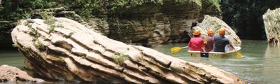
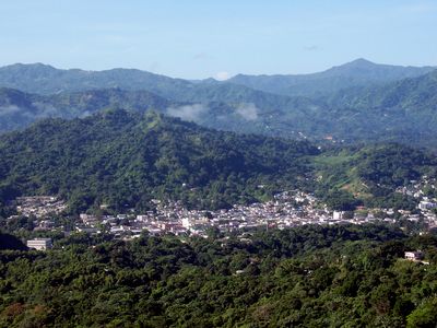
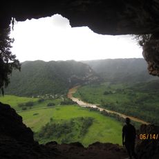
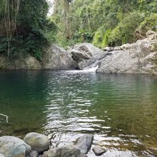
Utuado is a municipality located in the Cordillera Central mountain range of Puerto Rico, positioned between Arecibo and Ponce. The terrain here is rugged and elevated, with settlements scattered across valleys and hillsides throughout the interior landscape.

The municipality was founded in 1739 by Sebastian Murphy as the first European settlement deep in Puerto Rico's mountain interior. This establishment marked an important moment in opening the island's highland regions for settlement and development.

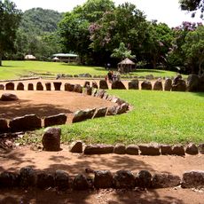
The Caguana Ceremonial Park displays ten plazas carved with petroglyphs created by the Taíno people. These spaces reveal how the original inhabitants gathered for ceremonies and community gatherings in their mountain home.

The location sits at higher elevation with changeable weather, so bring rain gear especially during wetter months when showers are common. Access to the area is best via main roads from larger coastal towns, though local roads can be narrow and winding as they navigate the mountain terrain.

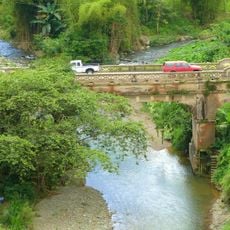
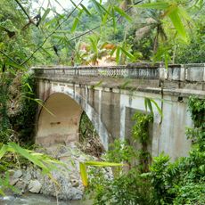
During the 1890s, this region became Puerto Rico's largest coffee producer, with plantations spreading across the mountain slopes. Though this prosperous era has passed, abandoned coffee structures and old ruins still remain scattered through the highlands, telling the story of that forgotten wealth.

The community of curious travelers

AroundUs brings together thousands of curated places, local tips, and hidden gems, enriched daily by 60,000 contributors worldwide.

Start exploring
Location
Inception
1739
Capital city
Utuado
Elevation above the sea
154 m
Shares border with
Jayuya, Adjuntas, Hatillo, Arecibo, Ponce, Ciales, Lares
GPS coordinates
18.26556,-66.70056
Latest update
December 20, 2025 14:56
« Utuado - Mountain municipality in Puerto Rico » is provided by Around Us (aroundus.com). Images and texts are derived from Wikimedia project under a Creative Commons license. You are allowed to copy, distribute, and modify copies of this page, under the conditions set by the license, as long as this note is clearly visible.

Discover hidden gems everywhere you go!

From secret cafés to breathtaking viewpoints, skip the crowded tourist spots and find places that match your style. Our app makes it easy with voice search, smart filtering, route optimization, and insider tips from travelers worldwide. Download now for the complete mobile experience.

Around Us App Screenshot

A unique approach to discovering new places

Le Figaro

All the places worth exploring

France Info

A tailor-made excursion in just a few clicks

20 Minutes

Around Us
Travel Guide & Maps
Download

Send to your phone

QR Code
1

Open the camera app on your mobile.

2

Point at the QR code with your camera. A notification will appear.

3

Tap the notification to open the link.