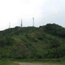
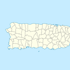
Monte Jayuya, Mountain summit in Cordillera Central, Puerto Rico
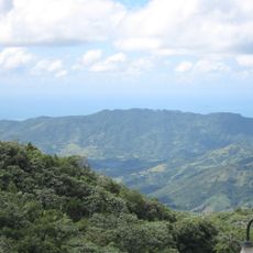
Monte Jayuya rises to 1,315 meters (4,318 feet) within the Toro Negro State Forest, making it the second highest elevation point in Puerto Rico. The mountain is covered in forest and crossed by hiking trails that run through the central mountain range of the island.
The area contains ancient Taino petroglyphs dating from 600 to 1200 AD, showing that indigenous people lived in this region for centuries. These rock carvings are among the oldest human traces found in Puerto Rico's highlands.
The mountain marks the boundary between two municipalities and reflects how highland communities connect to farming and mountain life. People in the region still view this area as part of their local identity.
Hiking trails start from the Toro Negro State Forest recreation areas and are easiest to access during the drier months. Bring sturdy shoes and plenty of water, as trails pass through forest where conditions can be wet and slippery.
From the summit area on clear days, visitors can see both the Atlantic Ocean and Caribbean Sea stretching on either side of the island. This view is only possible from a handful of spots across Puerto Rico.
The community of curious travelers
AroundUs brings together thousands of curated places, local tips, and hidden gems, enriched daily by 60,000 contributors worldwide.