Enable Location

We need your location to show you interesting places around you

Discover nearby places

Find interesting locations and hidden gems around you

Precise directions

Get accurate directions and distances to places

Your location is never shared with other users. It's only used when you tap the location button.

Manchester

Log in to your account

Start exploring — it's free

Trusted by 61,564 travelers worldwide

Continue with Google
Continue with Apple
or

We will send you a code to connect

By continuing, you accept our Terms and Conditions and our Privacy Policy

Check your inbox

We've sent a pincode in your inbox. Please enter the code below.

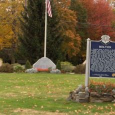
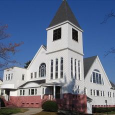
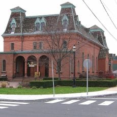
Manchester, Census-designated place in Hartford County, Connecticut, US

Description

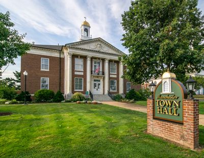
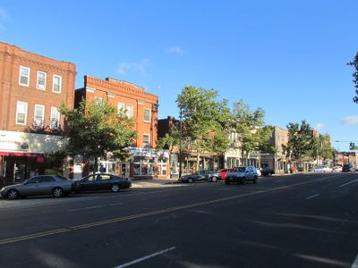
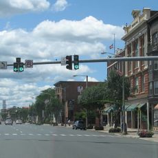
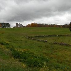
Manchester is a town in Hartford County, Connecticut, made up of residential areas, commercial streets, and several parks. The center spreads across roughly 17 square kilometers, with the different neighborhoods connected by broad roads and tree-lined pathways.

History

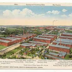
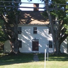
The area served as a camping ground for the Podunk tribe in the 17th century before European settlers arrived. From 1838, the Cheney family built a large silk manufacturing operation here, transforming the place into an industrial center.

Culture

The Manchester Pipe Band from 1914 performs regularly at local events and keeps the town's Scottish musical tradition alive. In the streets and parks, you often see groups gathering for practice or informal performances, showing a lively sense of community connection.

Practical

The town offers various public services and facilities across the different neighborhoods. Water and sewer services run through a municipal system that is currently being updated and adapted to meet current regulations.

Did you know?

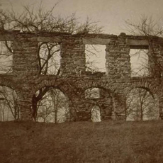
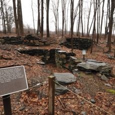
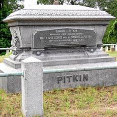
The Pitkin Glassworks received a monopoly on glass production in the 18th century after supplying gunpowder to the Continental Army. This glass factory was one of the few in the American colonies at the time and produced bottles and window glass.

Location
Inception
1672
Elevation above the sea
83 m
GPS coordinates
41.77528,-72.52417
Latest update
December 12, 2025 19:36

AroundUs brings together thousands of curated places, local tips, and hidden gems, enriched daily by 60,000 contributors worldwide. Discover all places nearby (Capitol Planning Region).

Around this place
Pratt & Whitney Stadium
United States of America

Pratt & Whitney Stadium

8.1 km
Gay City State Park
United States of America

Gay City State Park

8.9 km
Cheney Brothers Historic District
United States of America

Cheney Brothers Historic District

1.2 km
Crossroads Community Cathedral
United States of America

Crossroads Community Cathedral

4.6 km
Lutz Children's Museum
United States of America

Lutz Children's Museum

2.2 km
Downtown Main Street Historic District
United States of America

Downtown Main Street Historic District

9.8 km
Talcottville Historic District
United States of America

Talcottville Historic District

5.4 km
Pitkin Glassworks Ruin
United States of America

Pitkin Glassworks Ruin

1.7 km
Manchester Main Post Office
United States of America

Manchester Main Post Office

186 m
Fifth Camp of Rochambeau's Infantry
United States of America

Fifth Camp of Rochambeau's Infantry

8 km
Makens Bemont House
United States of America

Makens Bemont House

8.4 km
Gideon Welles House
United States of America

Gideon Welles House

9.9 km
Oliver White Tavern
United States of America

Oliver White Tavern

8.3 km
Case Brothers Historic District
United States of America

Case Brothers Historic District

3.2 km
Selden Brewer House
United States of America

Selden Brewer House

9.7 km
Windsor Farms Historic District
United States of America

Windsor Farms Historic District

10 km
Bolton Green Historic District
United States of America

Bolton Green Historic District

8 km
Elmore Houses
United States of America

Elmore Houses

6.6 km
Union Village Historic District
United States of America

Union Village Historic District

2.4 km
Manchester Historic District
United States of America

Manchester Historic District

682 m
Valley Falls Cotton Mill Site
United States of America

Valley Falls Cotton Mill Site

8.4 km
Dr. Elizur Hale House
United States of America

Dr. Elizur Hale House

8.4 km
Sharpe's Trout Hatchery Site
United States of America

Sharpe's Trout Hatchery Site

8.4 km
Woodbridge Farmstead
United States of America

Woodbridge Farmstead

2.2 km
Gilman-Hayden House
United States of America

Gilman-Hayden House

9.3 km
Central Avenue-Center Cemetery Historic District
United States of America

Central Avenue-Center Cemetery Historic District

9.8 km
Naubuc Avenue-Broad Street Historic District
United States of America

Naubuc Avenue-Broad Street Historic District

9.9 km
Pratt & Whitney Hangar Museum
United States of America

Pratt & Whitney Hangar Museum

9 km
Show the full map
« Manchester - Census-designated place in Hartford County, Connecticut, US » is provided by Around Us (aroundus.com). Images and texts are derived from Wikimedia project under a Creative Commons license. You are allowed to copy, distribute, and modify copies of this page, under the conditions set by the license, as long as this note is clearly visible.

Discover hidden gems everywhere you go!

From secret cafés to breathtaking viewpoints, skip the crowded tourist spots and find places that match your style. Our app makes it easy with voice search, smart filtering, route optimization, and insider tips from travelers worldwide. Download now for the complete mobile experience.

Around Us App Screenshot

A unique approach to discovering new places

Le Figaro

All the places worth exploring

France Info

A tailor-made excursion in just a few clicks

20 Minutes

Around Us
Travel Guide & Maps
Download

Send to your phone

QR Code
1

Open the camera app on your mobile.

2

Point at the QR code with your camera. A notification will appear.

3

Tap the notification to open the link.