Enable Location

We need your location to show you interesting places around you

Discover nearby places

Find interesting locations and hidden gems around you

Precise directions

Get accurate directions and distances to places

Your location is never shared with other users. It's only used when you tap the location button.

Saint Mary Lake

Log in to your account

Start exploring — it's free

Trusted by 67,767 travelers worldwide

Continue with Google
Continue with Apple
or

We will send you a code to connect

By continuing, you accept our Terms and Conditions and our Privacy Policy

Check your inbox

We've sent a pincode in your inbox. Please enter the code below.

Saint Mary Lake
Discussion Reviews 2 Photos
30.5k Popularity

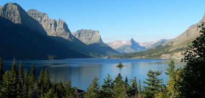
Saint Mary Lake, Lake in Glacier National Park, Montana, US

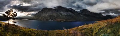
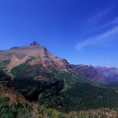
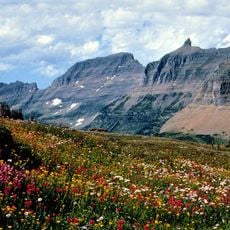
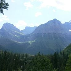
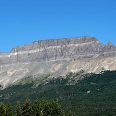
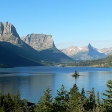
Saint Mary Lake is a large body of water in Glacier National Park, stretching through a deep valley surrounded by steep mountains on all sides. The clear water reflects the surrounding peaks and serves as a natural boundary between different landscapes within the park.

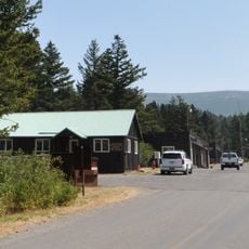
The lake served as an important route for indigenous peoples long before the park was established. Later, the construction of Going-to-the-Sun Road transformed it into a major destination, bringing visitors to explore its waters in entirely new ways.

The Blackfeet Nation hunted these lands for generations, and the lake remains deeply connected to their identity and stories. Walking along the shore today, you can sense this long relationship between the people and the water.

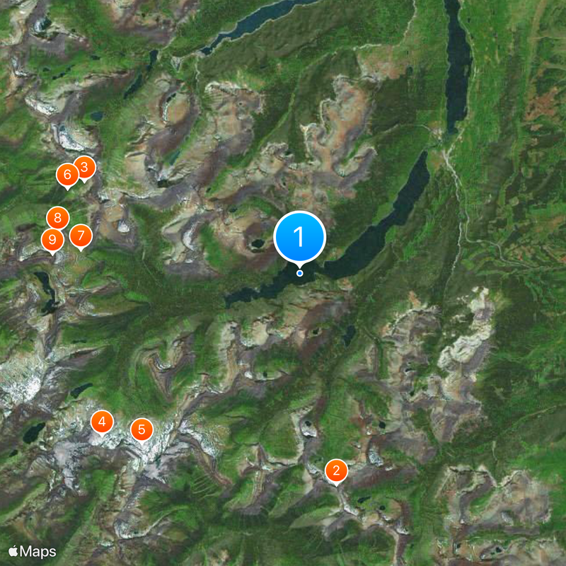
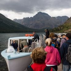
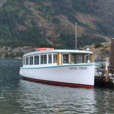
The best way to experience the lake is by boat from Rising Sun, especially when visibility is good and you can see the distant mountains clearly. Arriving early gives you a better chance of finding space and enjoying the quieter morning hours before crowds arrive.

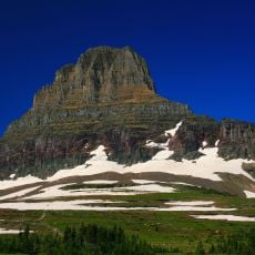
A small island covered with a few trees rises above the water and quickly becomes the lake's calling card when you drive down the road. This tiny island appears like a miniature against the enormous mountain backdrop and has become familiar to many visitors even before they reach the park.

The community of curious travelers

AroundUs brings together thousands of curated places, local tips, and hidden gems, enriched daily by 60,000 contributors worldwide.

Start exploring
Location
Elevation above the sea
1,367 m
GPS coordinates
48.68278,-113.54556
Latest update
December 20, 2025 02:17
Around this place
Triple Divide Peak
United States of America

Triple Divide Peak

12.4 km
Garden Wall
United States of America

Garden Wall

13.5 km
Jackson Glacier
United States of America

Jackson Glacier

14.8 km
Blackfoot Glacier
United States of America

Blackfoot Glacier

13.4 km
Weeping Wall
United States of America

Weeping Wall

14.3 km
Logan Pass Visitor Center
United States of America

Logan Pass Visitor Center

12.7 km
Mount Oberlin
United States of America

Mount Oberlin

14.2 km
Clements Mountain
United States of America

Clements Mountain

14.4 km
Saint Mary Visitor Center, Entrance Station and Checking Stations
United States of America

Saint Mary Visitor Center, Entrance Station and Checking Stations

10.2 km
United States of America

Haystack Butte

14.8 km
Cut Bank Ranger Station Historic District
United States of America

Cut Bank Ranger Station Historic District

15.1 km
Sun Camp Fireguard Cabin
United States of America

Sun Camp Fireguard Cabin

3.3 km
Glacier National Park Tourist Trails
United States of America

Glacier National Park Tourist Trails

1.8 km
Saint Mary Ranger Station
United States of America

Saint Mary Ranger Station

10.1 km
Red Eagle Glacier
United States of America

Red Eagle Glacier

11.4 km
Many Glacier Barn and Bunkhouse
United States of America

Many Glacier Barn and Bunkhouse

15.1 km
Roes Creek Campground Camptender's Cabin
United States of America

Roes Creek Campground Camptender's Cabin

2.2 km
Logan Glacier
United States of America

Logan Glacier

11 km
Pumpelly Glacier
United States of America

Pumpelly Glacier

13.9 km
Piegan Glacier
United States of America

Piegan Glacier

10.6 km
St. Mary Utility Area Historic District
United States of America

St. Mary Utility Area Historic District

10.6 km
Singleshot Mountain
United States of America

Singleshot Mountain

7.4 km
Morning Eagle
United States of America

Morning Eagle

14.8 km
Razoredge Mountain
United States of America

Razoredge Mountain

14.2 km
Little Chief
United States of America

Little Chief

1.7 km
Saint Mary Lake
United States of America

Saint Mary Lake

1.6 km
Rising Sun Auto Camp Historic District
United States of America

Rising Sun Auto Camp Historic District

2.5 km
Highline Trailhead South
United States of America

Highline Trailhead South

12.8 km
Show the full map
Reviews
Share your experience

No review yet

Discussions
Start a discussion...

No discussion yet

« Saint Mary Lake - Lake in Glacier National Park, Montana, US » is provided by Around Us (aroundus.com). Images and texts are derived from Wikimedia project under a Creative Commons license. You are allowed to copy, distribute, and modify copies of this page, under the conditions set by the license, as long as this note is clearly visible.

Discover hidden gems everywhere you go!

From secret cafés to breathtaking viewpoints, skip the crowded tourist spots and find places that match your style. Our app makes it easy with voice search, smart filtering, route optimization, and insider tips from travelers worldwide. Download now for the complete mobile experience.

Around Us App Screenshot

A unique approach to discovering new places

Le Figaro

All the places worth exploring

France Info

A tailor-made excursion in just a few clicks

20 Minutes

Around Us
Travel Guide & Maps
Download

Send to your phone

QR Code
1

Open the camera app on your mobile.

2

Point at the QR code with your camera. A notification will appear.

3

Tap the notification to open the link.