Chest opened
+${chestReward.xp} XP
Explorer
NOUVEAU ×${chestReward.collectible.quantity}
tapez pour fermer
Chest locked

Open chests in the app

Around Us is built for your phone — chests unlock when you walk, explore and capture nearby places.

Enable Location

We need your location to show you interesting places around you

Discover nearby places

Find interesting locations and hidden gems around you

Precise directions

Get accurate directions and distances to places

Your location is never shared with other users. It's only used when you tap the location button.

Log in to your account

Start exploring — it's free

Trusted by 72,928 travelers worldwide

Continue with Google
Continue with Apple
or

We will send you a code to connect

By continuing, you accept our Terms and Conditions and our Privacy Policy

Check your inbox

We've sent a pincode in your inbox. Please enter the code below.

Discussion Reviews Photo
17.9k Popularity

South Deering, Industrial neighborhood in Chicago, US.

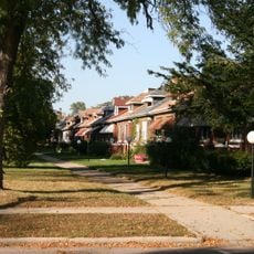
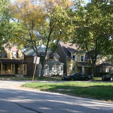
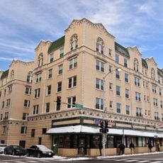
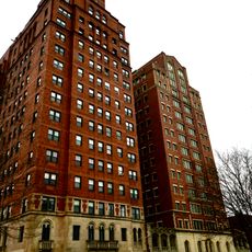
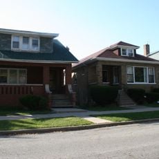
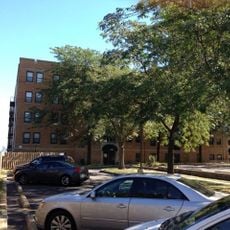
South Deering is Chicago's largest community area by territory, with industrial zones, natural wetlands, and parks dominating the landscape. The residential sections are concentrated in the northeast near Lake Calumet.

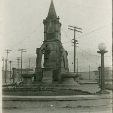
The area originated in 1875 when the Joseph H. Brown Iron and Steel Company established operations and created a settlement first called Irondale. The name changed to South Deering in 1903.

Workers from Ireland, Wales, England, Sweden, Germany, and Mexico shaped this neighborhood, building a diverse community centered on the Wisconsin Steel Works. Their descendants remain part of the fabric of local businesses and traditions.

Residential areas concentrate in the northeast corner near Lake Calumet, with public transportation offering connections to downtown Chicago through multiple bus routes. This makes exploring the neighborhood straightforward for visitors.

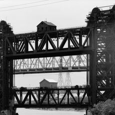
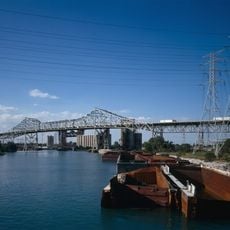
Calumet Fisheries, a seafood restaurant operating at the 95th Street Bridge crossing the Calumet River, has been serving the community since 1928. This landmark is a rare survivor from when the waterway was central to local commerce.

The community of curious travelers

AroundUs brings together thousands of curated places, local tips, and hidden gems, enriched daily by 60,000 contributors worldwide.

Start exploring
Location
GPS coordinates
41.71000,-87.56000
Latest update
December 7, 2025 19:23
Around this place
Mosque Maryam
United States of America

Mosque Maryam

6 km
Avalon Regal Theater
United States of America

Avalon Regal Theater

5 km
South Shore Cultural Center
United States of America

South Shore Cultural Center

6.7 km
Pullman National Historical Park
United States of America

Pullman National Historical Park

4.3 km
Calumet Park
United States of America

Calumet Park

2.7 km
Illinois-Indiana State Line Boundary Marker
United States of America

Illinois-Indiana State Line Boundary Marker

3 km
S. A. Foster House and Stable
United States of America

S. A. Foster House and Stable

7.2 km
Bronzeville Children's Museum
United States of America

Bronzeville Children's Museum

2.7 km
Allan Miller House
United States of America

Allan Miller House

6.3 km
Palmer Park
United States of America

Palmer Park

5.1 km
Drake Fountain
United States of America

Drake Fountain

2.1 km
Lake Shore and Michigan Southern Railway, Bridge No. 6
United States of America

Lake Shore and Michigan Southern Railway, Bridge No. 6

1.8 km
Carter G. Woodson Regional Library
United States of America

Carter G. Woodson Regional Library

7 km
South Park Manor Historic District
United States of America

South Park Manor Historic District

7.2 km
Garden Homes Historic District
United States of America

Garden Homes Historic District

5.9 km
Trumbull Park
United States of America

Trumbull Park

531 m
Stony Island Trust and Savings Bank Building
United States of America

Stony Island Trust and Savings Bank Building

7.2 km
South Shore Bungalow Historic District
United States of America

South Shore Bungalow Historic District

4.9 km
Windsor Beach Apartments
United States of America

Windsor Beach Apartments

6 km
Grand Crossing Park
United States of America

Grand Crossing Park

6.1 km
Hoosier Theater
United States of America

Hoosier Theater

6.3 km
Whiting Memorial Community House
United States of America

Whiting Memorial Community House

6.4 km
Jeffery–Cyril Historic District
United States of America

Jeffery–Cyril Historic District

6.2 km
Chicago Skyway
United States of America

Chicago Skyway

1.7 km
Shoreline Apartments
United States of America

Shoreline Apartments

7.1 km
West Chatham Bungalow Historic District
United States of America

West Chatham Bungalow Historic District

7.2 km
Lake-Side Terrace Apartments
United States of America

Lake-Side Terrace Apartments

5.8 km
Anton E. Hanson House
United States of America

Anton E. Hanson House

5.5 km
Show the full map
Reviews
Share your experience

No review yet

Discussions
Start a discussion...

No discussion yet

« South Deering - Industrial neighborhood in Chicago, US » is provided by Around Us (aroundus.com). Images and texts are derived from Wikimedia project under a Creative Commons license. You are allowed to copy, distribute, and modify copies of this page, under the conditions set by the license, as long as this note is clearly visible.

Discover hidden gems everywhere you go!

From secret cafés to breathtaking viewpoints, skip the crowded tourist spots and find places that match your style. Our app makes it easy with voice search, smart filtering, route optimization, and insider tips from travelers worldwide. Download now for the complete mobile experience.

Around Us App Screenshot

A unique approach to discovering new places

Le Figaro

All the places worth exploring

France Info

A tailor-made excursion in just a few clicks

20 Minutes

Around Us
Travel Guide & Maps
Download

Send to your phone

QR Code
1

Open the camera app on your mobile.

2

Point at the QR code with your camera. A notification will appear.

3

Tap the notification to open the link.