Enable Location

We need your location to show you interesting places around you

Discover nearby places

Find interesting locations and hidden gems around you

Precise directions

Get accurate directions and distances to places

Your location is never shared with other users. It's only used when you tap the location button.

Greenbelt

Log in to your account

Join the adventure

Create your free account and start exploring (like 60k+ others)

We will send you a code to connect

or
Continue with Google
Continue with Apple
By continuing, you accept our Terms and Conditions and our Privacy Policy

Check your inbox

We've sent a pincode in your inbox. Please enter the code below.

Greenbelt, Planned community from New Deal era in Prince George's County, United States.

Description

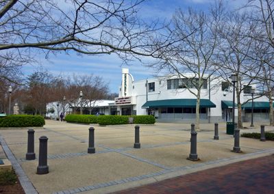
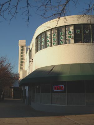
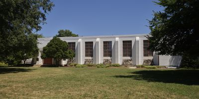
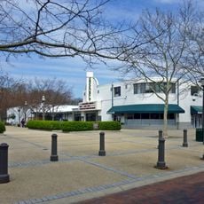
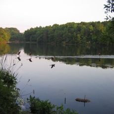
Greenbelt is a planned residential community from the 1930s, designed with abundant green spaces, sidewalks, and Art Deco-style buildings arranged in curved patterns around a central shopping district. The layout reflects a deliberate vision that integrates homes, parks, and businesses into a cohesive whole.

History

The government launched the project in 1936 during the Great Depression to provide housing and create jobs for workers. The first residents arrived in 1937, establishing this place as an experimental model for planned community development.

Culture

The community has deep roots in neighborly traditions, with residents gathering throughout the year for farmers markets, festivals, and local club meetings held in communal spaces. This sense of togetherness remains central to how people experience life here today.

Practical

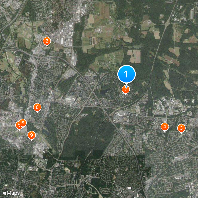
The location connects easily to Washington D.C. via the Metro Green Line station nearby. Parking is available throughout residential areas and near the shopping center, making arrival by car straightforward as well.

Did you know?

This place was an experimental laboratory for city planning ideas in its era, featuring curved streets designed to slow traffic and extensive green networks woven between residential blocks. These features became models that later communities across North America adopted.

Inception
June 1, 1935
Shares border with
Goddard, Berwyn Heights, Riverdale Park, New Carrollton, College Park, Lanham, Beltsville
GPS coordinates
39.00461,-76.87568
Latest update
December 14, 2025 18:07

AroundUs brings together thousands of curated places, local tips, and hidden gems, enriched daily by 60,000 contributors worldwide. Discover all places nearby (Prince George's County).

Around this place
United States National Agricultural Library
United States of America

United States National Agricultural Library

4.5 km
Diyanet Center of America
United States of America

Diyanet Center of America

3.6 km
Sri Siva Vishnu Temple
United States of America

Sri Siva Vishnu Temple

2.9 km
The Rossborough Inn
United States of America

The Rossborough Inn

5.8 km
University of Maryland Arboretum & Botanical Garden
United States of America

University of Maryland Arboretum & Botanical Garden

5.6 km
Old Greenbelt Theatre
United States of America

Old Greenbelt Theatre

360 m
United States of America

Rhode Island Avenue Trolley Trail

4.6 km
Cory House
United States of America

Cory House

5.4 km
O'Dea House
United States of America

O'Dea House

3.4 km
NASA Goddard Visitor Center (Building 089)
United States of America

NASA Goddard Visitor Center (Building 089)

2.8 km
Marenka House
United States of America

Marenka House

4.6 km
New Deal Cafe
United States of America

New Deal Cafe

370 m
Roosevelt Center
United States of America

Roosevelt Center

361 m
Buddy Attick Lake Park
United States of America

Buddy Attick Lake Park

1.1 km
Lake Artemesia
United States of America

Lake Artemesia

4.5 km
College Park Aviation Museum
United States of America

College Park Aviation Museum

4.9 km
United States of America

Greenbelt Park Campground

3.7 km
United States of America

Gallery 19

614 m
United States of America

Greenbelt Park Campground

3.9 km
United States of America

Paint Branch Golf Complex

5.2 km
United States of America

Mother and Child Statue

345 m
United States of America

Site of College Park Airport

5 km
United States of America

Work of art, sculpture

4.8 km
United States of America

Scenic viewpoint

4.6 km
United States of America

Paint Branch

4.7 km
United States of America

College Park Airport

4.8 km
United States of America

Waterfall

793 m
United States of America

Monument featuring aircraft, tourist attraction

5.6 km
Show the full map
« Greenbelt - Planned community from New Deal era in Prince George's County, United States » is provided by Around Us (aroundus.com). Images and texts are derived from Wikimedia project under a Creative Commons license. You are allowed to copy, distribute, and modify copies of this page, under the conditions set by the license, as long as this note is clearly visible.

Discover hidden gems everywhere you go!

From secret cafés to breathtaking viewpoints, skip the crowded tourist spots and find places that match your style. Our app makes it easy with voice search, smart filtering, route optimization, and insider tips from travelers worldwide. Download now for the complete mobile experience.

Around Us App Screenshot

A unique approach to discovering new places

Le Figaro

All the places worth exploring

France Info

A tailor-made excursion in just a few clicks

20 Minutes

Around Us
Travel Guide & Maps
Download

Send to your phone

QR Code
1

Open the camera app on your mobile.

2

Point at the QR code with your camera. A notification will appear.

3

Tap the notification to open the link.