Enable Location

We need your location to show you interesting places around you

Discover nearby places

Find interesting locations and hidden gems around you

Precise directions

Get accurate directions and distances to places

Your location is never shared with other users. It's only used when you tap the location button.

Asuncion Island

Log in to your account

Start exploring — it's free

Trusted by 68,318 travelers worldwide

Continue with Google
Continue with Apple
or

We will send you a code to connect

By continuing, you accept our Terms and Conditions and our Privacy Policy

Check your inbox

We've sent a pincode in your inbox. Please enter the code below.

Asuncion Island
Discussion Reviews 1 Photos
11.5k Popularity

Asuncion Island, Volcanic island in Northern Mariana Islands, United States.

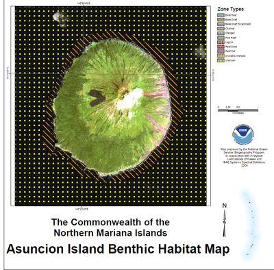
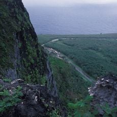
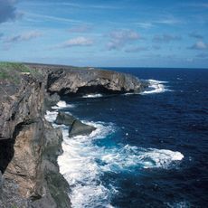
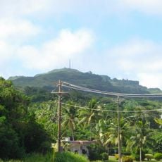
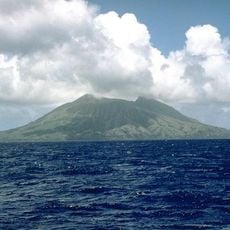
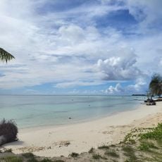
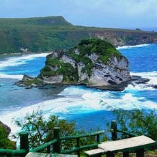
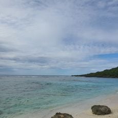
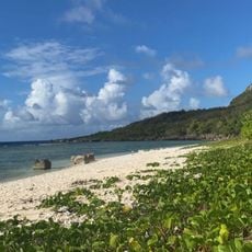
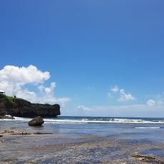
Asuncion Island is a volcanic formation in the Northern Mariana Islands with dramatic northeast slopes that rise steeply toward cliff faces reaching nearly 900 m (2,950 ft) in elevation. The landmass stretches roughly 3 km (2 mi) in length across a total area of about 8 square kilometers (3 square miles).

Spanish missionaries first reached the island in 1669 and named it after the Assumption of Mary, establishing early European contact in this part of the Pacific. Germany later took control in 1899, marking a shift in colonial power that reshaped the region's political landscape.

The island held deep connections to Chamorro and Carolinian communities who lived here before settling elsewhere in the Mariana chain. Their legacy continues to shape how people understand this part of the ocean today.

Reaching this island demands specialized transport such as boats or helicopters from other Northern Mariana islands, as no regular ferry services exist. Planning ahead is crucial since weather conditions and rough seas can affect arrival possibilities.

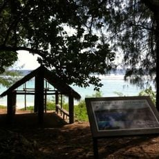
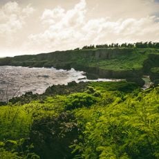
The island holds the most developed native forest north of Saipan, featuring uncommon Terminalia rostrata trees and a rich mix of plant life found nowhere else nearby. Few visitors ever get to see this hidden forest ecosystem that thrives on the volcanic slopes.

The community of curious travelers

AroundUs brings together thousands of curated places, local tips, and hidden gems, enriched daily by 60,000 contributors worldwide.

Start exploring
Elevation above the sea
891 m
Part of
Northern Mariana Islands
GPS coordinates
19.68333,145.40000
Latest update
December 8, 2025 13:40
Around this place
Suicide Cliff
United States of America

Suicide Cliff

492.4 km
Banzai Cliff
United States of America

Banzai Cliff

491.3 km
Military Air Transport Service
United States of America

Military Air Transport Service

508.7 km
United States of America

USS Gudgeon

403.8 km
Mount Tapochau
United States of America

Mount Tapochau

501.9 km
American Memorial Park
United States of America

American Memorial Park

498.4 km
East Field
United States of America

East Field

504.2 km
NMI Museum of History and Culture
United States of America

NMI Museum of History and Culture

500 km
Japanese Lighthouse
United States of America

Japanese Lighthouse

499 km
Sugar King Park
United States of America

Sugar King Park

500 km
Japanese Hospital
United States of America

Japanese Hospital

500.1 km
Catholic Belltower
United States of America

Catholic Belltower

500 km
Japanese 20mm Cannon Blockhouse
United States of America

Japanese 20mm Cannon Blockhouse

510 km
Japanese Jail Historic and Archeological District
United States of America

Japanese Jail Historic and Archeological District

483.5 km
Santa Remedios Church
United States of America

Santa Remedios Church

495.8 km
Alamagan (volcano)
United States of America

Alamagan (volcano)

236.2 km
American Saipan Memorial
United States of America

American Saipan Memorial

498.2 km
Pau Pau Beach
United States of America

Pau Pau Beach

494.9 km
Ladder Beach
United States of America

Ladder Beach

510.4 km
Micro Beach
United States of America

Micro Beach

498.1 km
Landing Beaches; Aslito/Isely Field; & Marpi Point, Saipan Island
United States of America

Landing Beaches; Aslito/Isely Field; & Marpi Point, Saipan Island

509.6 km
Bird Island Beach
United States of America

Bird Island Beach

494.3 km
Unai Baput
United States of America

Unai Baput

504.8 km
Unai Makpe
United States of America

Unai Makpe

493 km
Old man by the sea
United States of America

Old man by the sea

499.6 km
Joeten-Kiyu Public Library
United States of America

Joeten-Kiyu Public Library

504.8 km
Wing Beach
United States of America

Wing Beach

493 km
Jeffrey´s Beach
United States of America

Jeffrey´s Beach

499 km
Show the full map
Reviews
Share your experience

No review yet

Discussions
Start a discussion...

No discussion yet

« Asuncion Island - Volcanic island in Northern Mariana Islands, United States » is provided by Around Us (aroundus.com). Images and texts are derived from Wikimedia project under a Creative Commons license. You are allowed to copy, distribute, and modify copies of this page, under the conditions set by the license, as long as this note is clearly visible.

Discover hidden gems everywhere you go!

From secret cafés to breathtaking viewpoints, skip the crowded tourist spots and find places that match your style. Our app makes it easy with voice search, smart filtering, route optimization, and insider tips from travelers worldwide. Download now for the complete mobile experience.

Around Us App Screenshot

A unique approach to discovering new places

Le Figaro

All the places worth exploring

France Info

A tailor-made excursion in just a few clicks

20 Minutes

Around Us
Travel Guide & Maps
Download

Send to your phone

QR Code
1

Open the camera app on your mobile.

2

Point at the QR code with your camera. A notification will appear.

3

Tap the notification to open the link.