Big Sioux River, Tributary river between South Dakota and Iowa, United States.
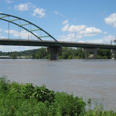
The Big Sioux River is a waterway that flows approximately 419 miles from Roberts County through eastern South Dakota and northwestern Iowa to meet the Missouri River at Sioux City. It winds through varied landscapes as it marks the boundary between these two states.
This waterway served as a crucial transportation route and boundary marker during early European settlement of the region. The official name was confirmed in 1931 by the United States Board on Geographic Names, honoring its connection to the Lakota people.
Native American tribes named this waterway Tehankasandata, meaning Thick Wooded River, reflecting their deep connection to the natural landscape.
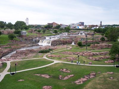
Visitors can access the river at several points for fishing, kayaking, and canoeing, with Falls Park in Sioux Falls offering particularly good views. Summer and early fall are ideal times to explore, as the weather is favorable and water levels remain manageable.
The river divides two distinct agricultural zones: corn-growing fields dominate the eastern side while cattle ranching characterizes the western side. This visible boundary between crop farming and livestock raising makes it a geographic point where different agricultural traditions meet.
The community of curious travelers
AroundUs brings together thousands of curated places, local tips, and hidden gems, enriched daily by 60,000 contributors worldwide.