Johnson City

Log in to your account

AroundUs is a community-driven map of interesting places, built by curious explorers like you. It grows with every review, story, and photo you share.
Connect to save your favorite spots, contribute locations, and create personalized routes.
By continuing, you accept our Terms and Conditions and our Privacy Policy
Add to collection
Map
Suggest a change
Share

Johnson City, Urban center in northeastern Tennessee, United States.

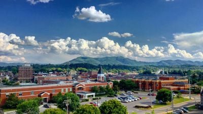
Johnson City is a town in northeastern Tennessee that spans Washington, Carter, and Sullivan counties. The settlement sits on hilly terrain at an elevation of about 500 meters (1,640 feet) and connects rural outskirts with urban neighborhoods that developed along former railway lines.

A railway station established in 1856 as Johnson's Depot attracted settlers and developed into a junction for three major rail lines. During the prohibition period in the 1920s, the place gained nationwide recognition for illegal alcohol production in the surrounding mountains.

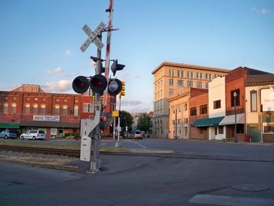
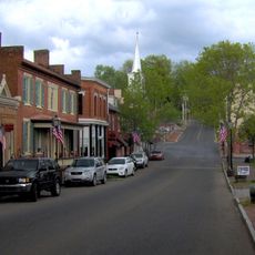
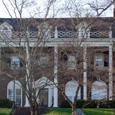
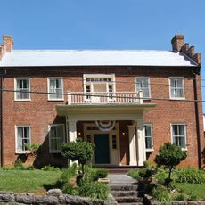
Local traders and residents often refer to the center simply as 'Downtown', where pedestrian zones with old facades line the main streets. Many shops and restaurants use historic buildings that still show traces of the earlier railway era and now serve as meeting points for students and families.

Visitors reach the center most easily via Interstate 26, which runs directly through the town and provides access to parking near the main street. Pedestrians find wide sidewalks and well-kept parks that suit calm walks through different neighborhoods.

A concert series in 1928 brought musicians from the surrounding mountains to a makeshift recording studio and documented traditional songs that had never been recorded before. These recordings, known as the Johnson City Sessions, are now considered an important source for research into early American folk music.

Location: Washington County

Location: Carter County

Location: Sullivan County

Inception: 1856

Elevation above the sea: 498 m

Website: https://johnsoncitytn.org

GPS coordinates: 36.31344,-82.35347

Latest update: December 12, 2025 01:21

Photos
Around this place
Show the full map
Gray Fossil Site
United States of America

Gray Fossil Site

15.3 km
Freedom Hall Civic Center
United States of America

Freedom Hall Civic Center

2.3 km
William B. Greene Jr. Stadium
United States of America

William B. Greene Jr. Stadium

2.4 km
Tipton-Haynes State Historic Site
United States of America

Tipton-Haynes State Historic Site

2.8 km
Rocky Mount, Tennessee
United States of America

Rocky Mount, Tennessee

10.4 km
Mountain Home National Cemetery
United States of America

Mountain Home National Cemetery

2.1 km
Jonesborough Historic District
United States of America

Jonesborough Historic District

11 km
DeVault-Massengill House
United States of America

DeVault-Massengill House

10.3 km
Aquone
United States of America

Aquone

2 km
Shelbridge
United States of America

Shelbridge

1.8 km
Mountain Branch, National Home for Disabled Volunteer Soldiers
United States of America

Mountain Branch, National Home for Disabled Volunteer Soldiers

1.8 km
Thankful Baptist Church
United States of America

Thankful Baptist Church

701 m
Jonesborough United Methodist Church
United States of America

Jonesborough United Methodist Church

11.2 km
Henry Hoss House
United States of America

Henry Hoss House

9.9 km
McAfee Bluff
United States of America

McAfee Bluff

10.2 km
Jackson Theatre
United States of America

Jackson Theatre

11.1 km
Liberty Theatre
United States of America

Liberty Theatre

2.4 km
Hyder Bluff
United States of America

Hyder Bluff

9.3 km
Johnson City Sign
United States of America

Johnson City Sign

484 m
Downtown Square Breezeway
United States of America

Downtown Square Breezeway

384 m
ETSU Golf Course
United States of America

ETSU Golf Course

2.5 km
International Storytelling Center
United States of America

International Storytelling Center

11 km
Goulding Amphitheater
United States of America

Goulding Amphitheater

9.1 km
The Warrior's Canvas & Veterans Art Center
United States of America

The Warrior's Canvas & Veterans Art Center

558 m
Tipton Gallery

Tipton Gallery

272 m
Junaluska
United States of America

Junaluska

3.1 km
Work of art, sculpture
United States of America

Work of art, sculpture

133 m
Work of art, sculpture
United States of America

Work of art, sculpture

146 m
Show the full map
Reviews

Visited this place? Tap the stars to rate it and share your experience / photos with the community! Try now! You can cancel it anytime.

« Johnson City - Urban center in northeastern Tennessee, United States » is provided by Around Us (aroundus.com). Images and texts are derived from Wikimedia project under a Creative Commons license. You are allowed to copy, distribute, and modify copies of this page, under the conditions set by the license, as long as this note is clearly visible.

Discover hidden gems everywhere you go!

From secret cafés to breathtaking viewpoints, skip the crowded tourist spots and find places that match your style. Our app makes it easy with voice search, smart filtering, route optimization, and insider tips from travelers worldwide. Download now for the complete mobile experience.

Around Us App Screenshot

A unique approach to discovering new places

Le Figaro

All the places worth exploring

France Info

A tailor-made excursion in just a few clicks

20 Minutes