·

Enable Location

We need your location to show you interesting places around you

Discover nearby places

Find interesting locations and hidden gems around you

Precise directions

Get accurate directions and distances to places

Your location is never shared with other users. It's only used when you tap the location button.

Carter County

Log in to your account

Start exploring — it's free

Trusted by 62,746 travelers worldwide

Continue with Google
Continue with Apple
or

We will send you a code to connect

By continuing, you accept our Terms and Conditions and our Privacy Policy

Check your inbox

We've sent a pincode in your inbox. Please enter the code below.

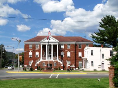
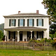
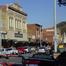
Carter County, County seat of northeastern Tennessee, United States

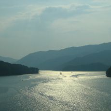
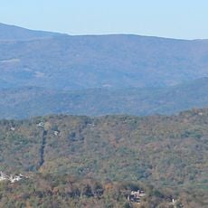
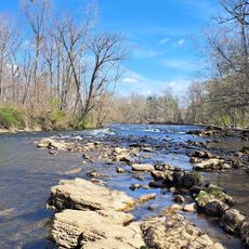
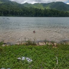
Carter County is an administrative division in northeastern Tennessee that spans forested mountain slopes and lakes. The area includes natural water bodies like Watauga Lake and is surrounded by national forest lands that shape the landscape.

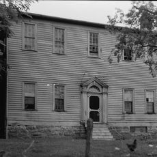
The county was established in 1796 and named after an early settler who took part in movements to create independent territories. This founding came during a time when the region was developing its own political identity.

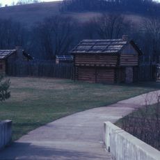
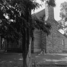
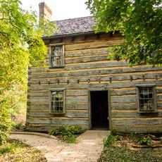
The area has deep roots in self-governance that trace back to the founding of the Watauga Association. Visitors can still sense this tradition in the local communities and how they conduct their lives today.

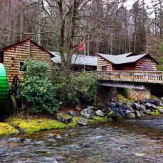
The county offers many opportunities for hiking, camping, and water activities at its lakes and surrounding forests. The best way to prepare for a visit is to check local websites and learn about access points to the natural areas.

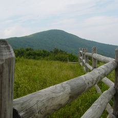
The county is home to Roan Mountain, one of the highest peaks in the state outside the Great Smoky Mountains. This mountain offers hikers notably alpine experiences in the region.

The community of curious travelers

AroundUs brings together thousands of curated places, local tips, and hidden gems, enriched daily by 60,000 contributors worldwide.

Start exploring
Location
Inception
April 9, 1796
Capital city
Elizabethton
Shares border with
Sullivan County, Johnson County, Avery County, Mitchell County, Unicoi County, Washington County
GPS coordinates
36.30000,-82.11667
Latest update
December 23, 2025 01:23
Around this place
Watauga Lake
United States of America

Watauga Lake

10.9 km
Sycamore Shoals
United States of America

Sycamore Shoals

13.3 km
Roan Mountain State Park
United States of America

Roan Mountain State Park

14.7 km
Overmountain Victory National Historic Trail
United States of America

Overmountain Victory National Historic Trail

10 km
United States of America

Fort Watauga

13.3 km
Sycamore Shoals State Historic Area
United States of America

Sycamore Shoals State Historic Area

13.1 km
Tipton-Haynes State Historic Site
United States of America

Tipton-Haynes State Historic Site

19.6 km
Rocky Mount, Tennessee
United States of America

Rocky Mount, Tennessee

23 km
Elizabethton Covered Bridge
United States of America

Elizabethton Covered Bridge

10 km
Sabine Hill
United States of America

Sabine Hill

14 km
United States of America

Big Laurel Branch Wilderness

6.2 km
Big Yellow Mountain
United States of America

Big Yellow Mountain

22.6 km
Sycamore Shoals State Historic Park
United States of America

Sycamore Shoals State Historic Park

13.3 km
Simerly-Butler House
United States of America

Simerly-Butler House

5.4 km
John T. Wilder House
United States of America

John T. Wilder House

12.3 km
Elk Park School
United States of America

Elk Park School

19.7 km
Shook Branch Swimming Area
United States of America

Shook Branch Swimming Area

1.1 km
United States of America

Sycamore Shoals Monument

13.5 km
United States of America

Pardee Point

6 km
United States of America

Flagpole Point

6.6 km
United States of America

Betty Range Cliff

16.4 km
United States of America

High Point Cliff

25.3 km
United States of America

Capitol Theatre

11.2 km
United States of America

Liberty Theatre

19.4 km
United States of America

Moody Cliff

15 km
United States of America

Elizabethton Historic District

10.2 km
United States of America

Coltens Cliff

21.7 km
Elizabethton Historic District
United States of America

Elizabethton Historic District

10 km
Show the full map
« Carter County - County seat of northeastern Tennessee, United States » is provided by Around Us (aroundus.com). Images and texts are derived from Wikimedia project under a Creative Commons license. You are allowed to copy, distribute, and modify copies of this page, under the conditions set by the license, as long as this note is clearly visible.

Discover hidden gems everywhere you go!

From secret cafés to breathtaking viewpoints, skip the crowded tourist spots and find places that match your style. Our app makes it easy with voice search, smart filtering, route optimization, and insider tips from travelers worldwide. Download now for the complete mobile experience.

Around Us App Screenshot

A unique approach to discovering new places

Le Figaro

All the places worth exploring

France Info

A tailor-made excursion in just a few clicks

20 Minutes

Around Us
Travel Guide & Maps
Download

Send to your phone

QR Code
1

Open the camera app on your mobile.

2

Point at the QR code with your camera. A notification will appear.

3

Tap the notification to open the link.