Overmountain Victory National Historic Trail, National Historic Trail across Virginia, Tennessee, North Carolina, and South Carolina, United States.
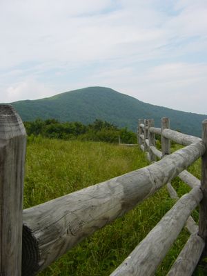
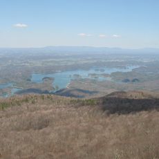
The Overmountain Victory National Historic Trail is a walking route spanning about 330 miles through four states that follows a military campaign from 1780. The path connects multiple historical sites and communities, with hiking sections and a marked motor route along state highways for those traveling by car.
In fall 1780, Revolutionary War militia troops marched over this mountainous route to fight British forces in a major battle. This military campaign ended in a decisive victory that secured control of the region for the revolutionary forces.
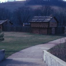
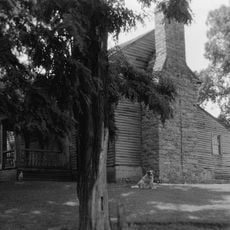
The trail links colonial settlements and frontier communities that shaped the southeastern United States during the 18th century. Local residents and visitors today continue to honor this heritage through commemorative events and shared stories about the people who lived along these routes.
The route offers about 87 miles of walking paths to explore and a marked driving route along state highways. Visitors should wear sturdy shoes and be prepared for changing weather, especially in mountainous sections where conditions can shift quickly.
Each September and October, participants conduct a commemorative march that retraces the original military campaign using the exact same dates and routes. This reenactment shows the hardship of the historical journey and lets visitors experience the landscape as the historical troops did.
The community of curious travelers
AroundUs brings together thousands of curated places, local tips, and hidden gems, enriched daily by 60,000 contributors worldwide.