Enable Location

We need your location to show you interesting places around you

Discover nearby places

Find interesting locations and hidden gems around you

Precise directions

Get accurate directions and distances to places

Your location is never shared with other users. It's only used when you tap the location button.

Lake Itasca

Log in to your account

Start exploring — it's free

Trusted by 67,572 travelers worldwide

Continue with Google
Continue with Apple
or

We will send you a code to connect

By continuing, you accept our Terms and Conditions and our Privacy Policy

Check your inbox

We've sent a pincode in your inbox. Please enter the code below.

Lake Itasca
Discussion Reviews 1 Photos
106k Popularity

Lake Itasca, Glacial lake in Clearwater County, Minnesota.

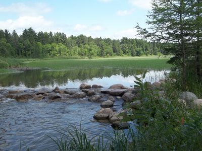
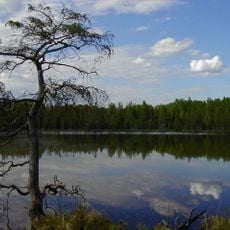
Lake Itasca is a glacial lake in Clearwater County, Minnesota, surrounded by mixed and pine forests within Itasca State Park. The lake covers about 1.8 square miles and reaches depths between 20 and 35 feet (6 and 11 meters) at an elevation of 1,475 feet (450 meters) above sea level.

Henry Schoolcraft confirmed Lake Itasca as the source of the Mississippi River in 1832, after William Morrison first explored the area in 1804. The recognition of the lake as the origin of the longest river in the United States made it a reference point for 19th-century geography and cartography.

The Ojibwe named this water body Omashkoozo-zaaga'igan, meaning Elk Lake, before French Canadian explorers called it Lac Labiche. The current name was coined by Henry Schoolcraft, who combined Latin terms into an invented word that references the true source.

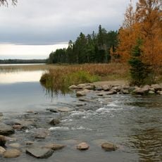
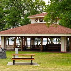
Visitors can reach the headwaters of the Mississippi River through stepping stones at the lake's outlet, located within Itasca State Park. The trails around the lake lead through forest and offer different viewpoints, with main paths easy to walk during the summer months.

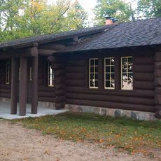
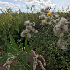
The University of Minnesota maintains a biological research station at this location, conducting year-round studies of the three converging ecosystems. Scientists observe at this site how boreal forests, prairie, and temperate deciduous forests meet and interact.

The community of curious travelers

AroundUs brings together thousands of curated places, local tips, and hidden gems, enriched daily by 60,000 contributors worldwide.

Start exploring
Elevation above the sea
450 m
GPS coordinates
47.21806,-95.20722
Latest update
December 12, 2025 23:03
Around this place
Paul Bunyan and Babe the Blue Ox
United States of America

Paul Bunyan and Babe the Blue Ox

37.5 km
Itasca State Park
United States of America

Itasca State Park

2.4 km
Lake Bemidji State Park
United States of America

Lake Bemidji State Park

46.2 km
Waldsee
United States of America

Waldsee

51.9 km
Minnesota State Sanatorium for Consumptives
United States of America

Minnesota State Sanatorium for Consumptives

50.8 km
Tamarac National Wildlife Refuge
United States of America

Tamarac National Wildlife Refuge

35.2 km
Paul Bunyan State Forest
United States of America

Paul Bunyan State Forest

12.4 km
Nevis Tiger Muskie
United States of America

Nevis Tiger Muskie

39.5 km
Bemidji Carnegie Library
United States of America

Bemidji Carnegie Library

37.6 km
Beltrami County Courthouse
United States of America

Beltrami County Courthouse

37.6 km
Nymore Bridge
United States of America

Nymore Bridge

37.2 km
David Park House
United States of America

David Park House

38.7 km
Gran Evangelical Lutheran Church
United States of America

Gran Evangelical Lutheran Church

41.8 km
Hubbard County Courthouse
United States of America

Hubbard County Courthouse

34.9 km
Diamond Point Beach
United States of America

Diamond Point Beach

39.1 km
White Earth State Forest
United States of America

White Earth State Forest

23.5 km
Smoky Hills State Forest
United States of America

Smoky Hills State Forest

34 km
Lake Bemidji State Park CCC/NYA/Rustic Style Historic Resources
United States of America

Lake Bemidji State Park CCC/NYA/Rustic Style Historic Resources

45.4 km
Sandtrap Golf Course
United States of America

Sandtrap Golf Course

47.2 km
Schoolcraft Fire Tower
United States of America

Schoolcraft Fire Tower

22.6 km
Nymore Beach
United States of America

Nymore Beach

37.7 km
Aiton Heights Fire Tower
United States of America

Aiton Heights Fire Tower

3.8 km
Height of Land Lookout Tower
United States of America

Height of Land Lookout Tower

22.4 km
Badoura Lookout Tower
United States of America

Badoura Lookout Tower

54 km
Pinewood Fire Tower
United States of America

Pinewood Fire Tower

42.9 km
Tulaby Lookout Tower
United States of America

Tulaby Lookout Tower

32.9 km
Kabekona Lookout Tower
United States of America

Kabekona Lookout Tower

24.9 km
Smoky Hills Lookout Tower
United States of America

Smoky Hills Lookout Tower

32.2 km
Show the full map
Reviews
Share your experience

No review yet

Discussions
Start a discussion...

No discussion yet

« Lake Itasca - Glacial lake in Clearwater County, Minnesota » is provided by Around Us (aroundus.com). Images and texts are derived from Wikimedia project under a Creative Commons license. You are allowed to copy, distribute, and modify copies of this page, under the conditions set by the license, as long as this note is clearly visible.

Discover hidden gems everywhere you go!

From secret cafés to breathtaking viewpoints, skip the crowded tourist spots and find places that match your style. Our app makes it easy with voice search, smart filtering, route optimization, and insider tips from travelers worldwide. Download now for the complete mobile experience.

Around Us App Screenshot

A unique approach to discovering new places

Le Figaro

All the places worth exploring

France Info

A tailor-made excursion in just a few clicks

20 Minutes

Around Us
Travel Guide & Maps
Download

Send to your phone

QR Code
1

Open the camera app on your mobile.

2

Point at the QR code with your camera. A notification will appear.

3

Tap the notification to open the link.