Chest opened
+${chestReward.xp} XP
Explorer
NOUVEAU ×${chestReward.collectible.quantity}
tapez pour fermer
Chest locked

Open chests in the app

Around Us is built for your phone — chests unlock when you walk, explore and capture nearby places.

Enable Location

We need your location to show you interesting places around you

Discover nearby places

Find interesting locations and hidden gems around you

Precise directions

Get accurate directions and distances to places

Your location is never shared with other users. It's only used when you tap the location button.

Albert Lea

Log in to your account

Start exploring — it's free

Trusted by 72,884 travelers worldwide

Continue with Google
Continue with Apple
or

We will send you a code to connect

By continuing, you accept our Terms and Conditions and our Privacy Policy

Check your inbox

We've sent a pincode in your inbox. Please enter the code below.

Discussion Reviews 4 Photos
40.6k Popularity

Albert Lea, Recreational city in Southern Minnesota, United States

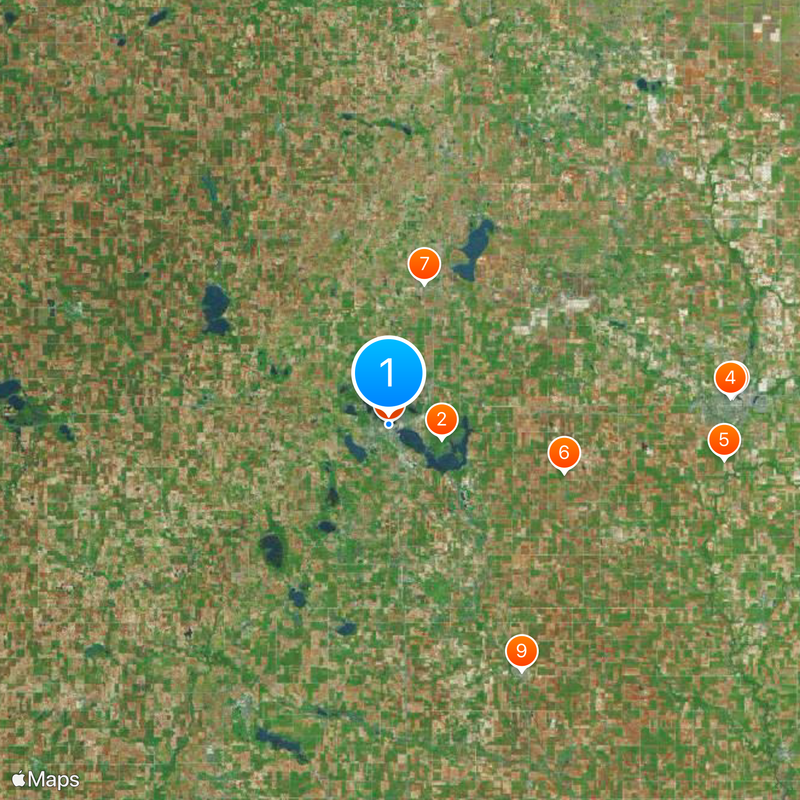
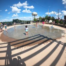
Albert Lea is a city in southern Minnesota that covers multiple square miles and encompasses several lakes including Fountain Lake, Pickerel Lake, and Albert Lea Lake. The city sits in Freeborn County and serves as an administrative and commercial center for the region.

The city was founded in 1855 and named after Lieutenant Albert Miller Lea, who surveyed the region in 1835. It later grew into the county seat and became an economic center for the area.

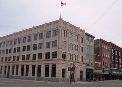
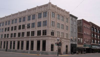
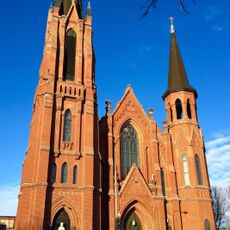
The Marion Ross Performing Arts Center in downtown Albert Lea is where locals and visitors experience theater, music performances, and community events throughout the year. The building shows how the city gathers people together for shared cultural moments and celebrations.

The city sits at the intersection of Interstate 35 and Interstate 90, making it easy to reach by car from major directions. Visitors will find good roads for exploring the lakes and surrounding areas on their own.

The city became the county seat in 1859 after winning a horse race competition against the rival town of Itasca, which no longer exists today. This unusual contest determined which settlement would become the region's administrative center.

The community of curious travelers

AroundUs brings together thousands of curated places, local tips, and hidden gems, enriched daily by 60,000 contributors worldwide.

Start exploring
Location
Inception
1855
Elevation above the sea
379 m
Part of
Southern Minnesota
GPS coordinates
43.64786,-93.36875
Latest update
December 17, 2025 08:34
Around this place
Myre-Big Island State Park
United States of America

Myre-Big Island State Park

5 km
Hormel Historic Home
United States of America

Hormel Historic Home

31.7 km
St. Augustine's Church
United States of America

St. Augustine's Church

31.4 km
United States of America

Sola Fide Observatory

30.9 km
Lodge Zare Zapadu
United States of America

Lodge Zare Zapadu

16.7 km
Clarks Grove Cooperative Creamery
United States of America

Clarks Grove Cooperative Creamery

13.3 km
Bessesen Building
United States of America

Bessesen Building

60 m
Worth County Courthouse
United States of America

Worth County Courthouse

25.7 km
Northwood Central Avenue Historic District
United States of America

Northwood Central Avenue Historic District

25.4 km
United States of America

Round Barn, Norway Township

25 km
Strangers Refuge Lodge Number 74, IOOF
United States of America

Strangers Refuge Lodge Number 74, IOOF

29.1 km
Old Worth County Courthouse
United States of America

Old Worth County Courthouse

25.7 km
Hormel Historic Home
United States of America

Hormel Historic Home

31.7 km
United States of America

Albert Lea Lake

7.3 km
United States of America

Hogsback Park Annex

27.1 km
United States of America

Christianson-Taylor Wildlife Area

18.1 km
United States of America

Hurd Park

25.7 km
United States of America

Hanson Area

20.1 km
United States of America

Silver Lake Marsh Wildlife Management Area

18.1 km
United States of America

Freeborn Lake

19.2 km
United States of America

Geneva Lake

15.8 km
United States of America

Saint Olaf Lake

28.4 km
United States of America

Rice Lake

29.6 km
Albert Lea Splash Pad
United States of America

Albert Lea Splash Pad

385 m
United States of America

Wedgewood Cove Golf Club

2.8 km
United States of America

Midway

30.4 km
United States of America

Mower County Fairgrounds

30.3 km
United States of America

Summerset Theater

30.3 km
Show the full map
Reviews
Share your experience

No review yet

Discussions
Start a discussion...

No discussion yet

« Albert Lea - Recreational city in Southern Minnesota, United States » is provided by Around Us (aroundus.com). Images and texts are derived from Wikimedia project under a Creative Commons license. You are allowed to copy, distribute, and modify copies of this page, under the conditions set by the license, as long as this note is clearly visible.

Discover hidden gems everywhere you go!

From secret cafés to breathtaking viewpoints, skip the crowded tourist spots and find places that match your style. Our app makes it easy with voice search, smart filtering, route optimization, and insider tips from travelers worldwide. Download now for the complete mobile experience.

Around Us App Screenshot

A unique approach to discovering new places

Le Figaro

All the places worth exploring

France Info

A tailor-made excursion in just a few clicks

20 Minutes

Around Us
Travel Guide & Maps
Download

Send to your phone

QR Code
1

Open the camera app on your mobile.

2

Point at the QR code with your camera. A notification will appear.

3

Tap the notification to open the link.