Enable Location

We need your location to show you interesting places around you

Discover nearby places

Find interesting locations and hidden gems around you

Precise directions

Get accurate directions and distances to places

Your location is never shared with other users. It's only used when you tap the location button.

Wards Island Bridge

Log in to your account

Start exploring — it's free

Trusted by 61,994 travelers worldwide

Continue with Google
Continue with Apple
or

We will send you a code to connect

By continuing, you accept our Terms and Conditions and our Privacy Policy

Check your inbox

We've sent a pincode in your inbox. Please enter the code below.

Wards Island Bridge

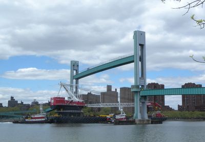
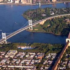
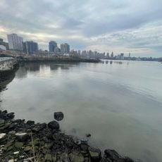
Wards Island Bridge, Vertical lift bridge between Manhattan and Wards Island, United States

Wards Island Bridge is a vertical-lift bridge made of steel that connects East Harlem in Manhattan with the southwestern part of Wards Island across the Harlem River. The structure comprises multiple steel beam sections with a central movable span that rises to allow boat traffic through the waterway.

Construction of the bridge began in 1949 under engineer Othmar Ammann's design and was officially inaugurated on May 18, 1951. It replaced an earlier wooden drawbridge that stood further north near 114th Street.

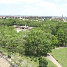
The structure transformed access to Wards Island's public parks and recreational spaces, replacing an earlier wooden drawbridge that existed near 114th Street.

The bridge is open year-round to pedestrians and cyclists, offering direct access from Manhattan's 103rd Street. After renovations in 2012, it provides a reliable and safe crossing with consistent conditions throughout the seasons.

The lift mechanism under the bridge deck operates independently and allows vessels to pass without prior notice to pedestrians. This feature makes it the only direct pedestrian connection to Wards Island with active bridge-lifting capability.

The community of curious travelers

AroundUs brings together thousands of curated places, local tips, and hidden gems, enriched daily by 60,000 contributors worldwide.

Start exploring
Location
Inception
May 18, 1951
Official opening
May 18, 1951
GPS coordinates
40.78630,-73.93740
Latest update
December 8, 2025 13:42
Around this place
Gracie Mansion
United States of America

Gracie Mansion

1.2 km
Hell Gate Bridge
United States of America

Hell Gate Bridge

1.4 km
Islamic Cultural Center of New York
United States of America

Islamic Cultural Center of New York

951 m
Icahn Stadium
United States of America

Icahn Stadium

1.3 km
Robert F. Kennedy Bridge
United States of America

Robert F. Kennedy Bridge

1.1 km
Carl Schurz Park
United States of America

Carl Schurz Park

1.3 km
Astoria Park
United States of America

Astoria Park

1.5 km
Blackwell Island Light
United States of America

Blackwell Island Light

1.5 km
Church of Our Lady of Mt. Carmel
United States of America

Church of Our Lady of Mt. Carmel

989 m
St. Cecilia's Church and Convent
United States of America

St. Cecilia's Church and Convent

1.1 km
Church of the Holy Agony
United States of America

Church of the Holy Agony

857 m
Holy Trinity Church, St. Christopher House and Parsonage
United States of America

Holy Trinity Church, St. Christopher House and Parsonage

1.4 km
Henderson Place Historic District
United States of America

Henderson Place Historic District

1.4 km
Public School 109
United States of America

Public School 109

854 m
Municipal Asphalt Plant
United States of America

Municipal Asphalt Plant

1 km
1235 Park Avenue
United States of America

1235 Park Avenue

1.3 km
Astor Terrace
United States of America

Astor Terrace

1 km
RiverEast, 408 East 92nd Street
United States of America

RiverEast, 408 East 92nd Street

1 km
The Kent
United States of America

The Kent

1.1 km
Pleasant Village Community Garden
United States of America

Pleasant Village Community Garden

1.3 km
1802 Second Avenue
United States of America

1802 Second Avenue

991 m
300 East 93rd Street
United States of America

300 East 93rd Street

1 km
96th Street Library
United States of America

96th Street Library

1.2 km
139 East 94th Street
United States of America

139 East 94th Street

1.2 km
The Monterey
United States of America

The Monterey

1 km
Pot Cove
United States of America

Pot Cove

1.2 km
302 East 94th Street
United States of America

302 East 94th Street

969 m
The Barclay
United States of America

The Barclay

978 m
Show the full map
« Wards Island Bridge - Vertical lift bridge between Manhattan and Wards Island, United States » is provided by Around Us (aroundus.com). Images and texts are derived from Wikimedia project under a Creative Commons license. You are allowed to copy, distribute, and modify copies of this page, under the conditions set by the license, as long as this note is clearly visible.

Discover hidden gems everywhere you go!

From secret cafés to breathtaking viewpoints, skip the crowded tourist spots and find places that match your style. Our app makes it easy with voice search, smart filtering, route optimization, and insider tips from travelers worldwide. Download now for the complete mobile experience.

Around Us App Screenshot

A unique approach to discovering new places

Le Figaro

All the places worth exploring

France Info

A tailor-made excursion in just a few clicks

20 Minutes

Around Us
Travel Guide & Maps
Download

Send to your phone

QR Code
1

Open the camera app on your mobile.

2

Point at the QR code with your camera. A notification will appear.

3

Tap the notification to open the link.