Enable Location

We need your location to show you interesting places around you

Discover nearby places

Find interesting locations and hidden gems around you

Precise directions

Get accurate directions and distances to places

Your location is never shared with other users. It's only used when you tap the location button.

Hell Gate Bridge

Log in to your account

Start exploring — it's free

Trusted by 61,553 travelers worldwide

Continue with Google
Continue with Apple
or

We will send you a code to connect

By continuing, you accept our Terms and Conditions and our Privacy Policy

Check your inbox

We've sent a pincode in your inbox. Please enter the code below.

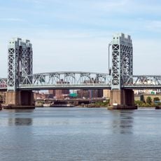
Hell Gate Bridge, Railway arch bridge in Queens and The Bronx, United States

Description

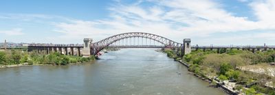
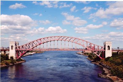
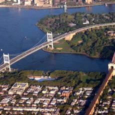
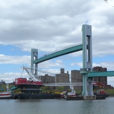
Hell Gate Bridge is a railway crossing over the East River between Queens and The Bronx, measuring 310 meters (about 1000 feet) long and rising 93 meters (around 305 feet) high. The steel structure carries four parallel tracks for passenger and freight service along the Northeast Corridor route.

History

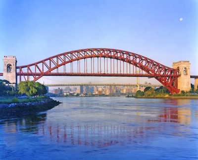
The crossing opened on March 9, 1917, as the longest steel arch span in the world at that time. Construction created the first continuous rail link between New York and New England, eliminating the need for trains to transfer onto ferries.

Culture

The name comes from Hellegat, a dangerous strait where many ships once wrecked before blasting work in the 1800s made passage safer. Today passenger and freight trains cross above while boats move through calmer water below, linking neighborhoods on either side.

Practical

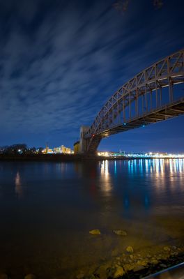
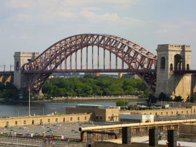
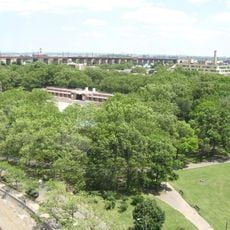
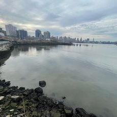
The structure is visible from many waterfront points in Astoria and Randalls Island, especially during sunrise or sunset over the water. Only rail traffic crosses it, but walkers find nearby parks with clear views of the arch above the river.

Did you know?

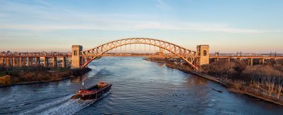
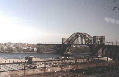
German saboteurs planned to destroy the crossing during World War II to cripple rail traffic along the East Coast. Today around 40 Amtrak trains pass through daily, carrying thousands of travelers between Boston and Washington.

Location
Location
Location
Inception
September 30, 1916
Height
93 m
Length
310 m
Longest Span
310 m
GPS coordinates
40.78250,-73.92194
Latest update
December 13, 2025 16:07

AroundUs brings together thousands of curated places, local tips, and hidden gems, enriched daily by 60,000 contributors worldwide. Discover all places nearby (Queens).

Around this place
Gracie Mansion
United States of America

Gracie Mansion

1.9 km
Icahn Stadium
United States of America

Icahn Stadium

1.2 km
Robert F. Kennedy Bridge
United States of America

Robert F. Kennedy Bridge

486 m
Carl Schurz Park
United States of America

Carl Schurz Park

2 km
Astoria Park
United States of America

Astoria Park

340 m
Wards Island Bridge
United States of America

Wards Island Bridge

1.4 km
Blackwell Island Light
United States of America

Blackwell Island Light

1.9 km
Socrates Sculpture Park
United States of America

Socrates Sculpture Park

2 km
New York House of Refuge
United States of America

New York House of Refuge

1.4 km
Steinway House
United States of America

Steinway House

2.1 km
Church of Our Lady of Mt. Carmel
United States of America

Church of Our Lady of Mt. Carmel

1.7 km
Holy Rosary Church
United States of America

Holy Rosary Church

1.9 km
Bohemian Citizens' Benevolent Society
United States of America

Bohemian Citizens' Benevolent Society

1.2 km
Sohmer and Company Piano Factory
United States of America

Sohmer and Company Piano Factory

1.8 km
Astoria Center of Israel
United States of America

Astoria Center of Israel

1.4 km
Statue of Christopher Columbus
United States of America

Statue of Christopher Columbus

1.4 km
Stevens House
United States of America

Stevens House

1.8 km
St. Irene Chrysovalantou Greek Orthodox Monastery
United States of America

St. Irene Chrysovalantou Greek Orthodox Monastery

1.5 km
Cathedral of Saint Markella
United States of America

Cathedral of Saint Markella

984 m
Henderson Place Historic District
United States of America

Henderson Place Historic District

2.1 km
Municipal Asphalt Plant
United States of America

Municipal Asphalt Plant

1.9 km
RiverEast, 408 East 92nd Street
United States of America

RiverEast, 408 East 92nd Street

2.1 km
Pleasant Village Community Garden
United States of America

Pleasant Village Community Garden

1.8 km
Astoria Theatre
United States of America

Astoria Theatre

2.1 km
1802 Second Avenue
United States of America

1802 Second Avenue

2.2 km
Robert F. Kennedy Bridge
United States of America

Robert F. Kennedy Bridge

2.1 km
Pot Cove
United States of America

Pot Cove

863 m
The Barclay
United States of America

The Barclay

2 km
Show the full map
« Hell Gate Bridge - Railway arch bridge in Queens and The Bronx, United States » is provided by Around Us (aroundus.com). Images and texts are derived from Wikimedia project under a Creative Commons license. You are allowed to copy, distribute, and modify copies of this page, under the conditions set by the license, as long as this note is clearly visible.

Discover hidden gems everywhere you go!

From secret cafés to breathtaking viewpoints, skip the crowded tourist spots and find places that match your style. Our app makes it easy with voice search, smart filtering, route optimization, and insider tips from travelers worldwide. Download now for the complete mobile experience.

Around Us App Screenshot

A unique approach to discovering new places

Le Figaro

All the places worth exploring

France Info

A tailor-made excursion in just a few clicks

20 Minutes

Around Us
Travel Guide & Maps
Download

Send to your phone

QR Code
1

Open the camera app on your mobile.

2

Point at the QR code with your camera. A notification will appear.

3

Tap the notification to open the link.