Enable Location

We need your location to show you interesting places around you

Discover nearby places

Find interesting locations and hidden gems around you

Precise directions

Get accurate directions and distances to places

Your location is never shared with other users. It's only used when you tap the location button.

Strongsville

Log in to your account

Start exploring — it's free

Trusted by 61,881 travelers worldwide

Continue with Google
Continue with Apple
or

We will send you a code to connect

By continuing, you accept our Terms and Conditions and our Privacy Policy

Check your inbox

We've sent a pincode in your inbox. Please enter the code below.

Strongsville, Suburban community in Cuyahoga County, United States

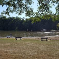
Strongsville is a city in Cuyahoga County that spreads across residential neighborhoods and business zones with the East Branch of the Rocky River running through it. The community blends suburban development with natural waterways that shape its character.

The community was established in 1818 and named after John Stoughton Strong, an early settler in the area. It evolved from a farming settlement to an incorporated city, formally achieving city status in 1960.

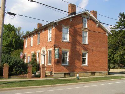
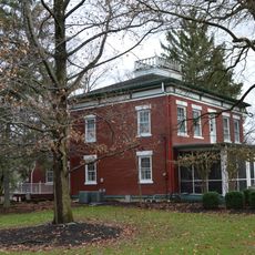
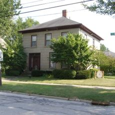
The Pomeroy House from 1847 was a vital refuge for people seeking freedom, reflecting the community's role in the struggle for emancipation. Walking through the area, you encounter remnants of this history woven into the local landscape.

Interstate 71 and the Ohio Turnpike provide direct connections to Cleveland to the north and regional destinations beyond. This location makes it easy to travel for day trips throughout the broader area.

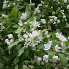
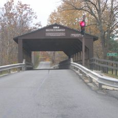
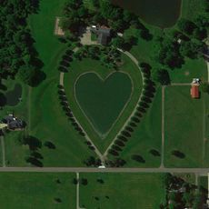
The Mill Stream Run Reservation creates extensive natural spaces within the city with forests and green areas. This conservation area offers outdoor recreation and trails throughout the developed community.

The community of curious travelers

AroundUs brings together thousands of curated places, local tips, and hidden gems, enriched daily by 60,000 contributors worldwide.

Start exploring
Location
Inception
1818
Elevation above the sea
284 m
Shares border with
Berea
GPS coordinates
41.31278,-81.83194
Latest update
December 20, 2025 03:09
Around this place
United States of America

Grand Pacific Junction

9 km
Gardenview Horticultural Park
United States of America

Gardenview Horticultural Park

4 m
John Wheeler House
United States of America

John Wheeler House

5.2 km
Baldwin–Wallace College South Campus Historic District
United States of America

Baldwin–Wallace College South Campus Historic District

6.3 km
Burrell Memorial Observatory
United States of America

Burrell Memorial Observatory

7.2 km
Old District 10 Schoolhouse
United States of America

Old District 10 Schoolhouse

8.5 km
Baldwin-Wallace College North Campus Historic District
United States of America

Baldwin-Wallace College North Campus Historic District

7.1 km
Buehl House
United States of America

Buehl House

6.1 km
Go Ape Treetop Adventure Course
United States of America

Go Ape Treetop Adventure Course

1.5 km
United States of America

Mill Stream Run Reservation

2.5 km
Walter F. Ehrnfelt Bridge
United States of America

Walter F. Ehrnfelt Bridge

3.4 km
Olmsted Falls Depot and Model Railroad Museum
United States of America

Olmsted Falls Depot and Model Railroad Museum

9.3 km
United States of America

Baldwin Lake

5.5 km
The Berea Triangle
United States of America

The Berea Triangle

6.2 km
Berea Union Depot
United States of America

Berea Union Depot

7.8 km
Harding Memorial Bridge
United States of America

Harding Memorial Bridge

9.3 km
The Ark
United States of America

The Ark

7.9 km
Woodvale Union Cemetery historical marker
United States of America

Woodvale Union Cemetery historical marker

5.2 km
Old District 10 Schoolhouse
United States of America

Old District 10 Schoolhouse

8.6 km
Columbia Township
United States of America

Columbia Township

8 km
Baldwin University
United States of America

Baldwin University

7 km
Heart-Shaped pond
United States of America

Heart-Shaped pond

5.9 km
United States of America

Pine Hills Golf Course

7.2 km
United States of America

Columbia Hills Golf and Swim Club

7.5 km
United States of America

Royal Crest Golf Club

4.4 km
United States of America

Mapleside Farms

4.9 km
Wallace Beach
United States of America

Wallace Beach

5.8 km
United States of America

Berea Falls Scenic Overlook

7.8 km
Show the full map
« Strongsville - Suburban community in Cuyahoga County, United States » is provided by Around Us (aroundus.com). Images and texts are derived from Wikimedia project under a Creative Commons license. You are allowed to copy, distribute, and modify copies of this page, under the conditions set by the license, as long as this note is clearly visible.

Discover hidden gems everywhere you go!

From secret cafés to breathtaking viewpoints, skip the crowded tourist spots and find places that match your style. Our app makes it easy with voice search, smart filtering, route optimization, and insider tips from travelers worldwide. Download now for the complete mobile experience.

Around Us App Screenshot

A unique approach to discovering new places

Le Figaro

All the places worth exploring

France Info

A tailor-made excursion in just a few clicks

20 Minutes

Around Us
Travel Guide & Maps
Download

Send to your phone

QR Code
1

Open the camera app on your mobile.

2

Point at the QR code with your camera. A notification will appear.

3

Tap the notification to open the link.