Chest opened
+${chestReward.xp} XP
Explorer
NOUVEAU ×${chestReward.collectible.quantity}
tapez pour fermer
Chest locked

Open chests in the app

Around Us is built for your phone — chests unlock when you walk, explore and capture nearby places.

Enable Location

We need your location to show you interesting places around you

Discover nearby places

Find interesting locations and hidden gems around you

Precise directions

Get accurate directions and distances to places

Your location is never shared with other users. It's only used when you tap the location button.

Cheat River

Log in to your account

Start exploring — it's free

Trusted by 72,888 travelers worldwide

Continue with Google
Continue with Apple
or

We will send you a code to connect

By continuing, you accept our Terms and Conditions and our Privacy Policy

Check your inbox

We've sent a pincode in your inbox. Please enter the code below.

Cheat River
Discussion Reviews 1 Photos
12.8k Popularity

Cheat River, River system in Pennsylvania, US

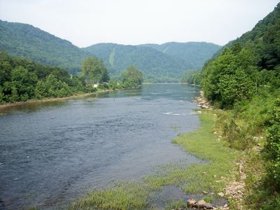
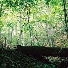
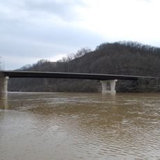
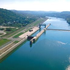
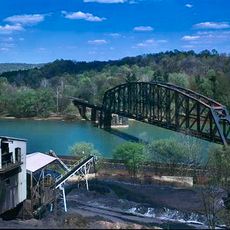
The Cheat River is a river system in Pennsylvania and West Virginia that flows for a considerable distance before joining the Monongahela River at Point Marion. The waterway is fed by several tributaries including Black Fork and Shavers Fork, which drain the surrounding highlands.

Originally called Ach-sin-ha-nac by the Delaware Indians, meaning stony river, the area was first settled by Europeans near Kingwood in 1772. This colonial period established the foundation for the region's development.

The river holds special meaning for outdoor enthusiasts and local communities who gather to celebrate it through the annual Cheat River Festival featuring paddling competitions and live music. This event reflects how the waterway brings people together around shared interests.

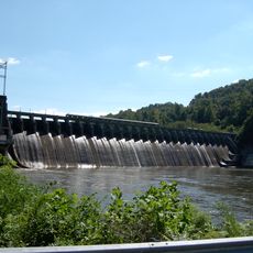
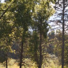
The river offers conditions for various water sports, with Class IV rapids that become most interesting in spring during snowmelt season. Visitors should plan for peak water levels during this period and come prepared for active conditions.

The tributaries of the river display different drainage patterns: Black Fork has a fan-shaped structure while Shavers Fork shows a long and narrow pattern. These geological differences influence how water flows through the landscape.

The community of curious travelers

AroundUs brings together thousands of curated places, local tips, and hidden gems, enriched daily by 60,000 contributors worldwide.

Start exploring
Location
GPS coordinates
39.74280,-79.90220
Latest update
December 7, 2025 20:43
Around this place
Mountaineer Field at Milan Puskar Stadium
United States of America

Mountaineer Field at Milan Puskar Stadium

11.2 km
Cheat Lake
United States of America

Cheat Lake

4.7 km
Mont Chateau State Park
United States of America

Mont Chateau State Park

10.4 km
United States of America

Cheat Canyon

88 m
Earl L. Core Arboretum
United States of America

Earl L. Core Arboretum

12.6 km
Sugar Grove Petroglyphs
United States of America

Sugar Grove Petroglyphs

10.6 km
Oglebay Hall
United States of America

Oglebay Hall

12.6 km
Point Marion Lock and Dam
United States of America

Point Marion Lock and Dam

1.9 km
Albert Gallatin Memorial Bridge
United States of America

Albert Gallatin Memorial Bridge

412 m
Star City Bridge
United States of America

Star City Bridge

12.2 km
Vance Farmhouse
United States of America

Vance Farmhouse

11.9 km
Greensboro Public School
United States of America

Greensboro Public School

5.7 km
James Jones House
United States of America

James Jones House

5.7 km
Masontown Bridge
United States of America

Masontown Bridge

12.5 km
Grays Landing Lock & Dam
United States of America

Grays Landing Lock & Dam

9.2 km
New Geneva Historic District
United States of America

New Geneva Historic District

5 km
Neils Red Covered Bridge
United States of America

Neils Red Covered Bridge

12.3 km
James Parreco House
United States of America

James Parreco House

5.8 km
John Minor Crawford House
United States of America

John Minor Crawford House

6.6 km
D.I.B. Anderson Farm
United States of America

D.I.B. Anderson Farm

11.1 km
Alexander V. Boughner House
United States of America

Alexander V. Boughner House

5.5 km
Peters-Graham House
United States of America

Peters-Graham House

5.6 km
Glassworks-Core House
United States of America

Glassworks-Core House

6.4 km
Glassworks-Gabler House
United States of America

Glassworks-Gabler House

6.4 km
Colver-Rogers Farmstead
United States of America

Colver-Rogers Farmstead

6.4 km
Ernest Thralls House
United States of America

Ernest Thralls House

6.4 km
Reppert-Gabler House
United States of America

Reppert-Gabler House

6.4 km
New Geneva Bridge
United States of America

New Geneva Bridge

5.1 km
Show the full map
Reviews
Share your experience

No review yet

Discussions
Start a discussion...

No discussion yet

« Cheat River - River system in Pennsylvania, US » is provided by Around Us (aroundus.com). Images and texts are derived from Wikimedia project under a Creative Commons license. You are allowed to copy, distribute, and modify copies of this page, under the conditions set by the license, as long as this note is clearly visible.

Discover hidden gems everywhere you go!

From secret cafés to breathtaking viewpoints, skip the crowded tourist spots and find places that match your style. Our app makes it easy with voice search, smart filtering, route optimization, and insider tips from travelers worldwide. Download now for the complete mobile experience.

Around Us App Screenshot

A unique approach to discovering new places

Le Figaro

All the places worth exploring

France Info

A tailor-made excursion in just a few clicks

20 Minutes

Around Us
Travel Guide & Maps
Download

Send to your phone

QR Code
1

Open the camera app on your mobile.

2

Point at the QR code with your camera. A notification will appear.

3

Tap the notification to open the link.