Enable Location

We need your location to show you interesting places around you

Discover nearby places

Find interesting locations and hidden gems around you

Precise directions

Get accurate directions and distances to places

Your location is never shared with other users. It's only used when you tap the location button.

Fairborn

Log in to your account

Start exploring — it's free

Trusted by 62,619 travelers worldwide

Continue with Google
Continue with Apple
or

We will send you a code to connect

By continuing, you accept our Terms and Conditions and our Privacy Policy

Check your inbox

We've sent a pincode in your inbox. Please enter the code below.

Fairborn, Educational city in Greene County, United States.

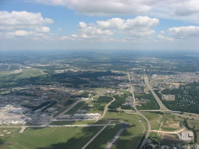
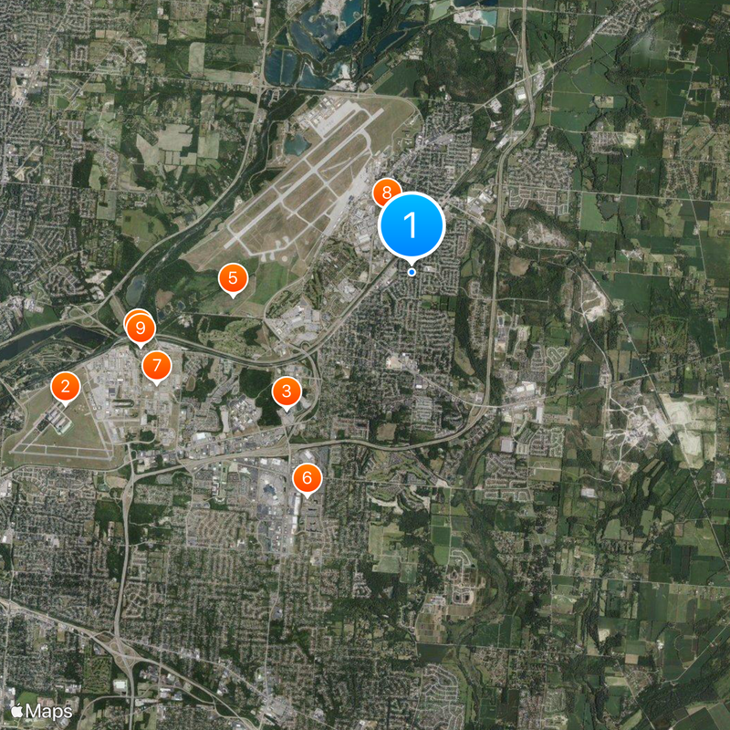
Fairborn is a city in Greene County situated in the Miami Valley region between Dayton, Cincinnati, and Columbus. The community includes residential neighborhoods and commercial areas with convenient access to Interstate 675 and Wright-Patterson Air Force Base.

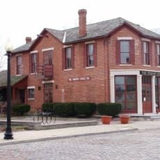
The city was created in 1950 through the merger of Fairfield and Osborn, two separate communities that joined together as one. A remarkable aspect of this union was that residents actually moved their houses during the formation process.

The name comes from joining two former villages, and you can still see this blend in the way different neighborhoods developed side by side. This creates a unique local character where older and newer sections coexist within the community.

The city is well-connected by Interstate 675, which has multiple interchanges and makes it easy to reach different parts of the community. Navigation is straightforward thanks to clear road connections to surrounding areas and major cities.

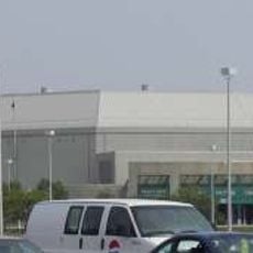
The Ervin J. Nutter Center is a venue with seating for around 11,000 people that hosts sports events and concerts throughout the year. It serves as the main gathering place for regional entertainment and draws visitors from surrounding communities.

The community of curious travelers

AroundUs brings together thousands of curated places, local tips, and hidden gems, enriched daily by 60,000 contributors worldwide.

Start exploring
Location
Inception
January 1, 1950
Elevation above the sea
255 m
GPS coordinates
39.80778,-84.02194
Latest update
December 20, 2025 12:39
Around this place
United States of America

National Aviation Hall of Fame

7.8 km
Nutter Center
United States of America

Nutter Center

3.9 km
Dayton Aviation Heritage National Historical Park
United States of America

Dayton Aviation Heritage National Historical Park

5.9 km
Huffman Prairie
United States of America

Huffman Prairie

3.8 km
Hindu Temple of Dayton
United States of America

Hindu Temple of Dayton

5.2 km
Wright-Patterson Air Force Base Mound
United States of America

Wright-Patterson Air Force Base Mound

5.8 km
Fairborn Twin Cinemas
United States of America

Fairborn Twin Cinemas

1.4 km
Huffman Prairie Flying Field Interpretive Center
United States of America

Huffman Prairie Flying Field Interpretive Center

5.9 km
Mercer Log House
United States of America

Mercer Log House

1.9 km
United States of America

Garland Wetland Preserve

2.1 km
United States of America

Great Escape Game

7.2 km
United States of America

Scenic viewpoint

5.9 km
United States of America

Beavercreek Golf Club

4.3 km
United States of America

Twin Base Golf Course

4 km
United States of America

Prairie Trace Golf Club

2.1 km
United States of America

Fairborn Community Park Amphitheatre

2.4 km
United States of America

Actors Theater

1.6 km
United States of America

Koehler Express

5.3 km
United States of America

Work of art

4.6 km
United States of America

Greene Country Club Event Center

5.6 km
United States of America

F-16

2.2 km
United States of America

F-15

2.2 km
United States of America

Wright Flyer replica

7.2 km
United States of America

Boeing C-17 Globemaster III; s/n 87-0025

7.7 km
United States of America

Boeing EC-135E; s/n 60-374

7.8 km
United States of America

Lockheed AC-130A

7.8 km
United States of America

Boeing KC-135R Stratotanker; s/n 60-0329

7.7 km
United States of America

Convair NC-131H Samaritan; s/n 53-7793

7.8 km
Show the full map
« Fairborn - Educational city in Greene County, United States » is provided by Around Us (aroundus.com). Images and texts are derived from Wikimedia project under a Creative Commons license. You are allowed to copy, distribute, and modify copies of this page, under the conditions set by the license, as long as this note is clearly visible.

Discover hidden gems everywhere you go!

From secret cafés to breathtaking viewpoints, skip the crowded tourist spots and find places that match your style. Our app makes it easy with voice search, smart filtering, route optimization, and insider tips from travelers worldwide. Download now for the complete mobile experience.

Around Us App Screenshot

A unique approach to discovering new places

Le Figaro

All the places worth exploring

France Info

A tailor-made excursion in just a few clicks

20 Minutes

Around Us
Travel Guide & Maps
Download

Send to your phone

QR Code
1

Open the camera app on your mobile.

2

Point at the QR code with your camera. A notification will appear.

3

Tap the notification to open the link.