Chest opened
+${chestReward.xp} XP
Explorer
NOUVEAU ×${chestReward.collectible.quantity}
tapez pour fermer
Chest locked

Open chests in the app

Around Us is built for your phone — chests unlock when you walk, explore and capture nearby places.

Enable Location

We need your location to show you interesting places around you

Discover nearby places

Find interesting locations and hidden gems around you

Precise directions

Get accurate directions and distances to places

Your location is never shared with other users. It's only used when you tap the location button.

Garfield

Log in to your account

Start exploring — it's free

Trusted by 72,882 travelers worldwide

Continue with Google
Continue with Apple
or

We will send you a code to connect

By continuing, you accept our Terms and Conditions and our Privacy Policy

Check your inbox

We've sent a pincode in your inbox. Please enter the code below.

Discussion Reviews 2 Photos
33.9k Popularity

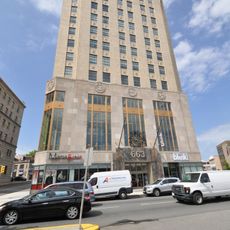
Garfield, Municipal center in Bergen County, United States.

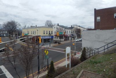
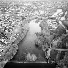
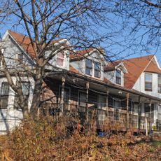
Garfield is a city in Bergen County, New Jersey, that sits along the Saddle River valley. The area mixes residential neighborhoods with commercial districts served by two train stations on the Bergen County Line.

The city was founded as East Passaic in 1873 and renamed in 1881 to honor President James Garfield. This change reflected the community's growth and shift in identity during that era.

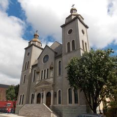
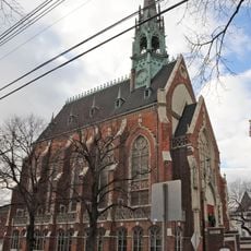
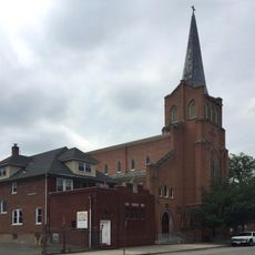
The Russian Orthodox Church of Three Saints stands as a center for the Ukrainian American community, reflecting the city's immigration patterns.

The city is accessible through two train stations that connect directly to regional transit networks, making movement around the area straightforward. Route 46 also provides good access for those driving through.

The municipal education system encompasses twelve separate schools serving 4,713 students from pre-kindergarten through high school graduation.

The community of curious travelers

AroundUs brings together thousands of curated places, local tips, and hidden gems, enriched daily by 60,000 contributors worldwide.

Start exploring
Location
Elevation above the sea
30 m
Shares border with
Passaic, Wallington, Lodi, Elmwood Park, Saddle Brook, Clifton, South Hackensack
GPS coordinates
40.87980,-74.10830
Latest update
December 19, 2025 23:12
Around this place
Dundee Canal
United States of America

Dundee Canal

1.2 km
Cathedral of St. Michael the Archangel
United States of America

Cathedral of St. Michael the Archangel

1.8 km
Union Avenue Bridge
United States of America

Union Avenue Bridge

4.4 km
Gregory Avenue Bridge
United States of America

Gregory Avenue Bridge

3 km
Aycrigg Mansion
United States of America

Aycrigg Mansion

3.5 km
People's Bank and Trust Company Building
United States of America

People's Bank and Trust Company Building

2.6 km
Van Houten-Hillman House
United States of America

Van Houten-Hillman House

2 km
Passaic Street Bridge
United States of America

Passaic Street Bridge

1.7 km
St. John's Evangelical Lutheran Church
United States of America

St. John's Evangelical Lutheran Church

2.1 km
Botany Worsted Mills Historic District
United States of America

Botany Worsted Mills Historic District

1.2 km
Saint Stephen of Hungary Church, Passaic, New Jersey
United States of America

Saint Stephen of Hungary Church, Passaic, New Jersey

1.4 km
John Hopper House
United States of America

John Hopper House

4 km
Passaic Elks Club
United States of America

Passaic Elks Club

2.7 km
Cornelius Demarest House
United States of America

Cornelius Demarest House

3 km
Garritse-Doremus-Westervelt House
United States of America

Garritse-Doremus-Westervelt House

3.4 km
Brinkerhoff House
United States of America

Brinkerhoff House

4.2 km
Monroe Street Bridge
United States of America

Monroe Street Bridge

1.3 km
Market Street Bridge
United States of America

Market Street Bridge

2.3 km
Fridolin Arnault House
United States of America

Fridolin Arnault House

4.2 km
New York, Susquehanna & Western Railroad 206
United States of America

New York, Susquehanna & Western Railroad 206

4 km
United States of America

Palace Theatre

1.7 km
United States of America

American Theater

1.9 km
United States of America

Strand Theater

2.8 km
United States of America

Brighton Asylum

3.8 km

Breslin Auditorium

1.7 km
United States of America

Buccaneer

4.6 km
United States of America

Saint Mother Teresa

1.2 km
United States of America

Waterfall

3.4 km
Show the full map
Reviews
Share your experience

No review yet

Discussions
Start a discussion...

No discussion yet

« Garfield - Municipal center in Bergen County, United States » is provided by Around Us (aroundus.com). Images and texts are derived from Wikimedia project under a Creative Commons license. You are allowed to copy, distribute, and modify copies of this page, under the conditions set by the license, as long as this note is clearly visible.

Discover hidden gems everywhere you go!

From secret cafés to breathtaking viewpoints, skip the crowded tourist spots and find places that match your style. Our app makes it easy with voice search, smart filtering, route optimization, and insider tips from travelers worldwide. Download now for the complete mobile experience.

Around Us App Screenshot

A unique approach to discovering new places

Le Figaro

All the places worth exploring

France Info

A tailor-made excursion in just a few clicks

20 Minutes

Around Us
Travel Guide & Maps
Download

Send to your phone

QR Code
1

Open the camera app on your mobile.

2

Point at the QR code with your camera. A notification will appear.

3

Tap the notification to open the link.