Chest opened
+${chestReward.xp} XP
Explorer
NOUVEAU ×${chestReward.collectible.quantity}
tapez pour fermer
Chest locked

Open chests in the app

Around Us is built for your phone — chests unlock when you walk, explore and capture nearby places.

Enable Location

We need your location to show you interesting places around you

Discover nearby places

Find interesting locations and hidden gems around you

Precise directions

Get accurate directions and distances to places

Your location is never shared with other users. It's only used when you tap the location button.

Log in to your account

Start exploring — it's free

Trusted by 72,973 travelers worldwide

Continue with Google
Continue with Apple
or

We will send you a code to connect

By continuing, you accept our Terms and Conditions and our Privacy Policy

Check your inbox

We've sent a pincode in your inbox. Please enter the code below.

Coteau des Prairies
Discussion Reviews Photo
15.1k Popularity

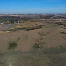
Coteau des Prairies, Plateau formation in Minnesota and Iowa, United States.

The Coteau des Prairies is a plateau that spreads across several hundred kilometers through the Great Plains of north-central United States. The terrain features gentle rolling hills and fertile soils shaped by glacial deposits from ice age periods.

French and Canadian explorers named this plateau during the New France period. Multiple ice ages shaped the formation through heavy glacial deposits that built up over time.

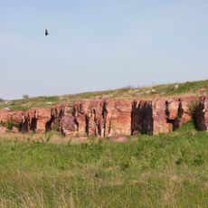
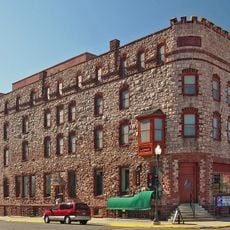
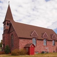
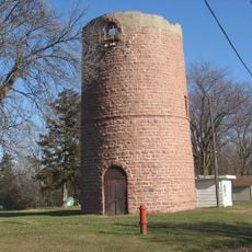
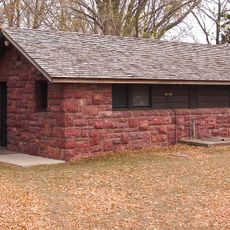
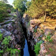
Native peoples quarried red stone from this region to craft ceremonial pipes, a practice documented at Pipestone National Monument today. The site remains significant for understanding how indigenous communities shaped and used the landscape.

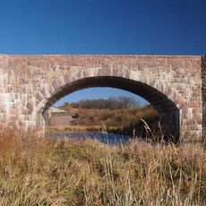
The region offers several viewpoints from which to see the rolling landscape spread out below. The terrain is easily accessible and good for exploring by car or on foot.

During the ice age, two glacier lobes flowed around the plateau and left material deposits up to 900 feet thick. This layering sets the Coteau apart from the flatter plains surrounding it.

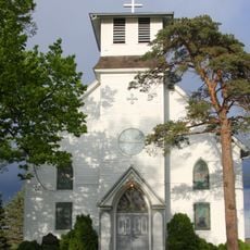
The community of curious travelers

AroundUs brings together thousands of curated places, local tips, and hidden gems, enriched daily by 60,000 contributors worldwide.

Start exploring
Location
Location
Location
GPS coordinates
44.00000,-96.31667
Latest update
December 7, 2025 19:31
Around this place
Blue Mounds State Park
United States of America

Blue Mounds State Park

33.1 km
Calumet Hotel
United States of America

Calumet Hotel

94 m
Palisades State Park
United States of America

Palisades State Park

38.3 km
Danebod
United States of America

Danebod

33.2 km
Split Rock Creek State Park
United States of America

Split Rock Creek State Park

12 km
McCrory Gardens and South Dakota Arboretum
United States of America

McCrory Gardens and South Dakota Arboretum

50.2 km
Church of St. Kilian
United States of America

Church of St. Kilian

43 km
Pipestone Water Tower
United States of America

Pipestone Water Tower

495 m
Pipestone Indian School Superintendent's House
United States of America

Pipestone Indian School Superintendent's House

2.3 km
Hole in the Mountain Prairie
United States of America

Hole in the Mountain Prairie

25.9 km
St. Peter's Lutheran Church
United States of America

St. Peter's Lutheran Church

37 km
Pipestone County Courthouse
United States of America

Pipestone County Courthouse

387 m
Carnegie Free Public Library
United States of America

Carnegie Free Public Library

37.1 km
Palisades Bridge
United States of America

Palisades Bridge

38.2 km
Holy Trinity Church-Episcopal
United States of America

Holy Trinity Church-Episcopal

39.3 km
John Rowe House
United States of America

John Rowe House

17.8 km
Odd Fellows Home of Dell Rapids
United States of America

Odd Fellows Home of Dell Rapids

37.4 km
Dell Rapids Water Tower
United States of America

Dell Rapids Water Tower

36.8 km
Pipestone Public Library
United States of America

Pipestone Public Library

187 m
William G. Milne House
United States of America

William G. Milne House

36.8 km
Gina Smith Campbell Bathhouse
United States of America

Gina Smith Campbell Bathhouse

36.8 km
McCrory Gardens
United States of America

McCrory Gardens

50.5 km
Drammen Farmers' Club
United States of America

Drammen Farmers' Club

36.9 km
Blue Mounds State Park WPA/Rustic Style Historic Resources
United States of America

Blue Mounds State Park WPA/Rustic Style Historic Resources

33.3 km
Winnewissa Falls
United States of America

Winnewissa Falls

1.7 km
Palace Theatre
United States of America

Palace Theatre

39.4 km
Devil's Gulch Park
United States of America

Devil's Gulch Park

34 km
Split Rock Bridge
United States of America

Split Rock Bridge

12.7 km
Show the full map
Reviews
Share your experience

No review yet

Discussions
Start a discussion...

No discussion yet

« Coteau des Prairies - Plateau formation in Minnesota and Iowa, United States » is provided by Around Us (aroundus.com). Images and texts are derived from Wikimedia project under a Creative Commons license. You are allowed to copy, distribute, and modify copies of this page, under the conditions set by the license, as long as this note is clearly visible.

Discover hidden gems everywhere you go!

From secret cafés to breathtaking viewpoints, skip the crowded tourist spots and find places that match your style. Our app makes it easy with voice search, smart filtering, route optimization, and insider tips from travelers worldwide. Download now for the complete mobile experience.

Around Us App Screenshot

A unique approach to discovering new places

Le Figaro

All the places worth exploring

France Info

A tailor-made excursion in just a few clicks

20 Minutes

Around Us
Travel Guide & Maps
Download

Send to your phone

QR Code
1

Open the camera app on your mobile.

2

Point at the QR code with your camera. A notification will appear.

3

Tap the notification to open the link.