Chest opened
+${chestReward.xp} XP
Explorer
NOUVEAU ×${chestReward.collectible.quantity}
tapez pour fermer
Chest locked

Open chests in the app

Around Us is built for your phone — chests unlock when you walk, explore and capture nearby places.

Enable Location

We need your location to show you interesting places around you

Discover nearby places

Find interesting locations and hidden gems around you

Precise directions

Get accurate directions and distances to places

Your location is never shared with other users. It's only used when you tap the location button.

Concord River

Log in to your account

Start exploring — it's free

Trusted by 72,882 travelers worldwide

Continue with Google
Continue with Apple
or

We will send you a code to connect

By continuing, you accept our Terms and Conditions and our Privacy Policy

Check your inbox

We've sent a pincode in your inbox. Please enter the code below.

Concord River
Discussion Reviews 1 Photos
9.1k Popularity

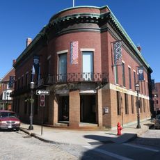
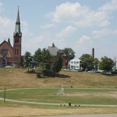
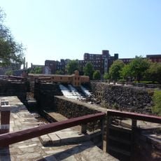
Concord River, River system in Middlesex County, Massachusetts.

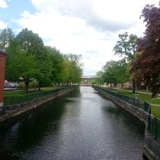
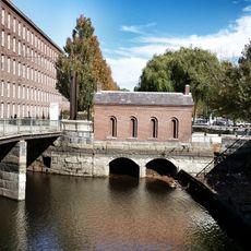
The Concord River is a waterway in Massachusetts that flows through Middlesex County and links two tributaries to the larger Merrimack River system. The water moves at a gentle pace, making the river easy to navigate through the surrounding landscape.

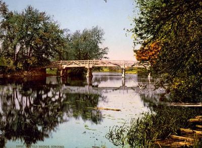
This river held strategic importance during the American Revolution when a major battle occurred at Old North Bridge in 1775. The confrontation there marked a turning point in early conflicts between colonial and British forces.

Local indigenous peoples named this waterway for its grass-covered banks and slow current, reflecting how closely early inhabitants connected with the river's natural character. This name choice shows how people read and understood the landscape around them.

The river offers paddling opportunities across several miles with sections suitable for short morning or afternoon trips. Visitors should know that the water moves slowly and access points exist at various locations along the route.

The riverbed carries deposits from industrial times that have led to fish consumption restrictions in certain areas. This condition reflects how past manufacturing activities have left a lasting mark on water quality.

The community of curious travelers

AroundUs brings together thousands of curated places, local tips, and hidden gems, enriched daily by 60,000 contributors worldwide.

Start exploring
Location
GPS coordinates
42.64389,-71.30361
Latest update
December 10, 2025 15:59
Around this place
Tsongas Center
United States of America

Tsongas Center

1.1 km
Lowell National Historical Park
United States of America

Lowell National Historical Park

959 m
Boott Mills
United States of America

Boott Mills

620 m
Lowell Memorial Auditorium
United States of America

Lowell Memorial Auditorium

143 m
American Textile History Museum
United States of America

American Textile History Museum

1.1 km
Whistler House Museum of Art
United States of America

Whistler House Museum of Art

947 m
Merrimack Repertory Theatre
United States of America

Merrimack Repertory Theatre

143 m
Pollard Memorial Library
United States of America

Pollard Memorial Library

957 m
New England Quilt Museum
United States of America

New England Quilt Museum

709 m
Merrimack Canal
United States of America

Merrimack Canal

824 m
Wannalancit Mills
United States of America

Wannalancit Mills

1.2 km
Belvidere Hill Historic District
United States of America

Belvidere Hill Historic District

1.1 km
City Hall Historic District
United States of America

City Hall Historic District

834 m
Colburn School
United States of America

Colburn School

469 m
The Worthen House
United States of America

The Worthen House

887 m
Rogers Fort Hill Park Historic District
United States of America

Rogers Fort Hill Park Historic District

1.2 km
Wamesit Canal-Whipple Mill Industrial Complex
United States of America

Wamesit Canal-Whipple Mill Industrial Complex

1.3 km
Hoyt-Shedd Estate
United States of America

Hoyt-Shedd Estate

1 km
Lowell Museum
United States of America

Lowell Museum

434 m
F. Bradford Morse Federal Building
United States of America

F. Bradford Morse Federal Building

294 m
South Common Historic District
United States of America

South Common Historic District

1 km
Lowell Historic Preservation District
United States of America

Lowell Historic Preservation District

483 m
Washington Square Historic District
United States of America

Washington Square Historic District

442 m
Brown-Maynard House
United States of America

Brown-Maynard House

1.2 km
National Streetcar Museum
United States of America

National Streetcar Museum

765 m
Portuguese Colonial Wars and Carnation Revolution memorial
United States of America

Portuguese Colonial Wars and Carnation Revolution memorial

571 m
Lower Locks
United States of America

Lower Locks

320 m
Howe Building
United States of America

Howe Building

837 m
Show the full map
Reviews
Share your experience

No review yet

Discussions
Start a discussion...

No discussion yet

« Concord River - River system in Middlesex County, Massachusetts » is provided by Around Us (aroundus.com). Images and texts are derived from Wikimedia project under a Creative Commons license. You are allowed to copy, distribute, and modify copies of this page, under the conditions set by the license, as long as this note is clearly visible.

Discover hidden gems everywhere you go!

From secret cafés to breathtaking viewpoints, skip the crowded tourist spots and find places that match your style. Our app makes it easy with voice search, smart filtering, route optimization, and insider tips from travelers worldwide. Download now for the complete mobile experience.

Around Us App Screenshot

A unique approach to discovering new places

Le Figaro

All the places worth exploring

France Info

A tailor-made excursion in just a few clicks

20 Minutes

Around Us
Travel Guide & Maps
Download

Send to your phone

QR Code
1

Open the camera app on your mobile.

2

Point at the QR code with your camera. A notification will appear.

3

Tap the notification to open the link.