City Hall Historic District

Log in to your account

AroundUs is a community-driven map of interesting places, built by curious explorers like you. It grows with every review, story, and photo you share.
Connect to save your favorite spots, contribute locations, and create personalized routes.
Continue with Google
Continue with Apple
Continue with X
Continue with Facebook
Continue with email
By continuing, you accept our Terms and Conditions and our Privacy Policy
Create an account
Add to collection
Map
Suggest a change
Share

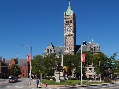
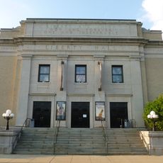
City Hall Historic District, Historic district in Cambridge, Massachusetts.

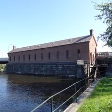
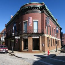
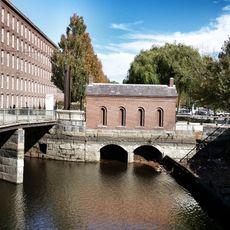
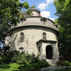
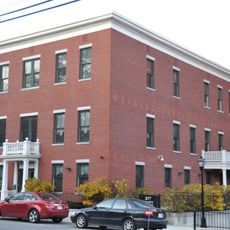
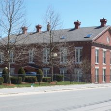
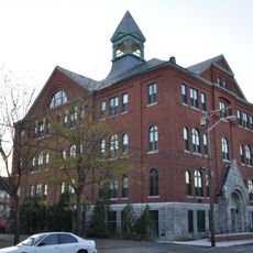
The City Hall Historic District is a municipal area in Cambridge comprising multiple buildings that blend Romanesque and Renaissance architectural styles along Massachusetts Avenue, Bigelow, and Temple Streets. The structures serve as functioning government offices that form a cohesive collection in the heart of the city's central area.

The district developed in the late 1800s and early 1900s as Cambridge expanded and needed modern government facilities. Its listing on the National Register of Historic Places in 1982 acknowledged its importance to the evolution of municipal administration in the region.

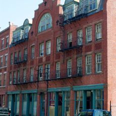
The district reflects how the city shaped its administration and civic identity over time, with different architects leaving their mark through varied building designs across different eras. Walking through the area, you can observe these differences and sense how tastes and building methods evolved as the city grew.

The district is centrally located in Cambridge and easy to navigate on foot, with clear streets and public spaces for orientation. The best way to explore the architecture is a leisurely walk along the three main streets, where you can view different building facades from the outside.

The concentration of government buildings from this period is denser here than anywhere else in Cambridge's core area. This makes the district a rare example of how civic architecture from this era was brought together in one cohesive setting.

Location: Middlesex County

GPS coordinates: 42.64611,-71.31333

Latest update: December 14, 2025 17:42

Photos
Around this place
Tsongas Center
United States of America

Tsongas Center

455 m
Lowell National Historical Park
United States of America

Lowell National Historical Park

933 m
Boott Mills
United States of America

Boott Mills

466 m
Lowell Memorial Auditorium
United States of America

Lowell Memorial Auditorium

756 m
American Textile History Museum
United States of America

American Textile History Museum

538 m
Lowell Power Canal System
United States of America

Lowell Power Canal System

549 m
Whistler House Museum of Art
United States of America

Whistler House Museum of Art

228 m
Merrimack Repertory Theatre
United States of America

Merrimack Repertory Theatre

756 m
Pollard Memorial Library
United States of America

Pollard Memorial Library

124 m
New England Quilt Museum
United States of America

New England Quilt Museum

131 m
Merrimack Canal
United States of America

Merrimack Canal

184 m
Wannalancit Mills
United States of America

Wannalancit Mills

476 m
Jonathan Bowers House
United States of America

Jonathan Bowers House

1.2 km
Lowell Post Office
United States of America

Lowell Post Office

641 m
St. Joseph's Convent and School
United States of America

St. Joseph's Convent and School

880 m
St. George Antiochian Orthodox Church
United States of America

St. George Antiochian Orthodox Church

926 m
Colburn School
United States of America

Colburn School

1 km
The Worthen House
United States of America

The Worthen House

86 m
Varnum Building
United States of America

Varnum Building

902 m
Lowell Museum
United States of America

Lowell Museum

415 m
F. Bradford Morse Federal Building
United States of America

F. Bradford Morse Federal Building

554 m
South Common Historic District
United States of America

South Common Historic District

1 km
Lowell Historic Preservation District
United States of America

Lowell Historic Preservation District

433 m
Saint Joseph's Roman Catholic College for Boys
United States of America

Saint Joseph's Roman Catholic College for Boys

671 m
National Streetcar Museum
United States of America

National Streetcar Museum

118 m
Portuguese Colonial Wars and Carnation Revolution memorial
United States of America

Portuguese Colonial Wars and Carnation Revolution memorial

812 m
Lower Locks
United States of America

Lower Locks

524 m
Howe Building
United States of America

Howe Building

620 m
Show the full map
Reviews

Visited this place? Tap the stars to rate it and share your experience / photos with the community! Try now! You can cancel it anytime.

« City Hall Historic District - Historic district in Cambridge, Massachusetts » is provided by Around Us (aroundus.com). Images and texts are derived from Wikimedia project under a Creative Commons license. You are allowed to copy, distribute, and modify copies of this page, under the conditions set by the license, as long as this note is clearly visible.

Discover hidden gems everywhere you go!

From secret cafés to breathtaking viewpoints, skip the crowded tourist spots and find places that match your style. Our app makes it easy with voice search, smart filtering, route optimization, and insider tips from travelers worldwide. Download now for the complete mobile experience.

Around Us App Screenshot

A unique approach to discovering new places

Le Figaro

All the places worth exploring

France Info

A tailor-made excursion in just a few clicks

20 Minutes