Lowell Power Canal System

Log in to your account

AroundUs is a community-driven map of interesting places, built by curious explorers like you. It grows with every review, story, and photo you share.
Connect to save your favorite spots, contribute locations, and create personalized routes.
Continue with Google
Continue with Apple
Continue with X
Continue with Facebook
Continue with email
By continuing, you accept our Terms and Conditions and our Privacy Policy
Create an account
Add to collection
Map
Suggest a change
Share

Lowell Power Canal System, Power canal system in Lowell, Massachusetts, US.

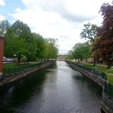
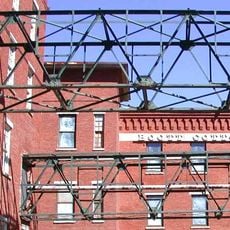
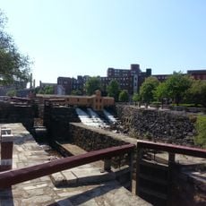
The Lowell Power Canal System is a network of waterways in Massachusetts that extends across several kilometers and consists of six major canals operating on two levels. The system features numerous gates, control structures, and water management infrastructure that connect the different channels together.

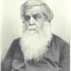
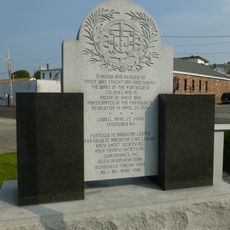
The system began in 1796 as the Pawtucket Canal for moving logs, but was redesigned in the 1820s to power textile mills with flowing water. This transformation under Francis Cabot Lowell and his partners turned the area into an early American industrial center.

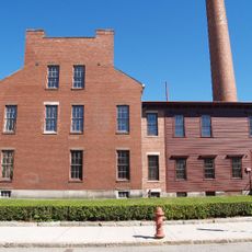
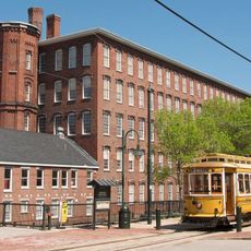
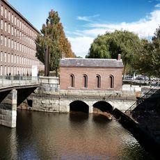
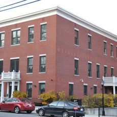
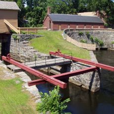
The waterways shaped how Lowell grew as a manufacturing hub, with large mill buildings positioned directly along the canals to harness water power. Visitors can still see how closely the buildings relate to the water channels that once drove their machinery.

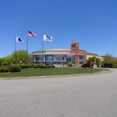
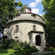
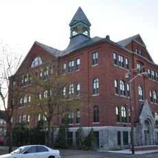
The Pawtucket Gatehouse controls water levels throughout the canal system, while modern facilities operate along the waterways. Visitors should keep in mind that the site spans different elevation levels and infrastructure appears at various locations throughout the area.

The system contains one of the first inward-flow Francis water turbines ever put into service, which shaped how water turbines were designed around the world. This early turbine stands as a key part of hydropower history and demonstrates how local innovation influenced global technology.

Location: Massachusetts

Part of: Lowell National Historical Park

GPS coordinates: 42.64556,-71.32000

Latest update: December 10, 2025 20:05

Photos
Around this place
Tsongas Center
United States of America

Tsongas Center

760 m
Lowell National Historical Park
United States of America

Lowell National Historical Park

1.1 km
Boott Mills
United States of America

Boott Mills

994 m
Pawtucket Falls
United States of America

Pawtucket Falls

1.1 km
American Textile History Museum
United States of America

American Textile History Museum

478 m
Whistler House Museum of Art
United States of America

Whistler House Museum of Art

413 m
Pollard Memorial Library
United States of America

Pollard Memorial Library

432 m
New England Quilt Museum
United States of America

New England Quilt Museum

654 m
Merrimack Canal
United States of America

Merrimack Canal

535 m
Wannalancit Mills
United States of America

Wannalancit Mills

525 m
Jonathan Bowers House
United States of America

Jonathan Bowers House

685 m
Lowell Post Office
United States of America

Lowell Post Office

996 m
St. Joseph's Convent and School
United States of America

St. Joseph's Convent and School

586 m
St. George Antiochian Orthodox Church
United States of America

St. George Antiochian Orthodox Church

447 m
City Hall Historic District
United States of America

City Hall Historic District

549 m
The Worthen House
United States of America

The Worthen House

477 m
Lowell Museum
United States of America

Lowell Museum

958 m
F. Bradford Morse Federal Building
United States of America

F. Bradford Morse Federal Building

1.1 km
South Common Historic District
United States of America

South Common Historic District

1.2 km
Lowell Historic Preservation District
United States of America

Lowell Historic Preservation District

983 m
Saint Joseph's Roman Catholic College for Boys
United States of America

Saint Joseph's Roman Catholic College for Boys

375 m
Wannalancit Street Historic District
United States of America

Wannalancit Street Historic District

783 m
National Streetcar Museum
United States of America

National Streetcar Museum

591 m
Pawtucket Dam
United States of America

Pawtucket Dam

1.1 km
Portuguese Colonial Wars and Carnation Revolution memorial
United States of America

Portuguese Colonial Wars and Carnation Revolution memorial

1.2 km
Lower Locks
United States of America

Lower Locks

1 km
Guard Locks
United States of America

Guard Locks

769 m
Howe Building
United States of America

Howe Building

812 m
Show the full map
Reviews

Visited this place? Tap the stars to rate it and share your experience / photos with the community! Try now! You can cancel it anytime.

« Lowell Power Canal System - Power canal system in Lowell, Massachusetts, US » is provided by Around Us (aroundus.com). Images and texts are derived from Wikimedia project under a Creative Commons license. You are allowed to copy, distribute, and modify copies of this page, under the conditions set by the license, as long as this note is clearly visible.

Discover hidden gems everywhere you go!

From secret cafés to breathtaking viewpoints, skip the crowded tourist spots and find places that match your style. Our app makes it easy with voice search, smart filtering, route optimization, and insider tips from travelers worldwide. Download now for the complete mobile experience.

Around Us App Screenshot

A unique approach to discovering new places

Le Figaro

All the places worth exploring

France Info

A tailor-made excursion in just a few clicks

20 Minutes