Enable Location

We need your location to show you interesting places around you

Discover nearby places

Find interesting locations and hidden gems around you

Precise directions

Get accurate directions and distances to places

Your location is never shared with other users. It's only used when you tap the location button.

Pawtucket Falls

Log in to your account

Start exploring — it's free

Trusted by 65,530 travelers worldwide

Continue with Google
Continue with Apple
or

We will send you a code to connect

By continuing, you accept our Terms and Conditions and our Privacy Policy

Check your inbox

We've sent a pincode in your inbox. Please enter the code below.

Pawtucket Falls
Discussion Reviews 1 Photos
5.1k Popularity

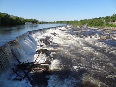
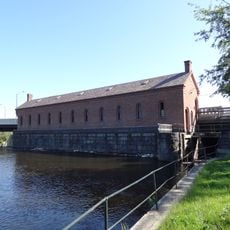
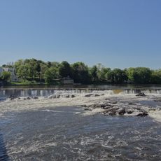
Pawtucket Falls, Waterfall on Merrimack River, Lowell, Massachusetts.

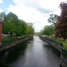
Pawtucket Falls is a waterfall on the Merrimack River in Lowell, Massachusetts, where the river drops over a wide rocky ledge and splits into several channels. The water runs through a series of rapids and narrower courses before the river gathers again downstream.

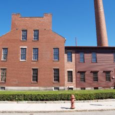
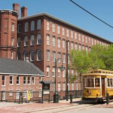
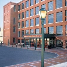
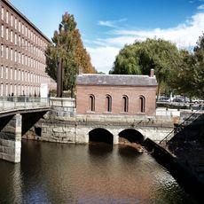
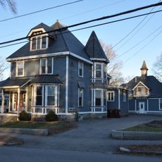
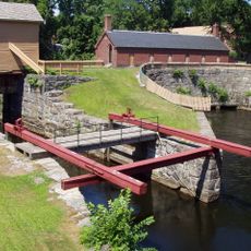
In the early 1800s, industrialists harnessed the power of the falls to build Lowell into one of the first planned factory towns in the country. Textile mills multiplied quickly along the river, shaping the character of the city for generations.

The name Pawtucket comes from an Algonkin language and refers to a place near a tidal stream. The Pennacook people fished at this spot long before the area was settled by Europeans, and that connection is still carried in the name today.

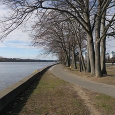
The falls are easy to see from a nearby bridge that gives a clear view over the rapids. The flow is noticeably stronger in spring during snowmelt, making that season a good time to visit if you want to see the river at its most active.

The location of the falls helped determine the boundary between Massachusetts and New Hampshire, settled by a colonial ruling in 1740. A territorial dispute over this stretch of the Merrimack made the waterfall an unexpected reference point in a border conflict that lasted for years.

The community of curious travelers

AroundUs brings together thousands of curated places, local tips, and hidden gems, enriched daily by 60,000 contributors worldwide.

Start exploring
Location
Part of
Merrimack River
GPS coordinates
42.64870,-71.33220
Latest update
March 3, 2026 08:15
Around this place
Tsongas Center
United States of America

Tsongas Center

1.6 km
Lowell National Historical Park
United States of America

Lowell National Historical Park

2.1 km
Boott Mills
United States of America

Boott Mills

1.9 km
American Textile History Museum
United States of America

American Textile History Museum

1.5 km
Lowell Power Canal System
United States of America

Lowell Power Canal System

1.1 km
Whistler House Museum of Art
United States of America

Whistler House Museum of Art

1.5 km
Lowell Heritage State Park
United States of America

Lowell Heritage State Park

2 km
Pollard Memorial Library
United States of America

Pollard Memorial Library

1.4 km
New England Quilt Museum
United States of America

New England Quilt Museum

1.7 km
Merrimack Canal
United States of America

Merrimack Canal

1.6 km
Wannalancit Mills
United States of America

Wannalancit Mills

1.3 km
Jonathan Bowers House
United States of America

Jonathan Bowers House

428 m
Lowell Post Office
United States of America

Lowell Post Office

2 km
St. Joseph's Convent and School
United States of America

St. Joseph's Convent and School

843 m
Allen House
United States of America

Allen House

781 m
St. George Antiochian Orthodox Church
United States of America

St. George Antiochian Orthodox Church

648 m
City Hall Historic District
United States of America

City Hall Historic District

1.6 km
The Worthen House
United States of America

The Worthen House

1.5 km
Lowell Museum
United States of America

Lowell Museum

2 km
Lowell Historic Preservation District
United States of America

Lowell Historic Preservation District

2 km
Tyler Park Historic District
United States of America

Tyler Park Historic District

2.1 km
Saint Joseph's Roman Catholic College for Boys
United States of America

Saint Joseph's Roman Catholic College for Boys

950 m
Wilder Street Historic District
United States of America

Wilder Street Historic District

1.4 km
Wannalancit Street Historic District
United States of America

Wannalancit Street Historic District

320 m
National Streetcar Museum
United States of America

National Streetcar Museum

1.6 km
Pawtucket Dam
United States of America

Pawtucket Dam

0 m
Guard Locks
United States of America

Guard Locks

656 m
Howe Building
United States of America

Howe Building

1.8 km
Show the full map
Reviews
Share your experience

No review yet

Discussions
Start a discussion...

No discussion yet

« Pawtucket Falls - Waterfall on Merrimack River, Lowell, Massachusetts » is provided by Around Us (aroundus.com). Images and texts are derived from Wikimedia project under a Creative Commons license. You are allowed to copy, distribute, and modify copies of this page, under the conditions set by the license, as long as this note is clearly visible.

Discover hidden gems everywhere you go!

From secret cafés to breathtaking viewpoints, skip the crowded tourist spots and find places that match your style. Our app makes it easy with voice search, smart filtering, route optimization, and insider tips from travelers worldwide. Download now for the complete mobile experience.

Around Us App Screenshot

A unique approach to discovering new places

Le Figaro

All the places worth exploring

France Info

A tailor-made excursion in just a few clicks

20 Minutes

Around Us
Travel Guide & Maps
Download

Send to your phone

QR Code
1

Open the camera app on your mobile.

2

Point at the QR code with your camera. A notification will appear.

3

Tap the notification to open the link.