Enable Location

We need your location to show you interesting places around you

Discover nearby places

Find interesting locations and hidden gems around you

Precise directions

Get accurate directions and distances to places

Your location is never shared with other users. It's only used when you tap the location button.

Elizabethtown

Log in to your account

Start exploring — it's free

Trusted by 68,224 travelers worldwide

Continue with Google
Continue with Apple
or

We will send you a code to connect

By continuing, you accept our Terms and Conditions and our Privacy Policy

Check your inbox

We've sent a pincode in your inbox. Please enter the code below.

Discussion Reviews 2 Photos
23.8k Popularity

Elizabethtown, County seat in Lancaster County, Pennsylvania.

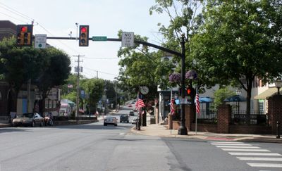
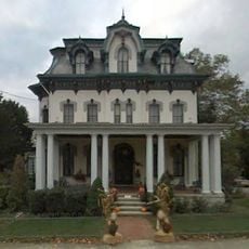
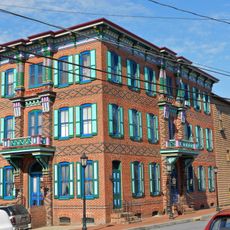
Elizabethtown is a borough situated in northwestern Lancaster County, Pennsylvania, positioned between the cities of Harrisburg, Lancaster, and York. The town features residential neighborhoods, local shops, and historic buildings arranged around a central public square.

The settlement was founded in 1779 and grew into a transportation hub when the Louisville and Nashville Railroad arrived in 1858. This rail connection linked the region to larger cities and fueled the town's development.

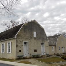
The town's religious character shaped its development, with multiple churches serving as gathering places for the community. This spiritual foundation remains visible today in how residents use public spaces and organize local activities.

The town is best explored on foot, as the downtown area with shops and buildings is compact and easy to navigate. Ample parking is available near the central square for those arriving by car.

A cannonball from the Civil War, embedded during General John Hunt Morgan's 1862 raid, remains lodged in a building on the public square. This tangible mark of conflict is still visible to those walking through the town today.

The community of curious travelers

AroundUs brings together thousands of curated places, local tips, and hidden gems, enriched daily by 60,000 contributors worldwide.

Start exploring
Location
Inception
1753
GPS coordinates
40.15330,-76.60060
Latest update
December 20, 2025 13:34
Around this place
Cameron Estate
United States of America

Cameron Estate

6.3 km
United States of America

Shocks Mills Bridge

10.7 km
United States of America

Conewago Falls

10.3 km
Donegal Presbyterian Church Complex
United States of America

Donegal Presbyterian Church Complex

6.5 km
Donegal Mills Plantation
United States of America

Donegal Mills Plantation

9.2 km
Ashley and Bailey Silk Mill
United States of America

Ashley and Bailey Silk Mill

11.4 km
Byers-Muma House
United States of America

Byers-Muma House

8.5 km
Chickies Historic District
United States of America

Chickies Historic District

11.3 km
Grove Mansion
United States of America

Grove Mansion

9.2 km
Adventure Sports in Hershey
United States of America

Adventure Sports in Hershey

9.4 km
Risser's Mill Covered Bridge
United States of America

Risser's Mill Covered Bridge

8.3 km
Central Hotel
United States of America

Central Hotel

9.5 km
Codorus Navigation
United States of America

Codorus Navigation

11.2 km
Locust Grove
United States of America

Locust Grove

9.7 km
United States of America

Nissly Swiss Chocolate Company

7.7 km
George Brown's Sons Cotton and Woolen Mill
United States of America

George Brown's Sons Cotton and Woolen Mill

10.2 km
Haldeman Mansion
United States of America

Haldeman Mansion

9.7 km
United States of America

Lake Frederic

10.4 km
United States of America

State Game Lands Number 145

11.4 km
Kreider Shoe Manufacturing Company
United States of America

Kreider Shoe Manufacturing Company

702 m
United States of America

Sunset Golf Course

10 km
United States of America

Treetop Golf Course

11.7 km
United States of America

Ship Mountjoy Sculpture

9.9 km
United States of America

Benjamin Franklin Carpenter

2.3 km
United States of America

Statue, Work of art

4.2 km
United States of America

Work of art, sculpture

4.3 km
United States of America

White Cliffs of Conoy

10.1 km
United States of America

The Overlook at Schull's Rock

11.2 km
Show the full map
Reviews
Share your experience

No review yet

Discussions
Start a discussion...

No discussion yet

« Elizabethtown - County seat in Lancaster County, Pennsylvania » is provided by Around Us (aroundus.com). Images and texts are derived from Wikimedia project under a Creative Commons license. You are allowed to copy, distribute, and modify copies of this page, under the conditions set by the license, as long as this note is clearly visible.

Discover hidden gems everywhere you go!

From secret cafés to breathtaking viewpoints, skip the crowded tourist spots and find places that match your style. Our app makes it easy with voice search, smart filtering, route optimization, and insider tips from travelers worldwide. Download now for the complete mobile experience.

Around Us App Screenshot

A unique approach to discovering new places

Le Figaro

All the places worth exploring

France Info

A tailor-made excursion in just a few clicks

20 Minutes

Around Us
Travel Guide & Maps
Download

Send to your phone

QR Code
1

Open the camera app on your mobile.

2

Point at the QR code with your camera. A notification will appear.

3

Tap the notification to open the link.