Enable Location

We need your location to show you interesting places around you

Discover nearby places

Find interesting locations and hidden gems around you

Precise directions

Get accurate directions and distances to places

Your location is never shared with other users. It's only used when you tap the location button.

Log in to your account

Start exploring — it's free

Trusted by 62,413 travelers worldwide

Continue with Google
Continue with Apple
or

We will send you a code to connect

By continuing, you accept our Terms and Conditions and our Privacy Policy

Check your inbox

We've sent a pincode in your inbox. Please enter the code below.

Conewago Falls

Conewago Falls, Waterfall in Lancaster County, Pennsylvania.

Conewago Falls is a series of waterfalls along the Susquehanna River in Lancaster County, Pennsylvania. The water cascades over diabase rock formations that create drops and rapids across a wide stretch of the riverbed.

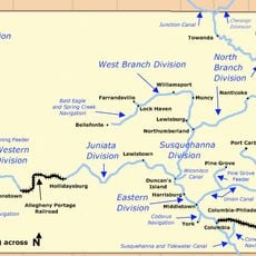
These falls formed through natural geological processes along the Susquehanna River and were altered by the construction of the York Haven Dam in 1904. That dam changed how water flows over the rapids and through the landscape.

Native American tribes, including Susquehannock, Iroquois, and Lenape, used elm bark canoes to navigate around these falls for trade purposes.

Access to the falls is available through the Falmouth Access area managed by the Pennsylvania Fish and Boat Commission, which can be reached from Collins Road off Route 441. The best viewing happens after rain or during high water flow, when the waterfalls are most powerful.

The diabase rocks at the falls contain numerous potholes formed by underwater sand erosion processes during the Ice Age period.

The community of curious travelers

AroundUs brings together thousands of curated places, local tips, and hidden gems, enriched daily by 60,000 contributors worldwide.

Start exploring
Location
Part of
Susquehanna River
GPS coordinates
40.12028,-76.71361
Latest update
December 14, 2025 11:25
Around this place
United States of America

Indian Echo Caverns

14.8 km
Susquehanna River Bridge
United States of America

Susquehanna River Bridge

12.2 km
Cameron Estate
United States of America

Cameron Estate

12.5 km
United States of America

Shocks Mills Bridge

9.2 km
Penn State Harrisburg Library
United States of America

Penn State Harrisburg Library

9.6 km
Donegal Presbyterian Church Complex
United States of America

Donegal Presbyterian Church Complex

12.7 km
Emig Mansion
United States of America

Emig Mansion

11.2 km
Codorus Forge and Furnace Historic District
United States of America

Codorus Forge and Furnace Historic District

9 km
Calver Island
United States of America

Calver Island

12.4 km
B'nai Jacob Synagogue
United States of America

B'nai Jacob Synagogue

8.7 km
Kise Mill Bridge
United States of America

Kise Mill Bridge

8.3 km
Sinking Springs Farms
United States of America

Sinking Springs Farms

12.5 km
Byers-Muma House
United States of America

Byers-Muma House

14.3 km
Charles and Joseph Raymond Houses
United States of America

Charles and Joseph Raymond Houses

8.5 km
Grove Mansion
United States of America

Grove Mansion

12.5 km
Pleasureville Historic District
United States of America

Pleasureville Historic District

13.1 km
Simon Cameron House and Bank
United States of America

Simon Cameron House and Bank

9 km
Codorus Navigation
United States of America

Codorus Navigation

9.1 km
Locust Grove
United States of America

Locust Grove

6.4 km
Michael and Magdealena Bixler Farmstead
United States of America

Michael and Magdealena Bixler Farmstead

11.1 km
Swatara Ferry House
United States of America

Swatara Ferry House

8.1 km
Henry Smith Farm
United States of America

Henry Smith Farm

10.3 km
Bridge between East Manchester and Newberry Townships
United States of America

Bridge between East Manchester and Newberry Townships

4.3 km
Hammersly-Strominger House
United States of America

Hammersly-Strominger House

11.9 km
Kise Mill Bridge Historic District
United States of America

Kise Mill Bridge Historic District

8.2 km
William Shelly School and Annex
United States of America

William Shelly School and Annex

9.3 km
Goldsboro Historic District
United States of America

Goldsboro Historic District

4.8 km
Conrad and Margaret Allerman House
United States of America

Conrad and Margaret Allerman House

13.4 km
Show the full map
« Conewago Falls - Waterfall in Lancaster County, Pennsylvania » is provided by Around Us (aroundus.com). Images and texts are derived from Wikimedia project under a Creative Commons license. You are allowed to copy, distribute, and modify copies of this page, under the conditions set by the license, as long as this note is clearly visible.

Discover hidden gems everywhere you go!

From secret cafés to breathtaking viewpoints, skip the crowded tourist spots and find places that match your style. Our app makes it easy with voice search, smart filtering, route optimization, and insider tips from travelers worldwide. Download now for the complete mobile experience.

Around Us App Screenshot

A unique approach to discovering new places

Le Figaro

All the places worth exploring

France Info

A tailor-made excursion in just a few clicks

20 Minutes

Around Us
Travel Guide & Maps
Download

Send to your phone

QR Code
1

Open the camera app on your mobile.

2

Point at the QR code with your camera. A notification will appear.

3

Tap the notification to open the link.