Chest opened
+${chestReward.xp} XP
Explorer
NOUVEAU ×${chestReward.collectible.quantity}
tapez pour fermer
Chest locked

Open chests in the app

Around Us is built for your phone — chests unlock when you walk, explore and capture nearby places.

Enable Location

We need your location to show you interesting places around you

Discover nearby places

Find interesting locations and hidden gems around you

Precise directions

Get accurate directions and distances to places

Your location is never shared with other users. It's only used when you tap the location button.

Kennebec River

Log in to your account

Start exploring — it's free

Trusted by 72,890 travelers worldwide

Continue with Google
Continue with Apple
or

We will send you a code to connect

By continuing, you accept our Terms and Conditions and our Privacy Policy

Check your inbox

We've sent a pincode in your inbox. Please enter the code below.

Kennebec River
Discussion Reviews 2 Photos
32.9k Popularity

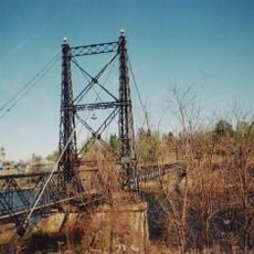
Kennebec River, Natural stream in northern Maine, United States.

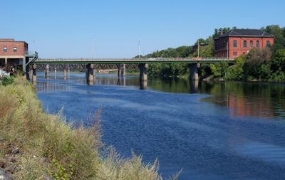
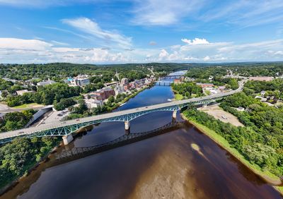
The Kennebec River is a waterway that flows roughly 170 miles from Moosehead Lake through central Maine, passing through several towns and communities. It eventually reaches the Gulf of Maine after winding through varied terrain.

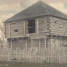
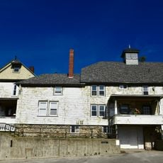
English settlers established a colony along this river in 1607 and built the first ocean-going vessel constructed in North America at that location. This early European presence shaped the region's development for centuries to come.

The Abenaki people called this waterway Kinipekw, reflecting their understanding of its calm waters. This indigenous connection to the river remains woven into the landscape and the ways locals relate to it.

The river offers year-round fishing opportunities with different fish species found in various sections depending on the season. Visitors should check local conditions and plan their visit based on what species they wish to pursue.

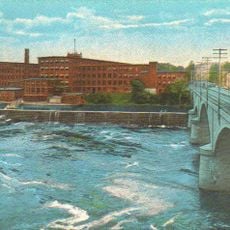
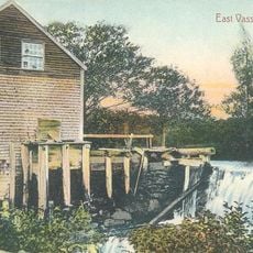
A dam along this river was removed in 1999 on federal order, marking the first time environmental protection outweighed power generation in such a decision. This event set a new precedent for dam management in the country.

The community of curious travelers

AroundUs brings together thousands of curated places, local tips, and hidden gems, enriched daily by 60,000 contributors worldwide.

Start exploring
Location
GPS coordinates
44.47250,-69.68583
Latest update
December 20, 2025 00:04
Around this place
Fort Halifax
United States of America

Fort Halifax

8.7 km
Colby College Museum of Art
United States of America

Colby College Museum of Art

10.5 km
Two Cent Bridge
United States of America

Two Cent Bridge

9.9 km
United States of America

Oak Grove-Coburn School

1.3 km
Universalist-Unitarian Church
United States of America

Universalist-Unitarian Church

9.2 km
River Meetinghouse
United States of America

River Meetinghouse

1 km
Oakland Public Library
United States of America

Oakland Public Library

8.4 km
Old Waterville High School
United States of America

Old Waterville High School

9.8 km
Waterville Opera House and City Hall
United States of America

Waterville Opera House and City Hall

9.7 km
Waterville Public Library
United States of America

Waterville Public Library

9.8 km
Lockwood Mill Historic District
United States of America

Lockwood Mill Historic District

9.3 km
Mill Agent's House
United States of America

Mill Agent's House

5.3 km
South China Meeting House
United States of America

South China Meeting House

12.3 km
Gov. Samuel Cony House
United States of America

Gov. Samuel Cony House

13.8 km
Redington Museum
United States of America

Redington Museum

9.2 km
Alvin O. Lombard House
United States of America

Alvin O. Lombard House

9.7 km
Pond Meeting House
United States of America

Pond Meeting House

13.2 km
East Vassalboro Grist and Saw Mill
United States of America

East Vassalboro Grist and Saw Mill

6.7 km
Pressey House
United States of America

Pressey House

8.2 km
Pendle Hill
United States of America

Pendle Hill

11.9 km
Heald House
United States of America

Heald House

9.8 km
Abel Jones House
United States of America

Abel Jones House

12.4 km
Amos Gerald House
United States of America

Amos Gerald House

14.3 km
Foster-Redington House
United States of America

Foster-Redington House

9.8 km
Redington House
United States of America

Redington House

9.2 km
Waterville Main Street Historic District
United States of America

Waterville Main Street Historic District

9.7 km
Riverview House
United States of America

Riverview House

10.4 km
Dutton-Small House
United States of America

Dutton-Small House

4.5 km
Show the full map
Reviews
Share your experience

No review yet

Discussions
Start a discussion...

No discussion yet

« Kennebec River - Natural stream in northern Maine, United States » is provided by Around Us (aroundus.com). Images and texts are derived from Wikimedia project under a Creative Commons license. You are allowed to copy, distribute, and modify copies of this page, under the conditions set by the license, as long as this note is clearly visible.

Discover hidden gems everywhere you go!

From secret cafés to breathtaking viewpoints, skip the crowded tourist spots and find places that match your style. Our app makes it easy with voice search, smart filtering, route optimization, and insider tips from travelers worldwide. Download now for the complete mobile experience.

Around Us App Screenshot

A unique approach to discovering new places

Le Figaro

All the places worth exploring

France Info

A tailor-made excursion in just a few clicks

20 Minutes

Around Us
Travel Guide & Maps
Download

Send to your phone

QR Code
1

Open the camera app on your mobile.

2

Point at the QR code with your camera. A notification will appear.

3

Tap the notification to open the link.