Enable Location

We need your location to show you interesting places around you

Discover nearby places

Find interesting locations and hidden gems around you

Precise directions

Get accurate directions and distances to places

Your location is never shared with other users. It's only used when you tap the location button.

East Lyme

Log in to your account

Start exploring — it's free

Trusted by 63,021 travelers worldwide

Continue with Google
Continue with Apple
or

We will send you a code to connect

By continuing, you accept our Terms and Conditions and our Privacy Policy

Check your inbox

We've sent a pincode in your inbox. Please enter the code below.

Discussion Reviews 2 Photos
18.1k Popularity

East Lyme, town in New London County, Connecticut, United States of America

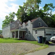
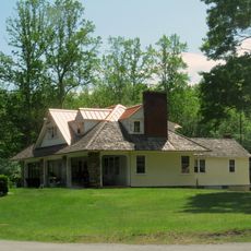
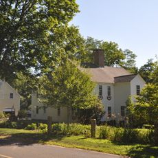
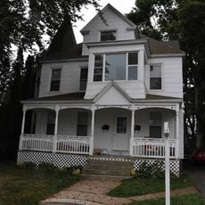
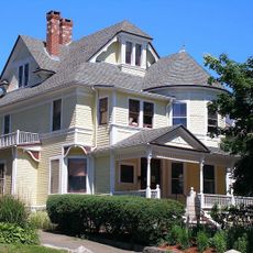
East Lyme is a town in southeastern Connecticut next to Long Island Sound, comprising two villages named Flanders and Niantic. The area contains historic homes, small local businesses, parks, and state forest covering hundreds of acres with diverse habitats and recreational trails.

The town was founded in 1839 from parts of Lyme and Waterford and was originally centered on fishing, shipbuilding, and stone quarrying. The railroad arrived in 1851, bringing visitors and summer homes along the shoreline.

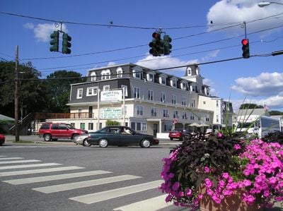
East Lyme consists of two villages, Flanders in the north and Niantic along the coast, each shaping the town's character and daily rhythms. The local identity centers on outdoor life and water activities, with residents gathering at community events and maintaining traditions that reflect their connection to the shoreline.

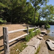
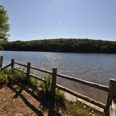
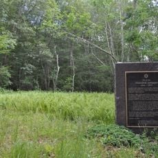
Rocky Neck State Park with over 700 acres is the most popular destination for outdoor activities and offers camping, beaches, and hiking trails. Visitors should explore the area on foot, as most activities are accessible by walking.

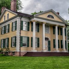
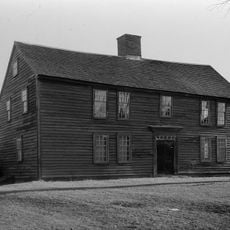
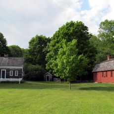
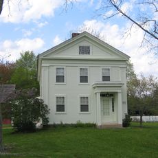
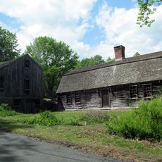
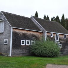
The Thomas Lee House and Museum is an old dwelling that shows how people once lived in East Lyme and the town's role in regional history. The building offers direct insight into the daily life of past generations.

The community of curious travelers

AroundUs brings together thousands of curated places, local tips, and hidden gems, enriched daily by 60,000 contributors worldwide.

Start exploring
Inception
1839
Elevation above the sea
64 m
GPS coordinates
41.35306,-72.22944
Latest update
February 17, 2026 00:00
Around this place
The Seaside
United States of America

The Seaside

9.9 km
Florence Griswold Museum
United States of America

Florence Griswold Museum

8.7 km
Rocky Neck State Park
United States of America

Rocky Neck State Park

5 km
Thomas Lee House
United States of America

Thomas Lee House

4 km
Niantic River Bridge
United States of America

Niantic River Bridge

5.5 km
Connecticut College Arboretum
United States of America

Connecticut College Arboretum

10.4 km
Nehantic State Forest
United States of America

Nehantic State Forest

7.8 km
Old Lyme Congregational Church
United States of America

Old Lyme Congregational Church

9.7 km
Becket Hill State Park Reserve
United States of America

Becket Hill State Park Reserve

6.2 km
Oswegatchie Historic District
United States of America

Oswegatchie Historic District

3.7 km
Jordan Village, Connecticut
United States of America

Jordan Village, Connecticut

7.4 km
Graniteville Historic District
United States of America

Graniteville Historic District

6.6 km
Smith-Harris House
United States of America

Smith-Harris House

1.2 km
Morton Freeman Plant Hunting Lodge
United States of America

Morton Freeman Plant Hunting Lodge

3.1 km
Samuel Smith House
United States of America

Samuel Smith House

2 km
Peck Tavern
United States of America

Peck Tavern

8.4 km
Hartford Colony
United States of America

Hartford Colony

9.1 km
Springbank
United States of America

Springbank

9.4 km
William Gorton Farm
United States of America

William Gorton Farm

7.3 km
Old Lyme Historic District
United States of America

Old Lyme Historic District

9.6 km
Civic Institutions Historic District
United States of America

Civic Institutions Historic District

9.8 km
McCook Point Park
United States of America

McCook Point Park

4.6 km
Jonathan Newton Harris House
United States of America

Jonathan Newton Harris House

10.4 km
United States Housing Corporation Historic District
United States of America

United States Housing Corporation Historic District

9.7 km
Montauk Avenue Historic District
United States of America

Montauk Avenue Historic District

10.4 km
Nathan A. Woodworth House
United States of America

Nathan A. Woodworth House

10.4 km
New England Hebrew Farmers of the Emanuel Society Synagogue and Creamery Site
United States of America

New England Hebrew Farmers of the Emanuel Society Synagogue and Creamery Site

8.4 km
Rocky Neck Park Trail Bridge
United States of America

Rocky Neck Park Trail Bridge

6.1 km
Show the full map
Reviews
Share your experience

No review yet

Discussions
Start a discussion...

No discussion yet

« East Lyme - town in New London County, Connecticut, United States of America » is provided by Around Us (aroundus.com). Images and texts are derived from Wikimedia project under a Creative Commons license. You are allowed to copy, distribute, and modify copies of this page, under the conditions set by the license, as long as this note is clearly visible.

Discover hidden gems everywhere you go!

From secret cafés to breathtaking viewpoints, skip the crowded tourist spots and find places that match your style. Our app makes it easy with voice search, smart filtering, route optimization, and insider tips from travelers worldwide. Download now for the complete mobile experience.

Around Us App Screenshot

A unique approach to discovering new places

Le Figaro

All the places worth exploring

France Info

A tailor-made excursion in just a few clicks

20 Minutes

Around Us
Travel Guide & Maps
Download

Send to your phone

QR Code
1

Open the camera app on your mobile.

2

Point at the QR code with your camera. A notification will appear.

3

Tap the notification to open the link.