Enable Location

We need your location to show you interesting places around you

Discover nearby places

Find interesting locations and hidden gems around you

Precise directions

Get accurate directions and distances to places

Your location is never shared with other users. It's only used when you tap the location button.

Log in to your account

Start exploring — it's free

Trusted by 62,928 travelers worldwide

Continue with Google
Continue with Apple
or

We will send you a code to connect

By continuing, you accept our Terms and Conditions and our Privacy Policy

Check your inbox

We've sent a pincode in your inbox. Please enter the code below.

Fort Thunder
Discussion Reviews Photo
6.8k Popularity

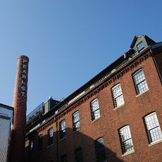
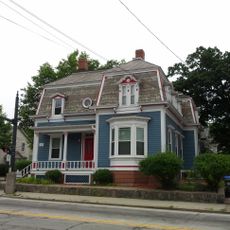
Fort Thunder, Underground music venue in Olneyville district, Providence, US

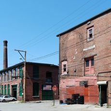
Fort Thunder was an art venue on the second floor of a former textile factory in the Olneyville neighborhood, hosting live music, art installations, and experimental events between 1995 and 2001. The space functioned simultaneously as a concert hall and living quarters for the collaborative artists who occupied it.

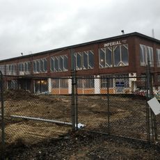
The venue began in 1995 within a pre-Civil War mill building and closed in 2001. Demolition followed shortly after to make way for retail and parking development.

Fort Thunder served as a gathering place for experimental artists and musicians who created alternative comics, noise rock, and video installations within its walls. The venue attracted creative people working outside the mainstream and shaped the underground art community of Providence during that era.

Visitors came not just for concerts but experienced art installations and performance exhibitions in a highly accessible, open environment. Regular events were promoted through handmade posters that reflected the DIY ethos of the place.

Several artists from this space were later invited to show their work at the prestigious Whitney Biennial in New York. This recognition proved that experimental work being created in this modest factory room deserved international artistic attention.

The community of curious travelers

AroundUs brings together thousands of curated places, local tips, and hidden gems, enriched daily by 60,000 contributors worldwide.

Start exploring
Location
GPS coordinates
41.82601,-71.43777
Latest update
December 9, 2025 18:41
Around this place
Classical High School
United States of America

Classical High School

1.7 km
Cranston Street Armory
United States of America

Cranston Street Armory

1.3 km
Providence Lying-In Hospital
United States of America

Providence Lying-In Hospital

1.3 km
Wedding Cake House
United States of America

Wedding Cake House

892 m
Veterans Memorial Auditorium
United States of America

Veterans Memorial Auditorium

1.7 km
Nicholson File Company Mill Complex
United States of America

Nicholson File Company Mill Complex

688 m
New England Butt Company
United States of America

New England Butt Company

1.7 km
Gloria Dei Evangelical Lutheran Church
United States of America

Gloria Dei Evangelical Lutheran Church

1.7 km
Westminster Street Historic District
United States of America

Westminster Street Historic District

1.6 km
Broadway-Armory Historic District
United States of America

Broadway-Armory Historic District

1.3 km
The Sister Dominica Manor
United States of America

The Sister Dominica Manor

1.4 km
Providence Viaduct
United States of America

Providence Viaduct

1.6 km
Our Lady of Lourdes Church Complex
United States of America

Our Lady of Lourdes Church Complex

832 m
Smith Street Primary School
United States of America

Smith Street Primary School

1.4 km
A.F. Cappelli Block
United States of America

A.F. Cappelli Block

924 m
Weybosset Mills Complex
United States of America

Weybosset Mills Complex

1.3 km
American Street School
United States of America

American Street School

849 m
Charles Dowler House
United States of America

Charles Dowler House

1.2 km
Smith Hill Historic District
United States of America

Smith Hill Historic District

1.3 km
Retro-Computing Society of Rhode Island
United States of America

Retro-Computing Society of Rhode Island

1.1 km
Pekin Street Historic District
United States of America

Pekin Street Historic District

1.7 km
Rochambeau Worsted Company Mill
United States of America

Rochambeau Worsted Company Mill

1.4 km
Andrew Dickhaut Cottages Historic District
United States of America

Andrew Dickhaut Cottages Historic District

1.3 km
Covell Street School
United States of America

Covell Street School

860 m
WaterFire Arts Center
United States of America

WaterFire Arts Center

500 m
Providence Flea
United States of America

Providence Flea

462 m
DePasquale Plaza
United States of America

DePasquale Plaza

929 m
Columbus Theatre
United States of America

Columbus Theatre

1.1 km
Show the full map
Reviews
Share your experience

No review yet

Discussions
Start a discussion...

No discussion yet

« Fort Thunder - Underground music venue in Olneyville district, Providence, US » is provided by Around Us (aroundus.com). Images and texts are derived from Wikimedia project under a Creative Commons license. You are allowed to copy, distribute, and modify copies of this page, under the conditions set by the license, as long as this note is clearly visible.

Discover hidden gems everywhere you go!

From secret cafés to breathtaking viewpoints, skip the crowded tourist spots and find places that match your style. Our app makes it easy with voice search, smart filtering, route optimization, and insider tips from travelers worldwide. Download now for the complete mobile experience.

Around Us App Screenshot

A unique approach to discovering new places

Le Figaro

All the places worth exploring

France Info

A tailor-made excursion in just a few clicks

20 Minutes

Around Us
Travel Guide & Maps
Download

Send to your phone

QR Code
1

Open the camera app on your mobile.

2

Point at the QR code with your camera. A notification will appear.

3

Tap the notification to open the link.