National Geospatial-Intelligence Agency, Intelligence agency in Springfield, US
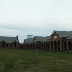
The National Geospatial-Intelligence Agency is an intelligence organization in Springfield, Virginia, focused on analyzing geographic information for national security purposes. The headquarters building rises several stories and houses analysis centers, computer rooms, and offices for thousands of employees.
The agency was created in 1996 by merging several mapping and imagery analysis units under the name National Imagery and Mapping Agency. The current name was adopted in 2003 to reflect the shift from pure cartography to comprehensive spatial data analysis.
The agency employs 14,500 professionals who analyze geographic information, create detailed maps, and provide intelligence support across multiple government departments.
The facility operates satellite offices in several states and works around the clock to process satellite imagery for military and civilian purposes. Public tours are not available due to security restrictions, as this is an active intelligence installation.
The central atrium of the facility could accommodate the Statue of Liberty, illustrating the scale of the building. This open space also serves as a meeting point for staff from different departments.
The community of curious travelers
AroundUs brings together thousands of curated places, local tips, and hidden gems, enriched daily by 60,000 contributors worldwide.