Enable Location

We need your location to show you interesting places around you

Discover nearby places

Find interesting locations and hidden gems around you

Precise directions

Get accurate directions and distances to places

Your location is never shared with other users. It's only used when you tap the location button.

Ironwood

Log in to your account

Start exploring — it's free

Trusted by 63,829 travelers worldwide

Continue with Google
Continue with Apple
or

We will send you a code to connect

By continuing, you accept our Terms and Conditions and our Privacy Policy

Check your inbox

We've sent a pincode in your inbox. Please enter the code below.

Discussion Reviews 1 Photos
34.6k Popularity

Ironwood, Mining city in Gogebic County, Michigan, United States.

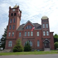
Ironwood is a city in Michigan's Upper Peninsula, situated near the Montreal River and Wisconsin border. The town features brick buildings from its mining era, with residential streets spreading across a river valley surrounded by forested hills.

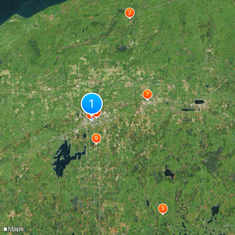
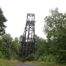
The city was named by mining captain James Wood in 1885 and grew rapidly after the railroad arrived. Iron ore extraction made the town prosperous for decades, driving its expansion and bringing thousands of workers to the region.

The town reflects the heritage of immigrant groups who arrived to work in the mines and stayed to build their communities. You can see this history today in the different neighborhoods and the local traditions that different families brought with them.

The best way to reach the town is by car via US Highway 2, which connects it to surrounding areas. Plan visits during warmer months if you want to explore the outdoors, as winters are long and cold in this part of Michigan.

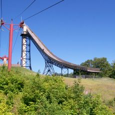
The local Carnegie Library, built in 1904, holds the record as Michigan's longest continuously operating library of its kind. The building retains its original details and continues to serve the community today.

The community of curious travelers

AroundUs brings together thousands of curated places, local tips, and hidden gems, enriched daily by 60,000 contributors worldwide.

Start exploring
Location
Elevation above the sea
459 m
GPS coordinates
46.45472,-90.17111
Latest update
December 19, 2025 22:38
Around this place
Copper Peak
United States of America

Copper Peak

17.4 km
United States of America

Black River

19.4 km
Ironwood Theatre
United States of America

Ironwood Theatre

160 m
Ironwood Memorial/Municipal Building
United States of America

Ironwood Memorial/Municipal Building

419 m
Ironwood Carnegie Library
United States of America

Ironwood Carnegie Library

291 m
Gogebic County Courthouse
United States of America

Gogebic County Courthouse

9.6 km
Solomon S. Curry House
United States of America

Solomon S. Curry House

756 m
Annala Round Barn
United States of America

Annala Round Barn

4.1 km
Old Iron County Courthouse
United States of America

Old Iron County Courthouse

1.2 km
Plummer Mine Headframe
United States of America

Plummer Mine Headframe

10.7 km
Planter Road – Jackson Creek Bridge
United States of America

Planter Road – Jackson Creek Bridge

16.7 km
Chicago and Northwestern Railroad Depot
United States of America

Chicago and Northwestern Railroad Depot

150 m
United States of America

Mount Zion Park

2.4 km
Main Street – Black River Bridge
United States of America

Main Street – Black River Bridge

13.2 km
United States of America

Sunday Lake

17.6 km
United States of America

Nee-gaw-nee-gaw-bow

17.8 km
United States of America

Boulder Creek Golf Course

11.2 km

Historic Ironwood Theatre

180 m
United States of America

Eagle Bluff Golf Club

3.2 km
United States of America

Big Powderhorn Welcome Sign

7.4 km
United States of America

Hiawatha, World's Largest Indian Statue

885 m
United States of America

Mural, Work of art

688 m
United States of America

Statue, Work of art

132 m
United States of America

Scenic viewpoint

17 km
United States of America

Scenic viewpoint

16.9 km
United States of America

Scenic viewpoint

16.9 km
United States of America

Scenic viewpoint

2.5 km
United States of America

Interstate Falls

3.1 km
Show the full map
Reviews
Share your experience

No review yet

Discussions
Start a discussion...

No discussion yet

« Ironwood - Mining city in Gogebic County, Michigan, United States » is provided by Around Us (aroundus.com). Images and texts are derived from Wikimedia project under a Creative Commons license. You are allowed to copy, distribute, and modify copies of this page, under the conditions set by the license, as long as this note is clearly visible.

Discover hidden gems everywhere you go!

From secret cafés to breathtaking viewpoints, skip the crowded tourist spots and find places that match your style. Our app makes it easy with voice search, smart filtering, route optimization, and insider tips from travelers worldwide. Download now for the complete mobile experience.

Around Us App Screenshot

A unique approach to discovering new places

Le Figaro

All the places worth exploring

France Info

A tailor-made excursion in just a few clicks

20 Minutes

Around Us
Travel Guide & Maps
Download

Send to your phone

QR Code
1

Open the camera app on your mobile.

2

Point at the QR code with your camera. A notification will appear.

3

Tap the notification to open the link.