Enable Location

We need your location to show you interesting places around you

Discover nearby places

Find interesting locations and hidden gems around you

Precise directions

Get accurate directions and distances to places

Your location is never shared with other users. It's only used when you tap the location button.

Redding

Log in to your account

Start exploring — it's free

Trusted by 63,233 travelers worldwide

Continue with Google
Continue with Apple
or

We will send you a code to connect

By continuing, you accept our Terms and Conditions and our Privacy Policy

Check your inbox

We've sent a pincode in your inbox. Please enter the code below.

Discussion Reviews 3 Photos
40.8k Popularity

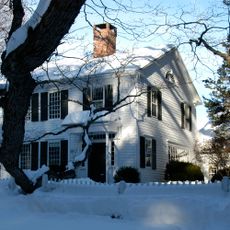
Redding, Residential town in Fairfield County, Connecticut, United States.

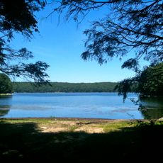
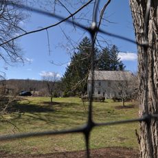
Redding is a residential town in Fairfield County, Connecticut, characterized by wooded terrain, winding roads, and natural ridges throughout the landscape. The area contains several protected open spaces, including Collis P. Huntington State Park and Devil's Den Preserve, which together make up a significant portion of the town.

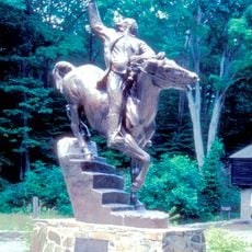
During the American Revolution, Continental Army troops under General George Washington stationed about 3,000 soldiers in the area during winter to safeguard military supply routes. This military presence from 1778 to 1779 left a lasting mark on the town's past.

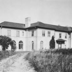
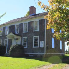
The Mark Twain Library, founded by Samuel Clemens in 1908, remains a gathering place for readers and community events. The building reflects the literary tradition that continues to shape how residents connect with their surroundings.

Visitors should prepare for longer drives on winding roads through wooded areas, as distances between attractions can be considerable. The protected natural areas offer year-round exploration, but weather conditions change with the seasons, so appropriate clothing and planning are recommended.

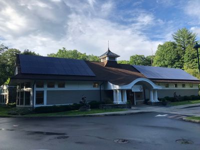
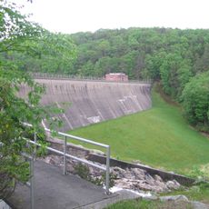
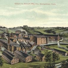
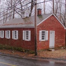
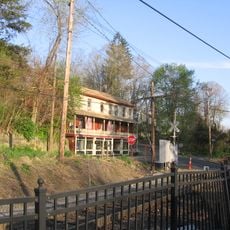
The Gilbert and Bennett Wire Mill has operated since 1834, producing specialized wire products and now serving as a window into industrial heritage. The site demonstrates how manufacturing shaped the region's development over many decades.

The community of curious travelers

AroundUs brings together thousands of curated places, local tips, and hidden gems, enriched daily by 60,000 contributors worldwide.

Start exploring
Location
Inception
1767
Elevation above the sea
144 m
Shares border with
Danbury, Ridgefield, Bethel, Newtown, Easton, Weston, Wilton
GPS coordinates
41.30444,-73.39278
Latest update
December 17, 2025 08:28
Around this place
Stormfield
United States of America

Stormfield

1.6 km
Saugatuck Reservoir
United States of America

Saugatuck Reservoir

5 km
Putnam Memorial State Park
United States of America

Putnam Memorial State Park

4 km
Collis P. Huntington State Park
United States of America

Collis P. Huntington State Park

6 km
Ida Tarbell House
United States of America

Ida Tarbell House

5.1 km
Georgetown Historic District
United States of America

Georgetown Historic District

6.4 km
Redding Center Historic District
United States of America

Redding Center Historic District

908 m
Centennial Watershed State Forest
United States of America

Centennial Watershed State Forest

4.7 km
Highstead Arboretum
United States of America

Highstead Arboretum

2.3 km
Aaron Barlow House
United States of America

Aaron Barlow House

3.3 km
Hugh Cain Fulling Mill and Elias Glover Woolen Mill Archeological Site
United States of America

Hugh Cain Fulling Mill and Elias Glover Woolen Mill Archeological Site

5.3 km
Umpawaug District School
United States of America

Umpawaug District School

3.3 km
Daniel and Esther Bartlett House
United States of America

Daniel and Esther Bartlett House

942 m
Branchville Railroad Tenement
United States of America

Branchville Railroad Tenement

5.8 km
United States of America

Great Pond

6.5 km
United States of America

Bushy Hill Pond

7.5 km
United States of America

3-town marker

3.8 km
United States of America

Redding Country Club

1.8 km
United States of America

Connecticut Golf Club

6.7 km
United States of America

Chestnut Ridge Reservoir

4.9 km
United States of America

Weir House

7.5 km
United States of America

Tonka Truck Tree

5.1 km
United States of America

Scenic viewpoint

6.5 km
United States of America

Scenic viewpoint

4.2 km
United States of America

Scenic viewpoint

3.9 km
United States of America

Scenic viewpoint

5 km
United States of America

Scenic viewpoint

4.1 km
United States of America

Scenic viewpoint

2 km
Show the full map
Reviews
Share your experience

No review yet

Discussions
Start a discussion...

No discussion yet

« Redding - Residential town in Fairfield County, Connecticut, United States » is provided by Around Us (aroundus.com). Images and texts are derived from Wikimedia project under a Creative Commons license. You are allowed to copy, distribute, and modify copies of this page, under the conditions set by the license, as long as this note is clearly visible.

Discover hidden gems everywhere you go!

From secret cafés to breathtaking viewpoints, skip the crowded tourist spots and find places that match your style. Our app makes it easy with voice search, smart filtering, route optimization, and insider tips from travelers worldwide. Download now for the complete mobile experience.

Around Us App Screenshot

A unique approach to discovering new places

Le Figaro

All the places worth exploring

France Info

A tailor-made excursion in just a few clicks

20 Minutes

Around Us
Travel Guide & Maps
Download

Send to your phone

QR Code
1

Open the camera app on your mobile.

2

Point at the QR code with your camera. A notification will appear.

3

Tap the notification to open the link.