Mount Wachusett, Mountain summit in Worcester County, Massachusetts.
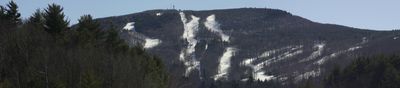
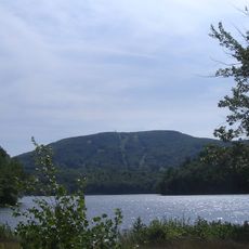
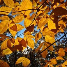
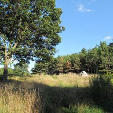
Mount Wachusett is a mountain summit in Worcester County that rises 611 meters and features large stretches of old-growth forest with trees aged between 150 and 370 years. The 220 acres of woodland form one of the most significant forest ecosystems in the eastern landscape.
The mountain appeared in historical records during King Philip's War in 1676, when a captive named Mary Rowlandson was brought to the valley in this area. This conflict marked a turning point in the region's colonial past.
The name comes from a Native American language rooted in the Nipmuc people who lived here long before Europeans arrived. The mountain held significance in their way of life and their relationship with the land.
The summit is accessible via a road open daily from Memorial Day weekend through late October, operating from 9 AM to sunset. Weather at elevation can change quickly, so bring layers and sturdy footwear for safe walking.
The mountain contains the largest old-growth forest east of the Connecticut River and stands as the highest point in Massachusetts east of that river. This combination makes it a remarkable place for both nature enthusiasts and researchers.
Location: Massachusetts
Elevation above the sea: 611 m
GPS coordinates: 42.48906,-71.88684
Latest update: December 7, 2025 19:26
North County
6.8 km
Leominster State Forest
5.3 km
Wachusett Mountain State Reservation
13 m
Dunn State Park
12.2 kmHigh Ledges Wildlife Sanctuary
3.6 km
Wachusett Meadow Wildlife Sanctuary
4 km
Doyle Community Park & Center
11.3 km
Doyle Community Park & Center
11.3 km
Frances H. and Jonathan Drake House
10.9 km
Monument Square Historic District
11.2 km
Hubbardston Public Library
10.1 km
F. A. Whitney Carriage Company Complex Historic District
11.7 km
Whitney & Company
11.8 km
Russell Corner Historic District
4.2 km
Westminster Village-Academy Hill Historic District
6.4 km
East Princeton Village Historic District
4.4 km
Hubbardston Town Common Historic District
9.9 kmLeominster High School
10.6 km
Fernside-Vacation House for Working Girls
2.3 km
Princeton Center Historic District
4.5 km
Ahijah Wood House
3.8 km
Manning-Ball House
12.2 km
Ezra Wood-Levi Warner Place
7.7 km
Sterling Center Historic District
11.9 km
Rev. Samuel Gay House
10.6 km
Four Corners-Goodnow Farm Historic District
4.6 km
Jabez Partridge Homestead
10.3 km
Nathan Wood House
3.9 kmVisited this place? Tap the stars to rate it and share your experience / photos with the community! Try now! You can cancel it anytime.
Discover hidden gems everywhere you go!
From secret cafés to breathtaking viewpoints, skip the crowded tourist spots and find places that match your style. Our app makes it easy with voice search, smart filtering, route optimization, and insider tips from travelers worldwide. Download now for the complete mobile experience.
A unique approach to discovering new places❞
— Le Figaro
All the places worth exploring❞
— France Info
A tailor-made excursion in just a few clicks❞
— 20 Minutes